
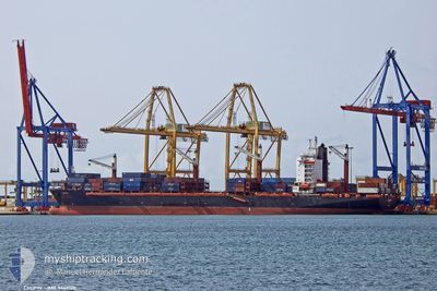
CHOPIN
Container Ship
Current Trip
| Time Travelled | 13 days |
|---|---|
| Remaining Time | 2 h, 27 mins |
| Distance Travelled | 3689.89 nm |
| Remaining Distance | 35.89 nm |
| AVG Speed | 12.3 Knop |
| MAX Speed | 16.2 Knop |
| AVG Wind | 12 knots |
| MAX Wind | 25.9 knots |
| MIN Temp | 16.8°C / 62.24°F |
| MAX Temp | 29.9°C / 85.82°F |
| Djupgående | 8.5 m |
| Position mottagen | 50 m sen |
Current Position
| Longitud | -5.94624° |
|---|---|
| Latitude | 35.89260° |
| Status | Under way using engine |
| Fart | 11.1 Knop |
| Kurs | 80.6° |
| Område | Strait of Gibraltar |
| Station | T-AIS |
| Position mottagen | 50 m sen |
Info
Information
The current position of CHOPIN is in Strait of Gibraltar with coordinates 35.89260° / -5.94624° as reported on 2024-05-17 02:14 by AIS to our vessel tracker app. The vessel's current speed is 11.1 Knop and is heading at the port of ALGECIRAS. The estimated time of arrival as calculated by MyShipTracking vessel tracking app is 2024-05-17 07:32 LT
The vessel CHOPIN (IMO: 9449120, MMSI: 636020438) is a Container Ship that was built in 2012 ( 12 År gammal ). It's sailing under the flag of [LR] Liberia.
In this page you can find informations about the vessels current position, last detected port calls, and current voyage information. If the vessels is not in coverage by AIS you will find the latest position.
The current position of CHOPIN is detected by our AIS receivers and we are not responsible for the reliability of the data. The last position was recorded while the vessel was in Coverage by the Ais receivers of our vessel tracking app.
The current draught of CHOPIN as reported by AIS is 8.5 meters
Weather
| Temperature | 16.9°C / 62.42°F |
|---|---|
| Wind Speed | 10 knots |
| Direction | 255° WSW |
| Pressure | 1012.2 hPa |
| Humidity | 82.5 % |
| Cloud Coverage | 13 % |
Featured Company
Last Port Calls
| Port | Arrival | Departure | Time In Port |
|---|---|---|---|
| 2024-05-02 10:56 | 2024-05-03 20:02 | 1 d | |
| 2024-04-29 08:27 | 2024-05-01 17:30 | 2 d | |
| 2024-04-24 12:40 | 2024-04-25 02:16 | 13 h | |
| 2024-04-23 04:08 | 2024-04-24 04:12 | 1 d | |
| 2024-04-14 12:51 | 2024-04-15 13:47 | 1 d | |
| 2024-04-12 17:09 | 2024-04-13 18:53 | 1 d | |
| 2024-04-08 13:28 | 2024-04-09 17:36 | 1 d | |
| 2024-03-19 16:10 | 2024-03-20 10:44 | 18 h | |
| 2024-03-18 19:14 | |||
| 2024-03-14 07:25 | 2024-03-15 06:40 | 23 h |
Last Trips
| Origin | Departure | Destination | Arrival | Distance | |
|---|---|---|---|---|---|
| 2024-05-01 17:30 | 2024-05-02 10:56 | 140.89 nm | |||
| 2024-04-25 02:16 | 2024-04-29 08:27 | 565.98 nm | |||
| 2024-04-24 04:12 | 2024-04-24 12:40 | 88.50 nm | |||
| 2024-04-15 13:47 | 2024-04-23 04:08 | 3061.01 nm | |||
| 2024-04-13 18:53 | 2024-04-14 12:51 | 119.24 nm | |||
| 2024-04-09 17:36 | 2024-04-12 17:09 | 425.53 nm | |||
| 2024-03-20 10:44 | 2024-04-08 13:28 | 4157.24 nm | |||
| 2024-03-18 19:14 | 2024-03-19 16:10 | 143.61 nm | |||
| 2024-03-13 23:32 | 2024-03-14 07:25 | 87.52 nm | |||
| 2024-03-04 16:01 | 2024-03-12 11:29 | 3073.56 nm |
Events
| Tid | Event | Detaljer | Position / Dest | Information |
|---|---|---|---|---|
| 2024-05-17 02:22 | Status ändrad | Default Under way using engine |
35.89588 / -5.91524
ESALG
|
Fart: 11.1 kn Kurs: 80.6° |
| 2024-05-17 02:14 | Byter havsområde | Moroccan part of the Strait of Gibraltar Moroccan part of the North Atlantic Ocean |
35.89260 / -5.94624
Strait of Gibraltar
ESALG
|
Fart: 11.1 kn Kurs: 80.6° |
| 2024-05-17 02:13 | Status ändrad | Under way using engine Default |
35.89182 / -5.95242
ESALG
|
Fart: 11.2 kn Kurs: 88° |
| 2024-05-17 01:46 | Status ändrad | Default Under way using engine |
35.88795 / -6.05330
ESALG
|
Fart: 10.9 kn Kurs: 87.2° |
| 2024-05-17 01:36 | Status ändrad | Under way using engine Default |
35.88636 / -6.09168
ESALG
|
Fart: 10.9 kn Kurs: 88° |
| 2024-05-17 01:18 | I täckningsområde |
35.88659 / -6.08529
North Atlantic Ocean
ESALG
|
Fart: 10.9 kn Kurs: 87.7° |
|
| 2024-05-16 09:10 | Status ändrad | Default Under way using engine |
33.94167 / -8.51500
ESALG
|
Fart: 13.2 kn Kurs: 42.6° |
| 2024-05-16 08:40 | Byter havsområde | Moroccan part of the North Atlantic Ocean Spanish (Canary Islands) part of the North Atlantic Ocean |
33.86734 / -8.59947
North Atlantic Ocean
ESALG
|
Fart: 13.2 kn Kurs: 42.6° |
| 2024-05-16 08:40 | UTANFÖR täckningsområde |
33.86734 / -8.59947
North Atlantic Ocean
ESALG
|
Fart: 13.2 kn Kurs: 42.6° |
|
| 2024-05-16 08:40 | Status ändrad | Under way using engine Default |
33.86500 / -8.60194
ESALG
|
Fart: 12 kn Kurs: 42° |