

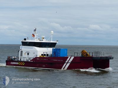
CARRIER
Crew Boat

Current Trip
| Trip Time | 11 h, 37 mins |
|---|---|
| Trip Distance | 47.86 nm |
| AVG Speed | 12.2 Knop |
| MAX Speed | 12.2 Knop |
| Djupgående | 2.2 m |
| AVG Wind | 11.7 knots |
| MAX Wind | 13 knots |
| MIN Temp | 4.7°C / 40.46°F |
| MAX Temp | 7°C / 44.6°F |
| Position mottagen | 3 m sen |
Current Position
| Longitud | --- |
|---|---|
| Latitude | --- |
| Status | Moored |
| Fart | |
| Kurs | 223° |
| Område | Baltic Sea |
| Station | T-AIS |
| Position mottagen | 3 m sen |
Information
The current position of CARRIER is in Baltic Sea with coordinates 54.65717° / 11.34942° as reported on 2025-03-26 05:51 by AIS to our vessel tracker app. The vessel's current speed is 0 Knop and is currently inside the port of RODBYHAVN.
The vessel CARRIER (IMO: 9707792, MMSI: 219018788) is a Crew Boat that was built in 2013 ( 12 År gammal ). It's sailing under the flag of [DK] Denmark.
In this page you can find informations about the vessels current position, last detected port calls, and current voyage information. If the vessels is not in coverage by AIS you will find the latest position.
The current position of CARRIER is detected by our AIS receivers and we are not responsible for the reliability of the data. The last position was recorded while the vessel was in Coverage by the Ais receivers of our vessel tracking app.
The current draught of CARRIER as reported by AIS is 2.2 meters
Weather
| Temperature | 5.9°C / 42.62°F |
|---|---|
| Wind Speed | 11 knots |
| Direction | 287° WNW |
| Pressure | 1015.7 hPa |
| Humidity | 88.2 % |
| Cloud Coverage | 62 % |


Featured Company
Last Port Calls
| Port | Arrival | Departure | Time In Port |
|---|---|---|---|
| 2025-03-25 18:58 | |||
| 2025-03-24 18:29 | 2025-03-25 07:21 | 12 h | |
| 2025-03-21 18:06 | 2025-03-24 09:23 | 2 d | |
| 2025-03-20 18:13 | 2025-03-21 07:37 | 13 h | |
| 2025-03-19 18:03 | 2025-03-20 07:35 | 13 h | |
| 2025-03-18 18:30 | 2025-03-19 08:45 | 14 h | |
| 2025-03-17 18:25 | 2025-03-18 07:36 | 13 h | |
| 2025-03-16 19:16 | 2025-03-17 07:46 | 12 h | |
| 2025-03-15 17:53 | 2025-03-16 07:42 | 13 h | |
| 2025-03-14 17:49 | 2025-03-15 07:34 | 13 h |
Last Trips
| Origin | Departure | Destination | Arrival | Distance | |
|---|---|---|---|---|---|
| 2025-03-25 07:21 | 2025-03-25 18:58 | 47.86 nm | |||
| 2025-03-24 09:23 | 2025-03-24 18:29 | 54.56 nm | |||
| 2025-03-21 07:37 | 2025-03-21 18:06 | 34.82 nm | |||
| 2025-03-20 07:35 | 2025-03-20 18:13 | 39.17 nm | |||
| 2025-03-19 08:45 | 2025-03-19 18:03 | 36.72 nm | |||
| 2025-03-18 07:36 | 2025-03-18 18:30 | 32.25 nm | |||
| 2025-03-17 07:46 | 2025-03-17 18:25 | 45.13 nm | |||
| 2025-03-16 07:42 | 2025-03-16 19:16 | 61.26 nm | |||
| 2025-03-15 07:34 | 2025-03-15 17:53 | 44.42 nm | |||
| 2025-03-14 07:41 | 2025-03-14 17:49 | 50.59 nm |
Events
| Tid | Event | Detaljer | Position / Dest | Information |
|---|---|---|---|---|
| 2025-03-25 19:57 | Status ändrad | Moored Under way using engine |
54.65717 / 11.34942
[DK] RODBYHAVN
|
Fart: Kurs: 225° |
| 2025-03-25 18:04 | STOPPAR förflyttning |
54.65716 / 11.34946
[DK] RODBYHAVN
|
Fart: 0.3 kn Kurs: 227° |
|
| 2025-03-25 17:58 | ANLÄNDER HAMN |
|
54.65051 / 11.34541
[DK] RODBYHAVN
|
Fart: 16 kn Kurs: 2.6° |
| 2025-03-25 17:27 | STARTAR förflyttning | 7.48 nm, South East of RODBYHAVN |
54.57633 / 11.51802
ROEDBYHAVN
|
Fart: 15.5 kn Kurs: 296.7° |
| 2025-03-25 17:23 | STOPPAR förflyttning | 7.57 nm, South East of RODBYHAVN |
54.57449 / 11.51868
ROEDBYHAVN
|
Fart: 0.3 kn Kurs: 241° |
| 2025-03-25 17:13 | STARTAR förflyttning | 10.34 nm, South East of RODBYHAVN |
54.53548 / 11.56569
ROEDBYHAVN
|
Fart: 17.1 kn Kurs: 325.6° |
| 2025-03-25 17:12 | STOPPAR förflyttning | 10.47 nm, South East of RODBYHAVN |
54.53360 / 11.56757
ROEDBYHAVN
|
Fart: 0.3 kn Kurs: 266° |
| 2025-03-25 17:08 | STARTAR förflyttning | 11.34 nm, South East of RODBYHAVN |
54.52945 / 11.59461
ROEDBYHAVN
|
Fart: 17 kn Kurs: 288.8° |
| 2025-03-25 17:02 | STOPPAR förflyttning | 11.46 nm, South East of RODBYHAVN |
54.52860 / 11.59818
ROEDBYHAVN
|
Fart: 0.3 kn Kurs: 260° |
| 2025-03-25 16:58 | STARTAR förflyttning | 10.56 nm, South East of RODBYHAVN |
54.53328 / 11.57048
ROEDBYHAVN
|
Fart: 16.9 kn Kurs: 91.7° |