
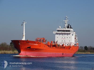
CAROLINE ESSBERGER
Oil/Chemical Tanker
Current Trip
| Time Travelled | 1 day |
|---|---|
| Remaining Time | 3 h, 14 mins |
| Distance Travelled | 450.21 nm |
| Remaining Distance | 39.18 nm |
| AVG Speed | 11.8 Knop |
| MAX Speed | 13 Knop |
| AVG Wind | 4.9 knots |
| MAX Wind | 9 knots |
| MIN Temp | 9.5°C / 49.1°F |
| MAX Temp | 11.7°C / 53.06°F |
| Djupgående | 6 m |
| Position mottagen | 1 m sen |
Current Position
| Longitud | 3.99722° |
|---|---|
| Latitude | 52.69535° |
| Status | Under way using engine |
| Fart | 10.4 Knop |
| Kurs | 155.6° |
| Område | North Sea |
| Station | T-AIS |
| Position mottagen | 1 m sen |
Info
Information
The current position of CAROLINE ESSBERGER is in North Sea with coordinates 52.69535° / 3.99722° as reported on 2024-05-09 01:18 by AIS to our vessel tracker app. The vessel's current speed is 10.4 Knop and is heading at the port of AMSTERDAM. The estimated time of arrival as calculated by MyShipTracking vessel tracking app is 2024-05-09 04:33 LT
The vessel CAROLINE ESSBERGER (IMO: 9439151, MMSI: 244024000) is a Oil/Chemical Tanker that was built in 2009 ( 15 År gammal ). It's sailing under the flag of [NL] Netherlands.
In this page you can find informations about the vessels current position, last detected port calls, and current voyage information. If the vessels is not in coverage by AIS you will find the latest position.
The current position of CAROLINE ESSBERGER is detected by our AIS receivers and we are not responsible for the reliability of the data. The last position was recorded while the vessel was in Coverage by the Ais receivers of our vessel tracking app.
The current draught of CAROLINE ESSBERGER as reported by AIS is 6 meters
Weather
| Temperature | 11.2°C / 52.16°F |
|---|---|
| Wind Speed | 1 knots |
| Direction | 102° ESE |
| Pressure | 1028.7 hPa |
| Humidity | 88.9 % |
| Cloud Coverage | 35 % |
Featured Company
Last Port Calls
| Port | Arrival | Departure | Time In Port |
|---|---|---|---|
| 2024-05-06 17:13 | 2024-05-07 11:28 | 18 h | |
| 2024-05-04 18:37 | 2024-05-05 07:08 | 12 h | |
| 2024-04-30 04:16 | 2024-05-01 02:01 | 21 h | |
| 2024-04-22 22:00 | 2024-04-24 13:18 | 1 d | |
| 2024-04-16 04:46 | 2024-04-17 19:16 | 1 d | |
| 2024-04-12 21:57 | 2024-04-14 22:08 | 2 d | |
| 2024-04-09 05:53 | 2024-04-10 09:29 | 1 d | |
| 2024-04-03 06:05 | 2024-04-04 17:13 | 1 d | |
| 2024-04-01 00:53 | 2024-04-02 03:04 | 1 d | |
| 2024-03-29 08:08 | 2024-03-30 21:10 | 1 d |
Most Visited Ports (Last year)
| Port | Arrivals | |
|---|---|---|
| 14 | ||
| 12 | ||
| 10 | ||
| 7 | ||
| 5 | ||
| 4 |
Last Trips
| Origin | Departure | Destination | Arrival | Distance | |
|---|---|---|---|---|---|
| 2024-05-05 09:08 | 2024-05-06 19:13 | 67.78 nm | |||
| 2024-05-01 04:01 | 2024-05-04 20:37 | 550.65 nm | |||
| 2024-04-24 15:18 | 2024-04-30 06:16 | 1362.10 nm | |||
| 2024-04-17 21:16 | 2024-04-23 00:00 | 1407.33 nm | |||
| 2024-04-15 00:08 | 2024-04-16 06:46 | 105.16 nm | |||
| 2024-04-10 11:29 | 2024-04-12 23:57 | 510.60 nm | |||
| 2024-04-04 19:13 | 2024-04-09 07:53 | 6.09 nm | |||
| 2024-04-02 05:04 | 2024-04-03 08:05 | 69.64 nm | |||
| 2024-03-30 22:10 | 2024-04-01 02:53 | 158.66 nm | |||
| 2024-03-21 14:55 | 2024-03-29 09:08 | 1887.49 nm |
Events
| Tid | Event | Detaljer | Position / Dest | Information |
|---|---|---|---|---|
| 2024-05-08 19:47 | Status ändrad | Under way using engine Default |
53.62382 / 4.66432
NLAMS
|
Fart: 10.9 kn Kurs: 202° |
| 2024-05-08 19:37 | Status ändrad | Default Under way using engine |
53.65138 / 4.68358
NLAMS
|
Fart: 10.8 kn Kurs: 202.7° |
| 2024-05-08 19:25 | Status ändrad | Under way using engine Default |
53.68419 / 4.70556
NLAMS
|
Fart: 10.7 kn Kurs: 204° |
| 2024-05-08 19:12 | Status ändrad | Default Under way using engine |
53.72092 / 4.73118
NLAMS
|
Fart: 10.8 kn Kurs: 202.8° |
| 2024-05-08 19:06 | Status ändrad | Under way using engine Default |
53.73541 / 4.74151
NLAMS
|
Fart: 10.8 kn Kurs: 203° |
| 2024-05-08 18:58 | Status ändrad | Default Under way using engine |
53.75750 / 4.75747
NLAMS
|
Fart: 10.8 kn Kurs: 201.7° |
| 2024-05-08 18:55 | Status ändrad | Under way using engine Default |
53.76622 / 4.76363
NLAMS
|
Fart: 10.7 kn Kurs: 202° |
| 2024-05-08 18:43 | I täckningsområde |
53.76622 / 4.76363
North Sea
NLAMS
|
Fart: 10.8 kn Kurs: 201.7° |
|
| 2024-05-08 14:58 | UTANFÖR täckningsområde |
54.44757 / 5.25389
North Sea
NLAMS
|
Fart: 11.6 kn Kurs: 201.4° |
|
| 2024-05-08 14:58 | Byter havsområde | Dutch part of the North Sea German part of the North Sea |
54.44757 / 5.25389
North Sea
NLAMS
|
Fart: 11.6 kn Kurs: 201.4° |