

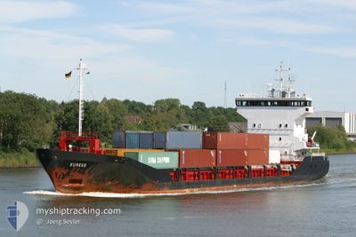
CAPO CINTO
General Cargo

Current Trip
| Time Travelled | 7 h, 18 mins |
|---|---|
| Remaining Time | 4 h, 46 mins |
| Distance Travelled | 60.06 nm |
| Remaining Distance | 87.28 nm |
| AVG Speed | 12.2 Knop |
| MAX Speed | 13.2 Knop |
| AVG Wind | 16.2 knots |
| MAX Wind | 19.6 knots |
| MIN Temp | 8.6°C / 47.48°F |
| MAX Temp | 11.2°C / 52.16°F |
| Djupgående | 4.7 m |
| Position mottagen | 2 h, 17 m sen |
Current Position
| Longitud | --- |
|---|---|
| Latitude | --- |
| Status | Under way using engine |
| Fart | 12.5 Knop |
| Kurs | 162.7° |
| Område | Mediterranean Sea - Western Basin |
| Station | T-AIS |
| Position mottagen | 2 h, 17 m sen |
Information
The current position of CAPO CINTO is in Mediterranean Sea - Western Basin with coordinates 42.76714° / 7.66598° as reported on 2025-02-19 23:37 by AIS to our vessel tracker app. The vessel's current speed is 12.5 Knop and is heading at the port of AJACCIO. The estimated time of arrival as calculated by MyShipTracking vessel tracking app is 2025-02-20 06:41 LT
The vessel CAPO CINTO (IMO: 9103790, MMSI: 228372900) is a General Cargo that was built in 1997 ( 28 År gammal ). It's sailing under the flag of [FR] France.
In this page you can find informations about the vessels current position, last detected port calls, and current voyage information. If the vessels is not in coverage by AIS you will find the latest position.
The current position of CAPO CINTO is detected by our AIS receivers and we are not responsible for the reliability of the data. The last position was recorded while the vessel was in Coverage by the Ais receivers of our vessel tracking app.
The current draught of CAPO CINTO as reported by AIS is 4.7 meters
Weather
| Temperature | 11.3°C / 52.34°F |
|---|---|
| Wind Speed | 17 knots |
| Direction | 52° NE |
| Pressure | 1025.3 hPa |
| Humidity | 78.4 % |
| Cloud Coverage | 18 % |


Featured Company
Last Port Calls
| Port | Arrival | Departure | Time In Port |
|---|---|---|---|
| 2025-02-19 05:37 | 2025-02-19 18:37 | 13 h | |
| 2025-02-18 06:04 | 2025-02-18 16:32 | 10 h | |
| 2025-02-17 05:50 | 2025-02-17 16:28 | 10 h | |
| 2025-02-13 19:53 | 2025-02-16 10:09 | 2 d | |
| 2025-02-11 09:51 | 2025-02-13 16:44 | 2 d | |
| 2025-02-07 19:37 | 2025-02-11 07:06 | 3 d | |
| 2025-02-07 04:33 | 2025-02-07 16:21 | 11 h | |
| 2025-02-04 06:17 | 2025-02-06 16:31 | 2 d | |
| 2025-01-31 18:54 | 2025-02-03 17:09 | 2 d | |
| 2025-01-30 19:14 | 2025-01-31 15:57 | 20 h |
Last Trips
| Origin | Departure | Destination | Arrival | Distance | |
|---|---|---|---|---|---|
| 2025-02-18 17:32 | 2025-02-19 06:37 | 138.20 nm | |||
| 2025-02-17 17:28 | 2025-02-18 07:04 | 88.28 nm | |||
| 2025-02-16 11:09 | 2025-02-17 06:50 | 180.58 nm | |||
| 2025-02-13 17:44 | 2025-02-13 20:53 | 37.63 nm | |||
| 2025-02-11 08:06 | 2025-02-11 10:51 | 36.96 nm | |||
| 2025-02-07 17:21 | 2025-02-07 20:37 | 37.01 nm | |||
| 2025-02-06 17:31 | 2025-02-07 05:33 | 129.50 nm | |||
| 2025-02-03 18:09 | 2025-02-04 07:17 | 127.88 nm | |||
| 2025-01-31 16:57 | 2025-01-31 19:54 | 36.84 nm | |||
| 2025-01-30 16:49 | 2025-01-30 20:14 | 37.42 nm |
Events
| Tid | Event | Detaljer | Position / Dest | Information |
|---|---|---|---|---|
| 2025-02-19 23:40 | Status ändrad | Default Under way using engine |
42.75957 / 7.66917
AJACCIO
|
Fart: 12.5 kn Kurs: 162.7° |
| 2025-02-19 23:37 | UTANFÖR täckningsområde |
42.76714 / 7.66598
Mediterranean Sea - Western Basin
AJACCIO
|
Fart: 12.5 kn Kurs: 162.7° |
|
| 2025-02-19 21:44 | Byter havsområde | French part of the Mediterranean Sea - Western Basin Mon�gasque part of the Mediterranean Sea - Western Basin |
43.16468 / 7.63544
Mediterranean Sea - Western Basin
AJACCIO
|
Fart: 12.8 kn Kurs: 180.2° |
| 2025-02-19 21:22 | Byter havsområde | Mon�gasque part of the Mediterranean Sea - Western Basin French part of the Mediterranean Sea - Western Basin |
43.24421 / 7.64702
Mediterranean Sea - Western Basin
AJACCIO
|
Fart: 13 kn Kurs: 187.4° |
| 2025-02-19 20:56 | Byter havsområde | French part of the Mediterranean Sea - Western Basin Mon�gasque part of the Mediterranean Sea - Western Basin |
43.32282 / 7.62262
Mediterranean Sea - Western Basin
AJACCIO
|
Fart: 10.8 kn Kurs: 119.8° |
| 2025-02-19 20:41 | Byter havsområde | Mon�gasque part of the Mediterranean Sea - Western Basin French part of the Mediterranean Sea - Western Basin |
43.34884 / 7.56800
Mediterranean Sea - Western Basin
AJACCIO
|
Fart: 11.5 kn Kurs: 125.6° |
| 2025-02-19 18:37 | AVGÅTT HAMN |
|
43.68780 / 7.28843
AJACCIO
|
Fart: 4.6 kn Kurs: 217° |
| 2025-02-19 18:34 | STARTAR förflyttning |
43.69074 / 7.28898
[FR] NICE
|
Fart: 3.9 kn Kurs: 148° |
|
| 2025-02-19 18:13 | Djupgående ändrat | 4.7 4.3 |
43.69262 / 7.28831
[FR] NICE
|
Fart: Kurs: 13° |
| 2025-02-19 18:07 | Status ändrad | Under way using engine Moored |
43.69262 / 7.28835
[FR] NICE
|
Fart: Kurs: 13° |