
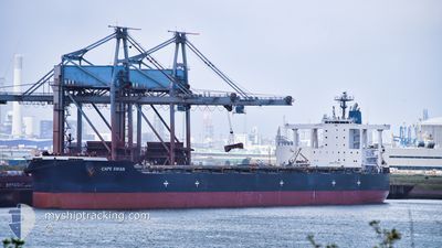
CAPE SWAN
Bulk Carrier
Current Trip
| Time Travelled | 9 days |
|---|---|
| Remaining Time | 16 days |
| Distance Travelled | 2850.47 nm |
| Remaining Distance | 5439.61 nm |
| AVG Speed | 12.1 Knop |
| MAX Speed | 17.6 Knop |
| AVG Wind | 12.9 knots |
| MAX Wind | 41.6 knots |
| MIN Temp | 17°C / 62.6°F |
| MAX Temp | 29.2°C / 84.56°F |
| Djupgående | 9 m |
| Position mottagen | 13 h, 3 m sen |
Current Position
| Longitud | --- |
|---|---|
| Latitude | --- |
| Status | Under way using engine |
| Fart | 15.2 Knop |
| Kurs | 306.5° |
| Område | Malacca Strait |
| Station | T-AIS |
| Position mottagen | 13 h, 3 m sen |
Info
Information
The current position of CAPE SWAN is in Malacca Strait with coordinates 1.46520° / 103.10629° as reported on 2024-11-24 09:27 by AIS to our vessel tracker app. The vessel's current speed is 15.2 Knop and is heading at the port of CAPE TOWN. The estimated time of arrival as calculated by MyShipTracking vessel tracking app is 2024-12-11 04:58 LT
The vessel CAPE SWAN (IMO: 9552381, MMSI: 636020563) is a Bulk Carrier that was built in 2012 ( 12 År gammal ). It's sailing under the flag of [LR] Liberia.
In this page you can find informations about the vessels current position, last detected port calls, and current voyage information. If the vessels is not in coverage by AIS you will find the latest position.
The current position of CAPE SWAN is detected by our AIS receivers and we are not responsible for the reliability of the data. The last position was recorded while the vessel was in Coverage by the Ais receivers of our vessel tracking app.
The current draught of CAPE SWAN as reported by AIS is 9 meters
Weather
| Temperature | 27.8°C / 82.04°F |
|---|---|
| Wind Speed | 1 knots |
| Direction | 214° SW |
| Pressure | 1007.1 hPa |
| Humidity | 73.4 % |
| Cloud Coverage | 100 % |
Featured Company
Most Visited Ports (Last year)
| Port | Arrivals | |
|---|---|---|
| 1 | ||
| 1 | ||
| 1 | ||
| 1 | ||
| 1 | ||
| 1 |
Events
| Tid | Event | Detaljer | Position / Dest | Information |
|---|---|---|---|---|
| 2024-11-24 09:33 | Status ändrad | Default Under way using engine |
1.47867 / 103.08834
ZACPT
|
Fart: 15.2 kn Kurs: 306.5° |
| 2024-11-24 09:27 | UTANFÖR täckningsområde |
1.46520 / 103.10629
Malacca Strait
ZACPT
|
Fart: 15.2 kn Kurs: 306.5° |
|
| 2024-11-24 09:25 | Status ändrad | Under way using engine Default |
1.46037 / 103.11276
ZACPT
|
Fart: 15.3 kn Kurs: 306° |
| 2024-11-24 08:53 | Status ändrad | Default Under way using engine |
1.37605 / 103.22579
ZACPT
|
Fart: 15.4 kn Kurs: 306.9° |
| 2024-11-24 07:48 | Byter havsområde | Malaysian part of the Malacca Strait Malaysian part of the Singapore Strait |
1.22330 / 103.45651
Malacca Strait
ZACPT
|
Fart: 15.2 kn Kurs: 287.1° |
| 2024-11-24 07:19 | Byter havsområde | Malaysian part of the Singapore Strait Indonesian part of the Singapore Strait |
1.19423 / 103.57745
Singapore Strait
ZACPT
|
Fart: 15.3 kn Kurs: 280.6° |
| 2024-11-24 06:59 | ETA ändrat | 2024/12/22 02:00 2024/12/22 23:00 |
1.17683 / 103.66250
ZACPT
|
Fart: 14.4 kn Kurs: 286.1° |
| 2024-11-24 06:52 | Destination ändrad | ZACPT BR PDM |
1.16535 / 103.68380
ZACPT
|
Fart: 14.6 kn Kurs: 301.8° |
| 2024-11-24 06:52 | ETA ändrat | 2024/12/22 23:00 2024/12/26 23:00 |
1.16535 / 103.68380
ZACPT
|
Fart: 14.6 kn Kurs: 301.8° |
| 2024-11-24 06:43 | Byter havsområde | Indonesian part of the Singapore Strait Singaporean part of the Singapore Strait |
1.14655 / 103.71522
Singapore Strait
|
Fart: 14 kn Kurs: 294° |