

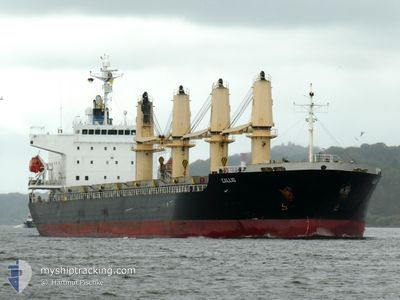
CALLIO
Bulk Carrier

Current Trip
| Time Travelled | 8 days |
|---|---|
| Remaining Time | --- |
| Distance Travelled | 841.35 nm |
| Remaining Distance | 1607.07 nm |
| AVG Speed | 10.9 Knop |
| MAX Speed | 15.1 Knop |
| AVG Wind | 12.9 knots |
| MAX Wind | 18 knots |
| MIN Temp | 22.9°C / 73.22°F |
| MAX Temp | 28.2°C / 82.76°F |
| Djupgående | 10.2 m |
| Position mottagen | 2025-02-10 02:32 |
Current Position
| Longitud | --- |
|---|---|
| Latitude | --- |
| Status | Under way using engine |
| Fart | 11.4 Knop |
| Kurs | 39° |
| Område | South Atlantic Ocean |
| Station | T-AIS |
| Position mottagen | 2025-02-10 02:32 |
Information
The current position of CALLIO is in South Atlantic Ocean with coordinates -27.75982° / -46.46992° as reported on 2025-02-10 02:32 by AIS to our vessel tracker app. The vessel's current speed is 11.4 Knop and is heading at the port of RIO DE JANEIRO.
The vessel CALLIO (IMO: 9310721, MMSI: 352112000) is a Bulk Carrier that was built in 2006 ( 19 År gammal ). It's sailing under the flag of [PA] Panama.
In this page you can find informations about the vessels current position, last detected port calls, and current voyage information. If the vessels is not in coverage by AIS you will find the latest position.
The current position of CALLIO is detected by our AIS receivers and we are not responsible for the reliability of the data. The last position was recorded while the vessel was in Coverage by the Ais receivers of our vessel tracking app.
The current draught of CALLIO as reported by AIS is 10.2 meters
Weather
| Temperature | 27.3°C / 81.14°F |
|---|---|
| Wind Speed | 16 knots |
| Direction | 111° ESE |
| Pressure | 1010.5 hPa |
| Humidity | 82.8 % |
| Cloud Coverage | 100 % |


Featured Company
Last Port Calls
| Port | Arrival | Departure | Time In Port |
|---|---|---|---|
| 2025-03-12 11:09 | 2025-03-19 01:20 | 6 d | |
| 2025-02-24 06:37 | 2025-03-08 07:50 | 12 d | |
| 2025-01-29 21:58 | 2025-02-05 20:14 | 6 d | |
| 2025-01-22 07:14 | 2025-01-23 20:45 | 1 d | |
| 2025-01-16 06:02 | 2025-01-20 04:14 | 3 d |
Most Visited Ports (Last year)
| Port | Arrivals | |
|---|---|---|
| 3 | ||
| 3 | ||
| 3 | ||
| 2 | ||
| 2 | ||
| 2 |
Last Trips
| Origin | Departure | Destination | Arrival | Distance | |
|---|---|---|---|---|---|
| 2025-03-08 07:50 | 2025-03-12 11:09 | 1115.45 nm | |||
| 2025-02-05 20:14 | 2025-02-24 06:37 | 4417.46 nm | |||
| 2025-01-23 20:45 | 2025-01-29 21:58 | 1601.99 nm | |||
| 2025-01-20 04:14 | 2025-01-22 07:14 | 505.88 nm | |||
| 2024-12-24 17:42 | 2025-01-16 06:02 | 1903.76 nm |
Events
| Tid | Event | Detaljer | Position / Dest | Information |
|---|---|---|---|---|
| 2025-03-22 09:46 | STOPPAR förflyttning |
-4.82848 / -37.05172
BRRIO
|
Fart: 0.1 kn Kurs: 86° |
|
| 2025-03-19 04:20 | AVGÅTT HAMN |
|
-1.39702 / -48.49870
BRRIO
|
Fart: 7.6 kn Kurs: 355° |
| 2025-03-19 03:57 | STARTAR förflyttning |
-1.43450 / -48.49505
[BR] BELEM
|
Fart: 3.1 kn Kurs: 8° |