
CALI
Cargo
Current Trip
| Time Travelled | 3 days |
|---|---|
| Remaining Time | 14 h, 17 mins |
| Distance Travelled | 1092.81 nm |
| Remaining Distance | 237.72 nm |
| AVG Speed | 14.1 Knop |
| MAX Speed | 19.7 Knop |
| AVG Wind | 8.3 knots |
| MAX Wind | 18 knots |
| MIN Temp | 9.6°C / 49.28°F |
| MAX Temp | 15.6°C / 60.08°F |
| Djupgående | 8.2 m |
| Position mottagen | 1 d sen |
Current Position
| Longitud | 149.28375° |
|---|---|
| Latitude | -43.27311° |
| Status | Under way using engine |
| Fart | 14.2 Knop |
| Kurs | 157.3° |
| Område | Tasman Sea |
| Station | T-AIS |
| Position mottagen | 1 d sen |
Info
Information
The current position of CALI is in Tasman Sea with coordinates -43.27311° / 149.28375° as reported on 2024-05-02 15:41 by AIS to our vessel tracker app. The vessel's current speed is 14.2 Knop and is heading at the port of BLUFF. The estimated time of arrival as calculated by MyShipTracking vessel tracking app is 2024-05-04 23:26 LT
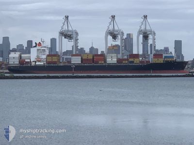
The vessel CALI (IMO: 9631101, MMSI: 636015667) is a Cargo It's sailing under the flag of [LR] Liberia.
In this page you can find informations about the vessels current position, last detected port calls, and current voyage information. If the vessels is not in coverage by AIS you will find the latest position.
The current position of CALI is detected by our AIS receivers and we are not responsible for the reliability of the data. The last position was recorded while the vessel was in Coverage by the Ais receivers of our vessel tracking app.
The current draught of CALI as reported by AIS is 8.2 meters
Weather
| Temperature | 10.4°C / 50.72°F |
|---|---|
| Wind Speed | 15 knots |
| Direction | 230° SW |
| Pressure | 1025.3 hPa |
| Humidity | 66.8 % |
| Cloud Coverage | 100 % |
Featured Company
Last Port Calls
| Port | Arrival | Departure | Time In Port |
|---|---|---|---|
| 2024-04-28 21:59 | 2024-04-30 11:27 | 1 d | |
| 2024-04-24 05:13 | 2024-04-24 21:30 | 16 h | |
| 2024-04-17 14:44 | 2024-04-20 21:13 | 3 d | |
| 2024-04-10 14:53 | 2024-04-11 02:13 | 11 h | |
| 2024-04-06 23:30 | 2024-04-08 08:22 | 1 d | |
| 2024-04-03 04:29 | 2024-04-04 06:45 | 1 d | |
| 2024-03-21 03:47 | 2024-03-22 23:21 | 1 d | |
| 2024-03-14 00:29 | 2024-03-15 15:49 | 1 d | |
| 2024-03-10 18:35 | 2024-03-12 18:21 | 1 d | |
| 2024-03-09 07:03 | 2024-03-10 01:51 | 18 h |
Most Visited Ports (Last year)
| Port | Arrivals | |
|---|---|---|
| 12 | ||
| 9 | ||
| 6 | ||
| 5 | ||
| 5 | ||
| 5 |
Last Trips
| Origin | Departure | Destination | Arrival | Distance | |
|---|---|---|---|---|---|
| 2024-04-25 07:00 | 2024-04-29 07:59 | 602.52 nm | |||
| 2024-04-21 05:13 | 2024-04-24 14:43 | 1386.91 nm | |||
| 2024-04-11 09:13 | 2024-04-17 22:44 | 1844.20 nm | |||
| 2024-04-08 16:22 | 2024-04-10 21:53 | 595.90 nm | |||
| 2024-04-04 14:45 | 2024-04-07 07:30 | 99.70 nm | |||
| 2024-03-23 09:21 | 2024-04-03 12:29 | 3999.63 nm | |||
| 2024-03-16 04:49 | 2024-03-21 13:47 | 1772.43 nm | |||
| 2024-03-13 07:21 | 2024-03-14 13:29 | 222.62 nm | |||
| 2024-03-10 14:51 | 2024-03-11 07:35 | 175.05 nm | |||
| 2024-03-09 10:08 | 2024-03-09 20:03 | 129.91 nm |
Events
| Tid | Event | Detaljer | Position / Dest | Information |
|---|---|---|---|---|
| 2024-05-02 15:43 | Status ändrad | Default Under way using engine |
-43.27783 / 149.28657
NZBLU
|
Fart: 14.2 kn Kurs: 157.3° |
| 2024-05-02 15:41 | UTANFÖR täckningsområde |
-43.27311 / 149.28375
Tasman Sea
NZBLU
|
Fart: 14.2 kn Kurs: 157.3° |
|
| 2024-05-02 15:40 | Status ändrad | Under way using engine Default |
-43.26953 / 149.28172
NZBLU
|
Fart: 14.1 kn Kurs: 160° |
| 2024-05-02 15:38 | Status ändrad | Default Under way using engine |
-43.25972 / 149.27620
NZBLU
|
Fart: 13.1 kn Kurs: 160.8° |
| 2024-05-02 15:34 | Status ändrad | Under way using engine Default |
-43.24708 / 149.26939
NZBLU
|
Fart: 13.3 kn Kurs: 168° |
| 2024-05-02 15:31 | Status ändrad | Default Under way using engine |
-43.23552 / 149.26326
NZBLU
|
Fart: 14.3 kn Kurs: 156.9° |
| 2024-05-02 12:46 | Status ändrad | Under way using engine Default |
-42.64152 / 149.05677
NZBLU
|
Fart: 13.6 kn Kurs: 166° |
| 2024-05-02 12:39 | Status ändrad | Default Under way using engine |
-42.61539 / 149.04823
NZBLU
|
Fart: 13.9 kn Kurs: 170.3° |
| 2024-05-02 04:38 | Byter havsområde | Australian part of the Tasman Sea Australian part of the Bass Strait |
-40.73268 / 148.33508
Tasman Sea
NZBLU
|
Fart: 14.7 kn Kurs: 114.9° |
| 2024-05-02 01:03 | STARTAR förflyttning |
-40.48674 / 147.40730
NZBLU
|
Fart: 4.2 kn Kurs: 9° |