
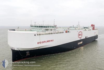
BYD EXPLORER NO.1
Cargo
Current Trip
CNNBOA POINT
| Time Travelled | 2 days |
|---|---|
| Remaining Time | --- |
| Distance Travelled | 1291.10 nm |
| Remaining Distance | --- |
| AVG Speed | 18.7 Knop |
| MAX Speed | 19.7 Knop |
| AVG Wind | 12.8 knots |
| MAX Wind | 17.7 knots |
| MIN Temp | 22.2°C / 71.96°F |
| MAX Temp | 28.9°C / 84.02°F |
| Djupgående | 7.9 m |
| Position mottagen | 2 d sen |
Current Position
| Longitud | --- |
|---|---|
| Latitude | --- |
| Status | Under way using engine |
| Fart | 18.9 Knop |
| Kurs | 266.8° |
| Område | North Pacific Ocean |
| Station | T-AIS |
| Position mottagen | 2 d sen |
Info
Information
The current position of BYD EXPLORER NO.1 is in North Pacific Ocean with coordinates 17.56019° / -108.46258° as reported on 2026-01-01 17:15 by AIS to our vessel tracker app. The vessel's current speed is 18.9 Knop
The vessel BYD EXPLORER NO.1 (MMSI: 636022995) is a Cargo It's sailing under the flag of [LR] Liberia.
In this page you can find informations about the vessels current position, last detected port calls, and current voyage information. If the vessels is not in coverage by AIS you will find the latest position.
The current position of BYD EXPLORER NO.1 is detected by our AIS receivers and we are not responsible for the reliability of the data. The last position was recorded while the vessel was in Coverage by the Ais receivers of our vessel tracking app.
The current draught of BYD EXPLORER NO.1 as reported by AIS is 7.9 meters
Weather
| Temperature | 22.4°C / 72.32°F |
|---|---|
| Wind Speed | 16 knots |
| Direction | 54° NE |
| Pressure | 1018.4 hPa |
| Humidity | 88.2 % |
| Cloud Coverage | 100 % |
Featured Company
Last Port Calls
| Port | Arrival | Departure | Time In Port |
|---|---|---|---|
| 2025-12-28 12:14 | 2025-12-31 15:34 | 3 d | |
| 2025-12-07 01:59 | 2025-12-08 14:55 | 1 d | |
| 2025-11-12 12:54 | 2025-11-14 03:26 | 1 d |
Most Visited Ports (Last year)
| Port | Arrivals | |
|---|---|---|
| 4 | ||
| 4 | ||
| 3 | ||
| 2 | ||
| 2 | ||
| 2 |
Last Trips
| Origin | Departure | Destination | Arrival | Distance | |
|---|---|---|---|---|---|
| 2025-12-08 14:55 | 2025-12-28 12:14 | 7791.24 nm | |||
| 2025-11-14 03:26 | 2025-12-07 01:59 | 7746.02 nm | |||
| 2025-10-23 13:00 | 2025-11-12 12:54 | 7865.11 nm |
Events
| Tid | Event | Detaljer | Position / Dest | Information |
|---|---|---|---|---|
| 2026-01-01 17:22 | Status ändrad | Default Under way using engine |
17.55872 / -108.49644
CNNBOA POINT
|
Fart: 18.9 kn Kurs: 266.8° |
| 2026-01-01 17:15 | Status ändrad | Under way using engine Default |
17.56019 / -108.46258
CNNBOA POINT
|
Fart: 18.8 kn Kurs: 268° |
| 2026-01-01 17:15 | UTANFÖR täckningsområde |
17.56019 / -108.46258
North Pacific Ocean
|
Fart: 18.9 kn Kurs: 266.8° |
|
| 2026-01-01 17:11 | Status ändrad | Default Under way using engine |
17.56112 / -108.44149
CNNBOA POINT
|
Fart: 18.7 kn Kurs: 267.4° |
| 2026-01-01 17:06 | Status ändrad | Under way using engine Default |
17.56239 / -108.41354
CNNBOA POINT
|
Fart: 18.9 kn Kurs: 268° |
| 2026-01-01 16:45 | Status ändrad | Default Under way using engine |
17.56754 / -108.29921
CNNBOA POINT
|
Fart: 18.8 kn Kurs: 267.3° |
| 2026-01-01 16:36 | Status ändrad | Under way using engine Default |
17.56973 / -108.24961
CNNBOA POINT
|
Fart: 19.1 kn Kurs: 267° |
| 2026-01-01 16:26 | I täckningsområde |
17.56947 / -108.25519
North Pacific Ocean
|
Fart: 18.8 kn Kurs: 267.3° |
|
| 2026-01-01 12:04 | Destination ändrad | CNNBOA POINT CNNBO |
17.63744 / -106.73501
CNNBOA POINT
|
Fart: 18.9 kn Kurs: 267° |
| 2026-01-01 11:45 | UTANFÖR täckningsområde |
17.64129 / -106.64337
North Pacific Ocean
|
Fart: 18.8 kn Kurs: 267.6° |