
BRABUS
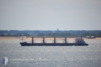
Bulk Carrier
Current Trip
| Time Travelled | --- |
|---|---|
| Remaining Time | 2 h, 16 mins |
| Distance Travelled | --- |
| Remaining Distance | 81.62 nm |
| AVG Speed | --- |
| MAX Speed | --- |
| AVG Wind | --- |
| MAX Wind | --- |
| MIN Temp | --- |
| MAX Temp | --- |
| Djupgående | 9.8 m |
| Position mottagen | 2 m sen |
Current Position
| Longitud | 118.34711° |
|---|---|
| Latitude | 23.87834° |
| Status | Under way using engine |
| Fart | 4.9 Knop |
| Kurs | 32° |
| Område | South China Sea |
| Station | T-AIS |
| Position mottagen | 2 m sen |
Info
Information
The current position of BRABUS is in South China Sea with coordinates 23.87834° / 118.34711° as reported on 2024-05-02 15:27 by AIS to our vessel tracker app. The vessel's current speed is 4.9 Knop and is heading at the port of XIAMEN. The estimated time of arrival as calculated by MyShipTracking vessel tracking app is 2024-05-02 17:46 LT
The vessel BRABUS (IMO: 9211559, MMSI: 372184000) is a Bulk Carrier that was built in 2000 ( 24 År gammal ). It's sailing under the flag of [PA] Panama.
In this page you can find informations about the vessels current position, last detected port calls, and current voyage information. If the vessels is not in coverage by AIS you will find the latest position.
The current position of BRABUS is detected by our AIS receivers and we are not responsible for the reliability of the data. The last position was recorded while the vessel was in Coverage by the Ais receivers of our vessel tracking app.
The current draught of BRABUS as reported by AIS is 9.8 meters
Weather
| Temperature | 21°C / 69.8°F |
|---|---|
| Wind Speed | 20 knots |
| Direction | 47° NE |
| Pressure | 1015.4 hPa |
| Humidity | 81.2 % |
| Cloud Coverage | 97 % |
Featured Company
Last Port Calls
| Port | Arrival | Departure | Time In Port |
|---|---|---|---|
| 2024-04-09 21:11 | |||
| 2024-04-04 14:12 | 2024-04-06 15:36 | 2 d | |
| 2024-03-07 10:57 | 2024-03-09 18:50 | 2 d |
Most Visited Ports (Last year)
| Port | Arrivals | |
|---|---|---|
| 2 | ||
| 2 | ||
| 2 | ||
| 2 | ||
| 1 | ||
| 1 |
Last Trips
| Origin | Departure | Destination | Arrival | Distance | |
|---|---|---|---|---|---|
| 2024-04-06 21:06 | 2024-04-10 02:41 | 263.70 nm | |||
| 2024-03-10 02:50 | 2024-04-04 19:42 | 4291.72 nm | |||
| 2024-02-26 15:23 | 2024-03-07 18:57 | 1551.38 nm |
Events
| Tid | Event | Detaljer | Position / Dest | Information |
|---|---|---|---|---|
| 2024-05-02 15:26 | Status ändrad | Under way using engine Default |
23.87689 / 118.34615
XIAMEN_CHINA
|
Fart: 4.8 kn Kurs: 29° |
| 2024-05-02 15:18 | Status ändrad | Default Under way using engine |
23.86628 / 118.33937
XIAMEN_CHINA
|
Fart: 5.3 kn Kurs: 0.2° |
| 2024-05-02 15:10 | Status ändrad | Under way using engine Default |
23.85741 / 118.33492
XIAMEN_CHINA
|
Fart: 4 kn Kurs: 11° |
| 2024-05-02 15:05 | I täckningsområde |
23.85741 / 118.33492
South China Sea
XIAMEN_CHINA
|
Fart: 5.3 kn Kurs: 0.2° |
|
| 2024-05-02 10:26 | Status ändrad | Default Under way using engine |
23.54948 / 118.00723
XIAMEN_CHINA
|
Fart: 5.5 kn Kurs: 55° |
| 2024-05-02 10:16 | UTANFÖR täckningsområde |
23.54006 / 117.99436
South China Sea
XIAMEN_CHINA
|
Fart: 5.5 kn Kurs: 55° |
|
| 2024-05-02 10:15 | Status ändrad | Under way using engine Default |
23.53930 / 117.99328
XIAMEN_CHINA
|
Fart: 5 kn Kurs: 46° |
| 2024-05-02 09:58 | I täckningsområde |
23.53977 / 117.99393
South China Sea
XIAMEN_CHINA
|
Fart: 5.4 kn Kurs: 47.4° |
|
| 2024-05-02 08:33 | Status ändrad | Default Under way using engine |
23.41848 / 117.84332
XIAMEN_CHINA
|
Fart: 8.5 kn Kurs: 51.7° |
| 2024-05-02 08:27 | UTANFÖR täckningsområde |
23.40881 / 117.83091
South China Sea
XIAMEN_CHINA
|
Fart: 8.5 kn Kurs: 51.7° |