

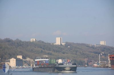
BOSPHORE
Cargo

Current Trip
| Time Travelled | 16 h, 52 mins |
|---|---|
| Remaining Time | --- |
| Distance Travelled | 77.31 nm |
| Remaining Distance | --- |
| AVG Speed | 7.9 Knop |
| MAX Speed | 10.5 Knop |
| AVG Wind | 7.1 knots |
| MAX Wind | 9 knots |
| MIN Temp | 2.5°C / 36.5°F |
| MAX Temp | 13.1°C / 55.58°F |
| Djupgående | 2.2 m |
| Position mottagen | 5 h, 53 m sen |
Current Position
| Longitud | --- |
|---|---|
| Latitude | --- |
| Status | Under way using engine |
| Fart | 8.3 Knop |
| Kurs | 84.3° |
| Område | English Channel |
| Station | T-AIS |
| Position mottagen | 5 h, 53 m sen |
Information
The current position of BOSPHORE is in English Channel with coordinates 49.31012° / 1.13012° as reported on 2025-04-10 11:08 by AIS to our vessel tracker app. The vessel's current speed is 8.3 Knop and is heading at the port of SAINT GRATIEN. The estimated time of arrival as calculated by MyShipTracking vessel tracking app is 2025-04-11 07:30 LT
The vessel BOSPHORE (MMSI: 226007020) is a Cargo It's sailing under the flag of [FR] France.
In this page you can find informations about the vessels current position, last detected port calls, and current voyage information. If the vessels is not in coverage by AIS you will find the latest position.
The current position of BOSPHORE is detected by our AIS receivers and we are not responsible for the reliability of the data. The last position was recorded while the vessel was in Coverage by the Ais receivers of our vessel tracking app.
The current draught of BOSPHORE as reported by AIS is 2.2 meters
Weather
| Temperature | 12.9°C / 55.22°F |
|---|---|
| Wind Speed | 8 knots |
| Direction | 49° NE |
| Pressure | 1029 hPa |
| Humidity | 58 % |
| Cloud Coverage | 24 % |


Featured Company
Last Port Calls
| Port | Arrival | Departure | Time In Port |
|---|---|---|---|
| 2025-04-10 00:39 | 2025-04-10 02:10 | 1 h | |
| 2025-04-09 17:55 | 2025-04-10 00:12 | 6 h | |
| 2025-04-09 15:59 | 2025-04-09 17:11 | 1 h | |
| 2025-03-26 23:11 | 2025-04-09 11:49 | 13 d | |
| 2025-03-26 14:21 | 2025-03-26 22:57 | 8 h | |
| 2025-03-26 12:41 | 2025-03-26 14:05 | 1 h | |
| 2025-03-25 19:20 | 2025-03-25 20:26 | 1 h | |
| 2025-03-22 16:44 | 2025-03-22 18:25 | 1 h | |
| 2025-03-21 10:44 | 2025-03-22 16:25 | 1 d | |
| 2025-03-21 09:01 | 2025-03-21 10:28 | 1 h |
Most Visited Ports (Last year)
| Port | Arrivals | |
|---|---|---|
| 291 | ||
| 24 | ||
| 14 | ||
| 7 | ||
| 5 | ||
| 3 |
Last Trips
| Origin | Departure | Destination | Arrival | Distance | |
|---|---|---|---|---|---|
| 2025-04-10 00:12 | 2025-04-10 00:39 | 1.59 nm | |||
| 2025-04-09 17:11 | 2025-04-09 17:55 | 4.72 nm | |||
| 2025-04-09 11:49 | 2025-04-09 15:59 | 5.68 nm | |||
| 2025-03-26 22:57 | 2025-03-26 23:11 | 1.25 nm | |||
| 2025-03-26 14:05 | 2025-03-26 14:21 | 1.79 nm | |||
| 2025-03-25 20:26 | 2025-03-26 12:41 | 3.01 nm | |||
| 2025-03-22 18:25 | 2025-03-25 19:20 | 146.21 nm | |||
| 2025-03-22 16:25 | 2025-03-22 16:44 | 1.37 nm | |||
| 2025-03-21 10:28 | 2025-03-21 10:44 | 2.05 nm | |||
| 2025-03-21 01:25 | 2025-03-21 09:01 | 3.92 nm |
Events
| Tid | Event | Detaljer | Position / Dest | Information |
|---|---|---|---|---|
| 2025-04-10 11:08 | UTANFÖR täckningsområde |
49.31012 / 1.13012
English Channel
GENNEVILLIERS
|
Fart: 8.3 kn Kurs: 84.3° |
|
| 2025-04-10 09:07 | STARTAR förflyttning | 0.2 nm, South East of ROUEN |
49.44079 / 1.07651
GENNEVILLIERS
|
Fart: 5.3 kn Kurs: 103.9° |
| 2025-04-10 09:06 | Status ändrad | Under way using engine Moored |
49.44107 / 1.07495
GENNEVILLIERS
|
Fart: 0.2 kn Kurs: 109° |
| 2025-04-10 08:42 | Status ändrad | Moored Under way using engine |
49.44125 / 1.07357
GENNEVILLIERS
|
Fart: Kurs: 112° |
| 2025-04-10 08:30 | STOPPAR förflyttning | 0.1 nm, South East of ROUEN |
49.44150 / 1.07378
GENNEVILLIERS
|
Fart: 0.1 kn Kurs: 114° |
| 2025-04-10 01:50 | STARTAR förflyttning | 1.38 nm, South West of RADICATEL |
49.47299 / .45602
GENNEVILLIERS
|
Fart: 3.9 kn Kurs: 93° |
| 2025-04-10 01:49 | Status ändrad | Under way using engine Moored |
49.47310 / .45396
GENNEVILLIERS
|
Fart: 0.1 kn Kurs: 92° |
| 2025-04-10 01:30 | STOPPAR förflyttning | 1.48 nm, South West of RADICATEL |
49.47315 / .45314
GENNEVILLIERS
|
Fart: 0.2 kn Kurs: 93° |
| 2025-04-10 01:30 | Status ändrad | Moored Under way using engine |
49.47315 / .45307
GENNEVILLIERS
|
Fart: 0.6 kn Kurs: 93° |
| 2025-04-10 00:10 | AVGÅTT HAMN |
|
49.49489 / .23286
GENNEVILLIERS
|
Fart: 7.5 kn Kurs: 104° |