
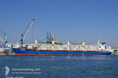
BOS BROOK
Bulk Carrier
Current Trip
SAFAJA
| Time Travelled | 7 days |
|---|---|
| Remaining Time | --- |
| Distance Travelled | 1843.53 nm |
| Remaining Distance | --- |
| AVG Speed | 9.9 Knop |
| MAX Speed | 9.9 Knop |
| AVG Wind | 7.6 knots |
| MAX Wind | 16 knots |
| MIN Temp | 18.6°C / 65.48°F |
| MAX Temp | 28°C / 82.4°F |
| Djupgående | 10 m |
| Position mottagen | 1 d sen |
Current Position
| Longitud | --- |
|---|---|
| Latitude | --- |
| Status | Under way using engine |
| Fart | 10.7 Knop |
| Kurs | 228.2° |
| Område | Arabian Sea |
| Station | T-AIS |
| Position mottagen | 1 d sen |
Info
Information
The current position of BOS BROOK is in Arabian Sea with coordinates 15.07696° / 54.08479° as reported on 2025-03-16 07:26 by AIS to our vessel tracker app. The vessel's current speed is 10.7 Knop
The vessel BOS BROOK (IMO: 9437505, MMSI: 375278000) is a Bulk Carrier that was built in 2010 ( 15 År gammal ). It's sailing under the flag of [VC] St Vincent Grenadines.
In this page you can find informations about the vessels current position, last detected port calls, and current voyage information. If the vessels is not in coverage by AIS you will find the latest position.
The current position of BOS BROOK is detected by our AIS receivers and we are not responsible for the reliability of the data. The last position was recorded while the vessel was in Coverage by the Ais receivers of our vessel tracking app.
The current draught of BOS BROOK as reported by AIS is 10 meters
Weather
| Temperature | 25.9°C / 78.62°F |
|---|---|
| Wind Speed | 15 knots |
| Direction | 69° ENE |
| Pressure | 1012.7 hPa |
| Humidity | 88.1 % |
| Cloud Coverage | 35 % |
Featured Company
Last Port Calls
| Port | Arrival | Departure | Time In Port |
|---|---|---|---|
| 2025-02-18 06:36 | 2025-03-10 10:59 | 20 d | |
| 2025-01-14 14:56 | 2025-01-19 01:03 | 4 d |
Most Visited Ports (Last year)
| Port | Arrivals | |
|---|---|---|
| 2 | ||
| 2 | ||
| 1 | ||
| 1 | ||
| 1 | ||
| 1 |
Last Trips
| Origin | Departure | Destination | Arrival | Distance | |
|---|---|---|---|---|---|
| 2025-01-19 01:03 | 2025-02-18 06:36 | 1414.48 nm | |||
| 2024-12-21 09:32 | 2025-01-14 14:56 | 2859.26 nm |
Events
| Tid | Event | Detaljer | Position / Dest | Information |
|---|---|---|---|---|
| 2025-03-16 07:29 | Status ändrad | Default Under way using engine |
15.07059 / 54.07745
SAFAJA
|
Fart: 10.7 kn Kurs: 228.2° |
| 2025-03-16 07:26 | UTANFÖR täckningsområde |
15.07696 / 54.08479
Arabian Sea
SAFAJA
|
Fart: 10.7 kn Kurs: 228.2° |
|
| 2025-03-16 07:19 | Status ändrad | Under way using engine Default |
15.09123 / 54.10088
SAFAJA
|
Fart: 10.7 kn Kurs: 226° |
| 2025-03-16 07:02 | I täckningsområde |
15.09123 / 54.10088
Arabian Sea
SAFAJA
|
Fart: 10.8 kn Kurs: 227.5° |
|
| 2025-03-16 04:27 | Status ändrad | Default Under way using engine |
15.42104 / 54.50626
SAFAJA
|
Fart: 10.5 kn Kurs: 234.2° |
| 2025-03-16 04:24 | UTANFÖR täckningsområde |
15.42776 / 54.51572
Arabian Sea
SAFAJA
|
Fart: 10.5 kn Kurs: 234.2° |
|
| 2025-03-16 04:19 | Status ändrad | Under way using engine Default |
15.43601 / 54.52729
SAFAJA
|
Fart: 10.5 kn Kurs: 233° |
| 2025-03-16 03:49 | Status ändrad | Default Under way using engine |
15.48805 / 54.59952
SAFAJA
|
Fart: 10.4 kn Kurs: 234.1° |
| 2025-03-16 03:15 | ETA ändrat | 2025/03/23 18:00 |
15.54923 / 54.68612
SAFAJA
|
Fart: 10.6 kn Kurs: 235.2° |
| 2025-03-16 03:12 | Status ändrad | Under way using engine Default |
15.55326 / 54.69190
SAFAJA
|
Fart: 10.6 kn Kurs: 234° |