

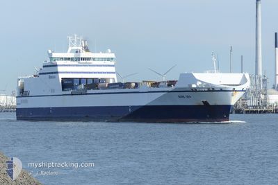
BORE SEA
Ro-Ro Cargo

Current Trip
| Time Travelled | 17 h, 35 mins |
|---|---|
| Remaining Time | 14 h, 17 mins |
| Distance Travelled | 288.31 nm |
| Remaining Distance | 269.14 nm |
| AVG Speed | 15 Knop |
| MAX Speed | 18.8 Knop |
| AVG Wind | 12.9 knots |
| MAX Wind | 16.6 knots |
| MIN Temp | 9.7°C / 49.46°F |
| MAX Temp | 12.7°C / 54.86°F |
| Djupgående | 6.7 m |
| Position mottagen | 2 m sen |
Current Position
| Longitud | --- |
|---|---|
| Latitude | --- |
| Status | Under way using engine |
| Fart | 18.2 Knop |
| Kurs | 233.3° |
| Område | Baltic Sea |
| Station | T-AIS |
| Position mottagen | 2 m sen |
Information
The current position of BORE SEA is in Baltic Sea with coordinates 56.29371° / 17.08369° as reported on 2025-06-03 13:03 by AIS to our vessel tracker app. The vessel's current speed is 18.2 Knop and is heading at the port of LUBECK. The estimated time of arrival as calculated by MyShipTracking vessel tracking app is 2025-06-04 03:23 LT
The vessel BORE SEA (IMO: 9443554, MMSI: 244130689) is a Ro-Ro Cargo that was built in 2011 ( 14 År gammal ). It's sailing under the flag of [NL] Netherlands.
In this page you can find informations about the vessels current position, last detected port calls, and current voyage information. If the vessels is not in coverage by AIS you will find the latest position.
The current position of BORE SEA is detected by our AIS receivers and we are not responsible for the reliability of the data. The last position was recorded while the vessel was in Coverage by the Ais receivers of our vessel tracking app.
The current draught of BORE SEA as reported by AIS is 6.7 meters
Weather
| Temperature | 11.4°C / 52.52°F |
|---|---|
| Wind Speed | 15 knots |
| Direction | 220° SW |
| Pressure | 1013 hPa |
| Humidity | 84.2 % |
| Cloud Coverage | --- |


Featured Company
Last Port Calls
| Port | Arrival | Departure | Time In Port |
|---|---|---|---|
| 2025-06-02 14:17 | 2025-06-02 19:31 | 5 h | |
| 2025-06-01 19:34 | 2025-06-02 14:12 | 18 h | |
| 2025-06-01 13:50 | 2025-06-01 17:03 | 3 h | |
| 2025-06-01 05:22 | 2025-06-01 11:08 | 5 h | |
| 2025-05-30 04:22 | 2025-05-30 22:38 | 18 h | |
| 2025-05-28 08:17 | 2025-05-28 19:47 | 11 h | |
| 2025-05-26 18:19 | 2025-05-27 18:48 | 1 d | |
| 2025-05-26 03:20 | 2025-05-26 08:35 | 5 h | |
| 2025-05-24 07:34 | 2025-05-24 16:14 | 8 h | |
| 2025-05-22 16:49 | 2025-05-22 23:23 | 6 h |
Last Trips
| Origin | Departure | Destination | Arrival | Distance | |
|---|---|---|---|---|---|
| 2025-06-02 17:12 | 2025-06-02 17:17 | 1.09 nm | |||
| 2025-06-01 20:03 | 2025-06-01 22:34 | 45.88 nm | |||
| 2025-06-01 14:08 | 2025-06-01 16:50 | 45.60 nm | |||
| 2025-05-31 00:38 | 2025-06-01 08:22 | 558.53 nm | |||
| 2025-05-28 22:47 | 2025-05-30 06:22 | 558.94 nm | |||
| 2025-05-27 21:48 | 2025-05-28 11:17 | 139.79 nm | |||
| 2025-05-26 11:35 | 2025-05-26 21:19 | 139.59 nm | |||
| 2025-05-24 18:14 | 2025-05-26 06:20 | 566.14 nm | |||
| 2025-05-23 02:23 | 2025-05-24 09:34 | 559.63 nm | |||
| 2025-05-22 17:14 | 2025-05-22 19:49 | 45.91 nm |
Events
| Tid | Event | Detaljer | Position / Dest | Information |
|---|---|---|---|---|
| 2025-06-03 12:09 | Status ändrad | Under way using engine Default |
56.45962 / 17.48225
DELBC [LUBECK]
|
Fart: 18.6 kn Kurs: 233° |
| 2025-06-03 12:07 | I täckningsområde |
56.45745 / 17.47700
Baltic Sea
DELBC [LUBECK]
|
Fart: 18.7 kn Kurs: 233.6° |
|
| 2025-06-03 09:27 | Status ändrad | Default Under way using engine |
56.98479 / 18.65356
DELBC [LUBECK]
|
Fart: 18.3 kn Kurs: 216° |
| 2025-06-03 09:19 | UTANFÖR täckningsområde |
57.01554 / 18.69459
Baltic Sea
DELBC [LUBECK]
|
Fart: 18.3 kn Kurs: 216° |
|
| 2025-06-03 05:48 | Status ändrad | Under way using engine Default |
57.89039 / 19.88056
DELBC [LUBECK]
|
Fart: 18.7 kn Kurs: 216° |
| 2025-06-03 05:43 | Status ändrad | Default Under way using engine |
57.91169 / 19.90874
DELBC [LUBECK]
|
Fart: 18.8 kn Kurs: 214.6° |
| 2025-06-03 05:36 | Status ändrad | Under way using engine Default |
57.93840 / 19.94398
DELBC [LUBECK]
|
Fart: 18.7 kn Kurs: 215° |
| 2025-06-03 05:35 | Status ändrad | Default Under way using engine |
57.94568 / 19.95366
DELBC [LUBECK]
|
Fart: 18.8 kn Kurs: 214.9° |
| 2025-06-03 05:23 | Byter havsområde | Swedish part of the Baltic Sea Estonian part of the Baltic Sea |
57.99664 / 20.02098
Baltic Sea
DELBC [LUBECK]
|
Fart: 18.7 kn Kurs: 214.9° |
| 2025-06-03 05:23 | Status ändrad | Under way using engine Default |
57.99664 / 20.02098
DELBC [LUBECK]
|
Fart: 18.8 kn Kurs: 215° |