
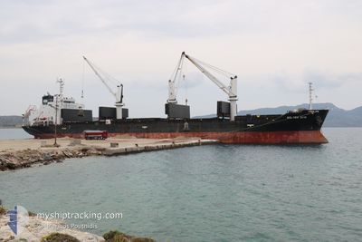
BOLTEN SYMI
General Cargo
Current Trip
| Time Travelled | 4 days |
|---|---|
| Remaining Time | --- |
| Distance Travelled | 1003.37 nm |
| Remaining Distance | --- |
| AVG Speed | 10.3 Knop |
| MAX Speed | 13.2 Knop |
| AVG Wind | 13.2 knots |
| MAX Wind | 26 knots |
| MIN Temp | 10.8°C / 51.44°F |
| MAX Temp | 15.7°C / 60.26°F |
| Djupgående | 7.9 m |
| Position mottagen | 2 m sen |
Current Position
| Longitud | -8.77571° |
|---|---|
| Latitude | 41.16888° |
| Status | At anchor |
| Fart | 0.7 Knop |
| Kurs | 345° |
| Område | North Atlantic Ocean |
| Station | T-AIS |
| Position mottagen | 2 m sen |
Info
Information
The current position of BOLTEN SYMI is in North Atlantic Ocean with coordinates 41.16888° / -8.77571° as reported on 2024-05-06 06:45 by AIS to our vessel tracker app. The vessel's current speed is 0.7 Knop
The vessel BOLTEN SYMI (IMO: 9427380, MMSI: 255976000) is a General Cargo that was built in 2009 ( 15 År gammal ). It's sailing under the flag of [PT] Portugal.
In this page you can find informations about the vessels current position, last detected port calls, and current voyage information. If the vessels is not in coverage by AIS you will find the latest position.
The current position of BOLTEN SYMI is detected by our AIS receivers and we are not responsible for the reliability of the data. The last position was recorded while the vessel was in Coverage by the Ais receivers of our vessel tracking app.
The current draught of BOLTEN SYMI as reported by AIS is 7.9 meters
Weather
| Temperature | 11.4°C / 52.52°F |
|---|---|
| Wind Speed | 9 knots |
| Direction | 360° N |
| Pressure | 1016 hPa |
| Humidity | 84.6 % |
| Cloud Coverage | --- |
Featured Company
Last Port Calls
| Port | Arrival | Departure | Time In Port |
|---|---|---|---|
| 2024-04-26 20:04 | 2024-05-01 23:36 | 5 d | |
| 2024-04-21 21:46 | 2024-04-26 10:26 | 4 d | |
| 2024-04-02 14:15 | 2024-04-10 09:02 | 7 d | |
| 2024-03-20 00:12 | 2024-03-31 02:01 | 11 d |
Last Trips
| Origin | Departure | Destination | Arrival | Distance | |
|---|---|---|---|---|---|
| 2024-04-26 12:26 | 2024-04-26 22:04 | 84.38 nm | |||
| 2024-04-10 12:02 | 2024-04-21 23:46 | 2883.86 nm | |||
| 2024-03-31 03:01 | 2024-04-02 17:15 | 736.33 nm | |||
| 2024-02-29 13:46 | 2024-03-20 01:12 | 1116.00 nm |
Events
| Tid | Event | Detaljer | Position / Dest | Information |
|---|---|---|---|---|
| 2024-05-05 21:57 | STOPPAR förflyttning | 3.32 nm, West of LEIXOES |
41.16869 / -8.77563
LEIXOES PT
|
Fart: 0.2 kn Kurs: 333° |
| 2024-05-05 21:33 | Status ändrad | At anchor Under way using engine |
41.17112 / -8.77608
LEIXOES PT
|
Fart: 0.7 kn Kurs: 256° |
| 2024-05-05 19:51 | Upptäckt i hav | Portuguese part of the North Atlantic Ocean |
41.42549 / -8.97597
North Atlantic Ocean
LEIXOES PT
|
Fart: 11.3 kn Kurs: 145.9° |
| 2024-05-05 19:51 | Status ändrad | Under way using engine Default |
41.42549 / -8.97597
LEIXOES PT
|
Fart: 11 kn Kurs: 148° |
| 2024-05-05 19:34 | I täckningsområde |
41.42549 / -8.97597
North Atlantic Ocean
LEIXOES PT
|
Fart: 11.3 kn Kurs: 145.9° |
|
| 2024-05-05 08:54 | Status ändrad | Default Under way using engine |
43.29666 / -10.07833
LEIXOES PT
|
Fart: 11.5 kn Kurs: 202° |
| 2024-05-05 08:52 | UTANFÖR täckningsområde |
43.30402 / -10.07546
North Atlantic Ocean
LEIXOES PT
|
Fart: 11.5 kn Kurs: 202° |
|
| 2024-05-05 08:50 | Status ändrad | Under way using engine Default |
43.31177 / -10.07090
LEIXOES PT
|
Fart: 11 kn Kurs: 205° |
| 2024-05-05 08:42 | Status ändrad | Default Under way using engine |
43.33167 / -10.05667
LEIXOES PT
|
Fart: 11.3 kn Kurs: 205.5° |
| 2024-05-05 08:32 | ETA ändrat | 2024/05/05 21:30 2024/05/05 17:00 |
43.36202 / -10.03899
LEIXOES PT
|
Fart: 10.9 kn Kurs: 205° |