

BOA
Cargo

Current Position
| Longitud | --- |
|---|---|
| Latitude | --- |
| Status | Moored |
| Fart | |
| Kurs | 210° |
| Område | Persian Gulf |
| Station | T-AIS |
| Position mottagen | 1 m sen |
Information
The current position of BOA is in Persian Gulf with coordinates 25.47039° / 55.48439° as reported on 2025-03-29 00:33 by AIS to our vessel tracker app. The vessel's current speed is 0 Knop and is currently inside the port of HAMRIYA.
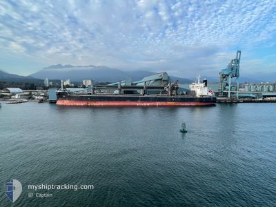
The vessel BOA (IMO: 9623764, MMSI: 538011105) is a Cargo It's sailing under the flag of [MH] Marshall Is.
In this page you can find informations about the vessels current position, last detected port calls, and current voyage information. If the vessels is not in coverage by AIS you will find the latest position.
The current position of BOA is detected by our AIS receivers and we are not responsible for the reliability of the data. The last position was recorded while the vessel was in Coverage by the Ais receivers of our vessel tracking app.
The current draught of BOA as reported by AIS is 6.3 meters
Weather
| Temperature | 22.3°C / 72.14°F |
|---|---|
| Wind Speed | 5 knots |
| Direction | 111° ESE |
| Pressure | 1012 hPa |
| Humidity | 39.6 % |
| Cloud Coverage | 7 % |


Featured Company
Most Visited Ports (Last year)
| Port | Arrivals | |
|---|---|---|
| 1 | ||
| 1 | ||
| 1 | ||
| 1 | ||
| 1 |
Last Trips
| Origin | Departure | Destination | Arrival | Distance |
|---|
Events
| Tid | Event | Detaljer | Position / Dest | Information |
|---|---|---|---|---|
| 2025-03-28 11:38 | Djupgående ändrat | 6.3 9.6 |
25.47039 / 55.48452
[AE] HAMRIYA
|
Fart: Kurs: 210° |
| 2025-03-28 11:38 | ETA ändrat | 2025/03/30 12:00 2025/03/24 12:00 |
25.47039 / 55.48452
[AE] HAMRIYA
|
Fart: Kurs: 210° |
| 2025-03-28 11:31 | Destination ändrad | AESHJ AEHAM |
25.47042 / 55.48443
[AE] HAMRIYA
|
Fart: Kurs: 210° |
| 2025-03-27 03:26 | Djupgående ändrat | 9.6 13.1 |
25.47175 / 55.48528
[AE] HAMRIYA
|
Fart: Kurs: 210° |
| 2025-03-24 09:05 | Status ändrad | Moored Under way using engine |
25.47169 / 55.48526
[AE] HAMRIYA
|
Fart: Kurs: 210° |
| 2025-03-24 08:34 | STOPPAR förflyttning |
25.47169 / 55.48499
[AE] HAMRIYA
|
Fart: 0.3 kn Kurs: 203° |
|
| 2025-03-24 08:13 | ANLÄNDER HAMN |
|
25.47898 / 55.47967
[AE] HAMRIYA
|
Fart: 5 kn Kurs: 191.2° |
| 2025-03-24 02:20 | Byter havsområde | United Arab Emirates part of the Persian Gulf Omani part of the Persian Gulf |
26.16145 / 55.91798
Persian Gulf
AEHAM
|
Fart: 11.3 kn Kurs: 213.7° |
| 2025-03-24 02:05 | Byter havsområde | Omani part of the Persian Gulf Omani part of the Gulf of Oman |
26.19974 / 55.95012
Persian Gulf
AEHAM
|
Fart: 11.5 kn Kurs: 217.4° |
| 2025-03-24 02:04 | I täckningsområde |
26.19974 / 55.95012
Persian Gulf
AEHAM
|
Fart: 11.5 kn Kurs: 217.4° |