
BLUE RIDGE HIGHWAY
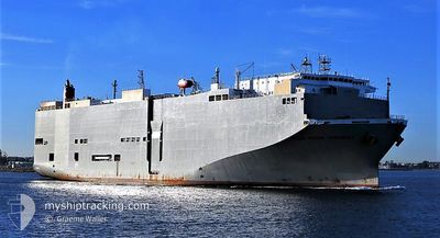
Vehicles Carrier
Current Trip
| Time Travelled | 15 h, 20 mins |
|---|---|
| Remaining Time | 1 day |
| Distance Travelled | 160.08 nm |
| Remaining Distance | 670.85 nm |
| AVG Speed | 16 Knop |
| MAX Speed | 17 Knop |
| AVG Wind | 9.9 knots |
| MAX Wind | 16 knots |
| MIN Temp | 30.4°C / 86.72°F |
| MAX Temp | 30.8°C / 87.44°F |
| Djupgående | 8.7 m |
| Position mottagen | 9 h, 53 m sen |
Current Position
| Longitud | 100.77458° |
|---|---|
| Latitude | 11.72183° |
| Status | Under way using engine |
| Fart | 16.7 Knop |
| Kurs | 206° |
| Område | Gulf of Thailand |
| Station | T-AIS |
| Position mottagen | 9 h, 53 m sen |
Info
Information
The current position of BLUE RIDGE HIGHWAY is in Gulf of Thailand with coordinates 11.72183° / 100.77458° as reported on 2024-05-05 23:09 by AIS to our vessel tracker app. The vessel's current speed is 16.7 Knop and is heading at the port of SINGAPORE. The estimated time of arrival as calculated by MyShipTracking vessel tracking app is 2024-05-07 17:01 LT
The vessel BLUE RIDGE HIGHWAY (IMO: 9510151, MMSI: 355558000) is a Vehicles Carrier that was built in 2009 ( 15 År gammal ). It's sailing under the flag of [PA] Panama.
In this page you can find informations about the vessels current position, last detected port calls, and current voyage information. If the vessels is not in coverage by AIS you will find the latest position.
The current position of BLUE RIDGE HIGHWAY is detected by our AIS receivers and we are not responsible for the reliability of the data. The last position was recorded while the vessel was in Coverage by the Ais receivers of our vessel tracking app.
The current draught of BLUE RIDGE HIGHWAY as reported by AIS is 8.7 meters
Weather
| Temperature | 30.8°C / 87.44°F |
|---|---|
| Wind Speed | 4 knots |
| Direction | 188° S |
| Pressure | 1008.4 hPa |
| Humidity | 69.3 % |
| Cloud Coverage | 99 % |
Featured Company
Last Port Calls
| Port | Arrival | Departure | Time In Port |
|---|---|---|---|
| 2024-05-04 23:26 | 2024-05-05 17:43 | 18 h | |
| 2024-04-28 11:40 | 2024-04-29 06:20 | 18 h | |
| 2024-04-24 08:11 | 2024-04-25 05:20 | 21 h | |
| 2024-04-17 23:17 | 2024-04-18 17:19 | 18 h | |
| 2024-04-15 04:18 | 2024-04-15 18:51 | 14 h | |
| 2024-04-13 23:58 | 2024-04-14 13:02 | 13 h | |
| 2024-04-10 23:16 | 2024-04-12 03:32 | 1 d | |
| 2024-04-08 23:38 | 2024-04-09 09:22 | 9 h | |
| 2024-04-05 23:13 | 2024-04-06 17:36 | 18 h | |
| 2024-03-31 14:10 | 2024-04-01 17:28 | 1 d |
Most Visited Ports (Last year)
| Port | Arrivals | |
|---|---|---|
| 28 | ||
| 25 | ||
| 15 | ||
| 13 | ||
| 9 | ||
| 6 |
Last Trips
| Origin | Departure | Destination | Arrival | Distance | |
|---|---|---|---|---|---|
| 2024-04-29 14:20 | 2024-05-05 06:26 | 1463.06 nm | |||
| 2024-04-25 12:20 | 2024-04-28 19:40 | 1005.14 nm | |||
| 2024-04-19 00:19 | 2024-04-24 15:11 | 1509.22 nm | |||
| 2024-04-16 02:51 | 2024-04-18 06:17 | 827.42 nm | |||
| 2024-04-14 21:02 | 2024-04-15 12:18 | 199.15 nm | |||
| 2024-04-12 10:32 | 2024-04-14 07:58 | 762.83 nm | |||
| 2024-04-09 17:22 | 2024-04-11 06:16 | 568.30 nm | |||
| 2024-04-07 00:36 | 2024-04-09 07:38 | 816.30 nm | |||
| 2024-04-02 00:28 | 2024-04-06 06:13 | 1374.76 nm | |||
| 2024-03-26 17:18 | 2024-03-31 21:10 | 1455.12 nm |
Events
| Tid | Event | Detaljer | Position / Dest | Information |
|---|---|---|---|---|
| 2024-05-05 23:16 | Status ändrad | Default Under way using engine |
11.69263 / 100.76075
SG SIN
|
Fart: 16.7 kn Kurs: 206° |
| 2024-05-05 23:09 | UTANFÖR täckningsområde |
11.72183 / 100.77458
Gulf of Thailand
SG SIN
|
Fart: 16.7 kn Kurs: 206° |
|
| 2024-05-05 23:07 | Status ändrad | Under way using engine Default |
11.72952 / 100.77843
SG SIN
|
Fart: 16.7 kn Kurs: 198° |
| 2024-05-05 23:03 | Status ändrad | Default Under way using engine |
11.74758 / 100.78650
SG SIN
|
Fart: 16.5 kn Kurs: 208° |
| 2024-05-05 22:56 | Status ändrad | Under way using engine Default |
11.77917 / 100.80070
SG SIN
|
Fart: 16.9 kn Kurs: 178° |
| 2024-05-05 22:44 | Status ändrad | Default Under way using engine |
11.83560 / 100.79997
SG SIN
|
Fart: 17.1 kn Kurs: 178° |
| 2024-05-05 22:38 | Status ändrad | Under way using engine Default |
11.86280 / 100.79902
SG SIN
|
Fart: 17 kn Kurs: 177° |
| 2024-05-05 22:35 | Status ändrad | Default Under way using engine |
11.87560 / 100.79850
SG SIN
|
Fart: 17 kn Kurs: 178° |
| 2024-05-05 22:31 | Status ändrad | Under way using engine Default |
11.89618 / 100.79762
SG SIN
|
Fart: 17 kn Kurs: 177° |
| 2024-05-05 22:21 | I täckningsområde |
11.89515 / 100.79765
Gulf of Thailand
SG SIN
|
Fart: 17 kn Kurs: 178° |