
BLUE PRINCE
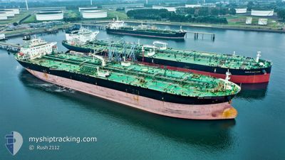
Crude Oil Tanker
Current Trip
FOR ORDERS
| Time Travelled | 6 days |
|---|---|
| Remaining Time | --- |
| Distance Travelled | 2168.22 nm |
| Remaining Distance | --- |
| AVG Speed | 12.6 Knop |
| MAX Speed | 15.8 Knop |
| AVG Wind | 9.8 knots |
| MAX Wind | 15.9 knots |
| MIN Temp | 16.6°C / 61.88°F |
| MAX Temp | 26.7°C / 80.06°F |
| Djupgående | 11 m |
| Position mottagen | 3 d sen |
Current Position
| Longitud | -79.33971° |
|---|---|
| Latitude | 26.32255° |
| Status | Under way using engine |
| Fart | 14.2 Knop |
| Kurs | 17.3° |
| Område | North Atlantic Ocean |
| Station | T-AIS |
| Position mottagen | 3 d sen |
Info
Information
The current position of BLUE PRINCE is in North Atlantic Ocean with coordinates 26.32255° / -79.33971° as reported on 2024-05-03 04:38 by AIS to our vessel tracker app. The vessel's current speed is 14.2 Knop
The vessel BLUE PRINCE (IMO: 9429182, MMSI: 538008070) is a Crude Oil Tanker that was built in 2009 ( 15 År gammal ). It's sailing under the flag of [MH] Marshall Is.
In this page you can find informations about the vessels current position, last detected port calls, and current voyage information. If the vessels is not in coverage by AIS you will find the latest position.
The current position of BLUE PRINCE is detected by our AIS receivers and we are not responsible for the reliability of the data. The last position was recorded while the vessel was in Coverage by the Ais receivers of our vessel tracking app.
The current draught of BLUE PRINCE as reported by AIS is 11 meters
Weather
| Temperature | 16.6°C / 61.88°F |
|---|---|
| Wind Speed | 4 knots |
| Direction | 54° NE |
| Pressure | 1023.2 hPa |
| Humidity | 57.2 % |
| Cloud Coverage | 100 % |
Featured Company
Last Port Calls
| Port | Arrival | Departure | Time In Port |
|---|---|---|---|
| 2024-04-26 19:33 | 2024-04-29 13:33 | 2 d | |
| 2024-04-16 12:09 | 2024-04-16 12:49 | 40 m | |
| 2024-04-07 02:51 | 2024-04-08 14:23 | 1 d | |
| 2024-03-02 16:04 |
Most Visited Ports (Last year)
| Port | Arrivals | |
|---|---|---|
| 3 | ||
| 2 | ||
| 2 | ||
| 2 | ||
| 2 | ||
| 1 |
Last Trips
| Origin | Departure | Destination | Arrival | Distance | |
|---|---|---|---|---|---|
| 2024-04-16 07:49 | 2024-04-26 14:33 | 839.60 nm | |||
| 2024-04-08 10:23 | 2024-04-16 07:09 | 2433.21 nm | |||
| 2024-03-02 10:04 | 2024-04-06 22:51 | 8984.75 nm |
Events
| Tid | Event | Detaljer | Position / Dest | Information |
|---|---|---|---|---|
| 2024-05-03 04:46 | Status ändrad | Default Under way using engine |
26.35408 / -79.32983
FOR ORDERS
|
Fart: 14.2 kn Kurs: 17.3° |
| 2024-05-03 04:38 | UTANFÖR täckningsområde |
26.32255 / -79.33971
North Atlantic Ocean
FOR ORDERS
|
Fart: 14.2 kn Kurs: 17.3° |
|
| 2024-05-03 03:43 | Status ändrad | Under way using engine Default |
26.10956 / -79.39759
FOR ORDERS
|
Fart: 14.5 kn Kurs: 12° |
| 2024-05-03 03:42 | Status ändrad | Default Under way using engine |
26.10552 / -79.39857
FOR ORDERS
|
Fart: 14.6 kn Kurs: 12.4° |
| 2024-05-03 03:37 | Status ändrad | Under way using engine Default |
26.08308 / -79.40396
FOR ORDERS
|
Fart: 14 kn Kurs: 12° |
| 2024-05-03 03:15 | Status ändrad | Default Under way using engine |
25.99482 / -79.42217
FOR ORDERS
|
Fart: 14.9 kn Kurs: 12.3° |
| 2024-05-03 03:13 | Status ändrad | Under way using engine Default |
25.98791 / -79.42383
FOR ORDERS
|
Fart: 15 kn Kurs: 11° |
| 2024-05-03 03:08 | Status ändrad | Default Under way using engine |
25.96500 / -79.42834
FOR ORDERS
|
Fart: 15 kn Kurs: 11.2° |
| 2024-05-03 02:02 | ETA ändrat | 2024/05/18 14:00 2024/05/18 06:00 |
25.69883 / -79.49914
FOR ORDERS
|
Fart: 14.8 kn Kurs: 12.8° |
| 2024-05-03 01:44 | Status ändrad | Under way using engine Default |
25.62301 / -79.50617
FOR ORDERS
|
Fart: 14 kn Kurs: 359° |