
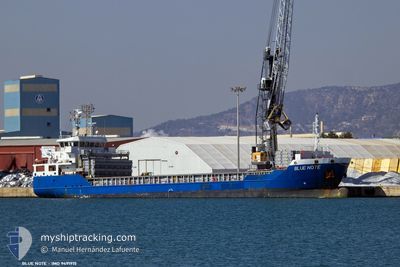
BLUE NOTE
General Cargo
Current Trip
| Time Travelled | 15 days |
|---|---|
| Remaining Time | --- |
| Distance Travelled | 1195.69 nm |
| Remaining Distance | --- |
| AVG Speed | 7.4 Knop |
| MAX Speed | 11.3 Knop |
| AVG Wind | 15.8 knots |
| MAX Wind | 44 knots |
| MIN Temp | 10.3°C / 50.54°F |
| MAX Temp | 20.9°C / 69.62°F |
| Djupgående | 3.8 m |
| Position mottagen | 14 d sen |
Current Position
| Longitud | --- |
|---|---|
| Latitude | --- |
| Status | Under way using engine |
| Fart | 10.6 Knop |
| Kurs | 211.6° |
| Område | North Atlantic Ocean |
| Station | T-AIS |
| Position mottagen | 14 d sen |
Info
Information
The current position of BLUE NOTE is in North Atlantic Ocean with coordinates 39.99783° / -9.35454° as reported on 2025-12-24 19:53 by AIS to our vessel tracker app. The vessel's current speed is 10.6 Knop
The vessel BLUE NOTE (IMO: 9491915, MMSI: 305565000) is a General Cargo that was built in 2010 ( 16 År gammal ). It's sailing under the flag of [AG] Antigua Barbuda.
In this page you can find informations about the vessels current position, last detected port calls, and current voyage information. If the vessels is not in coverage by AIS you will find the latest position.
The current position of BLUE NOTE is detected by our AIS receivers and we are not responsible for the reliability of the data. The last position was recorded while the vessel was in Coverage by the Ais receivers of our vessel tracking app.
The current draught of BLUE NOTE as reported by AIS is 3.8 meters
Weather
| Temperature | 14°C / 57.2°F |
|---|---|
| Wind Speed | 9 knots |
| Direction | 25° NNE |
| Pressure | 1031.9 hPa |
| Humidity | 69.9 % |
| Cloud Coverage | --- |
Featured Company
Last Port Calls
| Port | Arrival | Departure | Time In Port |
|---|---|---|---|
| 2025-12-23 10:44 | 2025-12-24 15:24 | 1 d | |
| 2025-12-18 14:10 | 2025-12-19 12:36 | 22 h | |
| 2025-12-01 15:04 | 2025-12-07 14:53 | 5 d | |
| 2025-11-24 00:58 | 2025-11-27 01:42 | 3 d | |
| 2025-11-17 18:37 | 2025-11-20 18:01 | 2 d | |
| 2025-11-14 10:58 | 2025-11-15 21:18 | 1 d | |
| 2025-11-11 06:46 | 2025-11-12 10:22 | 1 d | |
| 2025-11-07 01:01 | 2025-11-08 00:15 | 23 h | |
| 2025-11-01 18:06 | 2025-11-03 18:38 | 2 d |
Last Trips
| Origin | Departure | Destination | Arrival | Distance | |
|---|---|---|---|---|---|
| 2025-12-19 12:36 | 2025-12-23 10:44 | 372.80 nm | |||
| 2025-12-07 14:53 | 2025-12-18 14:10 | 1345.55 nm | |||
| 2025-11-27 01:42 | 2025-12-01 15:04 | 365.35 nm | |||
| 2025-11-20 18:01 | 2025-11-24 00:58 | 349.36 nm | |||
| 2025-11-15 21:18 | 2025-11-17 18:37 | 321.14 nm | |||
| 2025-11-12 10:22 | 2025-11-14 10:58 | 154.53 nm | |||
| 2025-11-08 00:15 | 2025-11-11 06:46 | 598.03 nm | |||
| 2025-11-03 18:38 | 2025-11-07 01:01 | 392.58 nm | |||
| 2025-10-29 17:36 | 2025-11-01 18:06 | 411.20 nm |
Events
| Tid | Event | Detaljer | Position / Dest | Information |
|---|---|---|---|---|
| 2026-01-06 08:27 | STOPPAR förflyttning | 5.94 nm, South West of JORF LASFAR |
33.07137 / -8.72950
MAJFL
|
Fart: 0.3 kn Kurs: 48° |
| 2026-01-02 20:37 | STARTAR förflyttning | 14.66 nm, West of JORF LASFAR |
33.06105 / -8.91286
MAJFL
|
Fart: 3.5 kn Kurs: 234° |
| 2026-01-02 19:32 | STOPPAR förflyttning | 13.01 nm, West of JORF LASFAR |
33.07500 / -8.88333
MAJFL
|
Fart: Kurs: -1° |
| 2026-01-02 12:01 | STARTAR förflyttning | 5.78 nm, South West of JORF LASFAR |
33.07550 / -8.72912
MAJFL
|
Fart: 5.5 kn Kurs: 248° |