
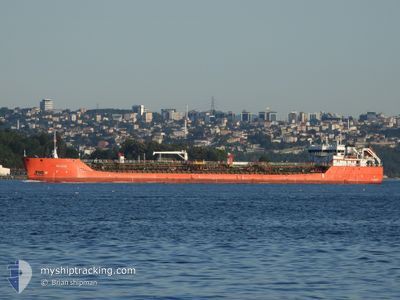
BLUE LAKE STAR
Tanker B
Current Trip
TRIST
| Time Travelled | 1 day |
|---|---|
| Remaining Time | --- |
| Distance Travelled | 268.18 nm |
| Remaining Distance | --- |
| AVG Speed | 7.7 Knop |
| MAX Speed | 8.5 Knop |
| AVG Wind | 8.5 knots |
| MAX Wind | 16 knots |
| MIN Temp | 4.5°C / 40.1°F |
| MAX Temp | 9.8°C / 49.64°F |
| Djupgående | 3.4 m |
| Position mottagen | 1 d sen |
Current Position
| Longitud | --- |
|---|---|
| Latitude | --- |
| Status | Under way using engine |
| Fart | 8.1 Knop |
| Kurs | 82.3° |
| Område | Black Sea |
| Station | T-AIS |
| Position mottagen | 1 d sen |
Info
Information
The current position of BLUE LAKE STAR is in Black Sea with coordinates 41.35065° / 29.61473° as reported on 2025-02-15 13:55 by AIS to our vessel tracker app. The vessel's current speed is 8.1 Knop
The vessel BLUE LAKE STAR (IMO: 9729582, MMSI: 352001410) is a Tanker B It's sailing under the flag of [PA] Panama.
In this page you can find informations about the vessels current position, last detected port calls, and current voyage information. If the vessels is not in coverage by AIS you will find the latest position.
The current position of BLUE LAKE STAR is detected by our AIS receivers and we are not responsible for the reliability of the data. The last position was recorded while the vessel was in Coverage by the Ais receivers of our vessel tracking app.
The current draught of BLUE LAKE STAR as reported by AIS is 3.4 meters
Weather
| Temperature | 6.1°C / 42.98°F |
|---|---|
| Wind Speed | 8 knots |
| Direction | 69° ENE |
| Pressure | 1017.6 hPa |
| Humidity | 91.8 % |
| Cloud Coverage | 100 % |
Featured Company
Last Port Calls
| Port | Arrival | Departure | Time In Port |
|---|---|---|---|
| 2025-02-15 08:51 | 2025-02-15 10:54 | 2 h | |
| 2025-02-02 15:16 | 2025-02-05 02:25 | 2 d | |
| 2025-01-23 11:30 | 2025-01-24 09:30 | 22 h | |
| 2025-01-01 14:31 | 2025-01-03 03:13 | 1 d | |
| 2024-12-25 12:12 | 2024-12-26 05:23 | 17 h | |
| 2024-12-20 05:22 | 2024-12-21 05:16 | 23 h |
Last Trips
| Origin | Departure | Destination | Arrival | Distance | |
|---|---|---|---|---|---|
| 2025-02-05 04:25 | 2025-02-15 11:51 | 1134.17 nm | |||
| 2025-01-24 13:30 | 2025-02-02 17:16 | 1460.13 nm | |||
| 2025-01-03 05:13 | 2025-01-23 15:30 | 1527.39 nm | |||
| 2024-12-26 08:23 | 2025-01-01 16:31 | 981.08 nm | |||
| 2024-12-21 09:16 | 2024-12-25 15:12 | 656.96 nm | |||
| 2024-11-27 07:12 | 2024-12-20 09:22 | 1829.05 nm |
Events
| Tid | Event | Detaljer | Position / Dest | Information |
|---|---|---|---|---|
| 2025-02-15 14:08 | Status ändrad | Default Under way using engine |
41.35485 / 29.65360
TRIST
|
Fart: 8.1 kn Kurs: 82.3° |
| 2025-02-15 13:55 | Status ändrad | Under way using engine Default |
41.35065 / 29.61473
TRIST
|
Fart: 8.1 kn Kurs: 80° |
| 2025-02-15 13:55 | UTANFÖR täckningsområde |
41.35065 / 29.61473
Black Sea
|
Fart: 8.1 kn Kurs: 82.3° |
|
| 2025-02-15 13:38 | Status ändrad | Default Under way using engine |
41.34533 / 29.56776
TRIST
|
Fart: 7.9 kn Kurs: 74.2° |
| 2025-02-15 11:10 | Byter havsområde | Turkish part of the Black Sea Turkish part of the Sea of Marmara |
41.23045 / 29.15234
Black Sea
|
Fart: 8.3 kn Kurs: 54.4° |
| 2025-02-15 10:54 | AVGÅTT HAMN |
|
41.20366 / 29.11692
TRIST
|
Fart: 8 kn Kurs: 42° |
| 2025-02-15 08:51 | ANLÄNDER HAMN |
|
41.00792 / 28.99977
[TR] ISTANBUL
|
Fart: 6.4 kn Kurs: 0.4° |
| 2025-02-15 06:25 | STARTAR förflyttning | 9.77 nm, South West of MALTEPE |
40.78397 / 29.00163
TRIST
|
Fart: 3.5 kn Kurs: 19° |
| 2025-02-15 04:25 | STOPPAR förflyttning | 10.53 nm, South West of MALTEPE |
40.80187 / 28.95167
TRIST
|
Fart: 0.3 kn Kurs: 286° |
| 2025-02-15 04:08 | STARTAR förflyttning | 9.65 nm, South West of MALTEPE |
40.80585 / 28.97295
TRIST
|
Fart: 3.2 kn Kurs: 255° |