
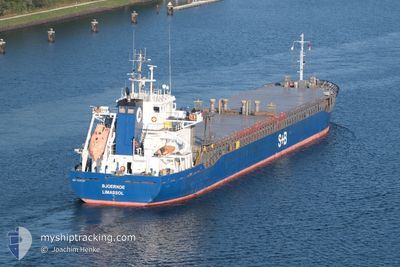
BJOERKOE
General Cargo
Current Trip
| Time Travelled | 3 days |
|---|---|
| Remaining Time | --- |
| Distance Travelled | 824.22 nm |
| Remaining Distance | --- |
| AVG Speed | 10 Knop |
| MAX Speed | 10.8 Knop |
| AVG Wind | 7.2 knots |
| MAX Wind | 16.4 knots |
| MIN Temp | 6.2°C / 43.16°F |
| MAX Temp | 12.8°C / 55.04°F |
| Djupgående | 5.3 m |
| Position mottagen | 1 m sen |
Current Position
| Longitud | --- |
|---|---|
| Latitude | --- |
| Status | Under way using engine |
| Fart | 10.1 Knop |
| Kurs | 270° |
| Område | Baltic Sea |
| Station | T-AIS |
| Position mottagen | 1 m sen |
Info
Information
The current position of BJOERKOE is in Baltic Sea with coordinates 54.44061° / 11.98540° as reported on 2024-10-05 06:32 by AIS to our vessel tracker app. The vessel's current speed is 10.1 Knop and is heading at the port of BILBAO. The estimated time of arrival as calculated by MyShipTracking vessel tracking app is 2024-10-10 10:00 LT
The vessel BJOERKOE (IMO: 9376787, MMSI: 212153000) is a General Cargo that was built in 2009 ( 15 År gammal ). It's sailing under the flag of [CY] Cyprus.
In this page you can find informations about the vessels current position, last detected port calls, and current voyage information. If the vessels is not in coverage by AIS you will find the latest position.
The current position of BJOERKOE is detected by our AIS receivers and we are not responsible for the reliability of the data. The last position was recorded while the vessel was in Coverage by the Ais receivers of our vessel tracking app.
The current draught of BJOERKOE as reported by AIS is 5.3 meters
Weather
| Temperature | 12°C / 53.6°F |
|---|---|
| Wind Speed | 3 knots |
| Direction | 1° N |
| Pressure | 1021.1 hPa |
| Humidity | 63.7 % |
| Cloud Coverage | --- |
Featured Company
Last Port Calls
| Port | Arrival | Departure | Time In Port |
|---|---|---|---|
| 2024-09-30 19:34 | 2024-10-01 20:26 | 1 d | |
| 2024-09-26 18:29 | 2024-09-28 17:09 | 1 d | |
| 2024-09-19 18:19 | 2024-09-21 00:04 | 1 d | |
| 2024-09-08 11:25 | 2024-09-09 22:13 | 1 d | |
| 2024-08-30 05:25 | 2024-09-04 13:48 | 5 d | |
| 2024-08-24 01:47 | 2024-08-27 00:17 | 2 d | |
| 2024-08-21 17:56 | 2024-08-22 17:39 | 23 h | |
| 2024-08-18 13:19 | 2024-08-20 20:08 | 2 d | |
| 2024-08-12 12:29 | 2024-08-14 13:22 | 2 d | |
| 2024-08-08 13:36 | 2024-08-09 14:05 | 1 d |
Last Trips
| Origin | Departure | Destination | Arrival | Distance | |
|---|---|---|---|---|---|
| 2024-09-28 20:09 | 2024-09-30 21:34 | 93.06 nm | |||
| 2024-09-21 02:04 | 2024-09-26 21:29 | 1475.86 nm | |||
| 2024-09-10 01:13 | 2024-09-19 20:19 | 1132.80 nm | |||
| 2024-09-04 15:48 | 2024-09-08 14:25 | 454.19 nm | |||
| 2024-08-27 03:17 | 2024-08-30 07:25 | 626.98 nm | |||
| 2024-08-22 20:39 | 2024-08-24 04:47 | 130.47 nm | |||
| 2024-08-20 22:08 | 2024-08-21 20:56 | 210.61 nm | |||
| 2024-08-14 15:22 | 2024-08-18 15:19 | 652.13 nm | |||
| 2024-08-09 16:05 | 2024-08-12 14:29 | 155.08 nm | |||
| 2024-07-25 16:53 | 2024-08-08 15:36 | 1361.51 nm |
Events
| Tid | Event | Detaljer | Position / Dest | Information |
|---|---|---|---|---|
| 2024-10-05 01:58 | Byter havsområde | Danish part of the Baltic Sea German part of the Baltic Sea |
54.84610 / 12.94294
Baltic Sea
ES BIO
|
Fart: 9.4 kn Kurs: 254° |
| 2024-10-04 23:22 | Status ändrad | Under way using engine Default |
54.98231 / 13.63102
ES BIO
|
Fart: 10 kn Kurs: 250° |
| 2024-10-04 23:21 | Status ändrad | Default Under way using engine |
54.98291 / 13.63403
ES BIO
|
Fart: 9.9 kn Kurs: 252° |
| 2024-10-04 22:46 | Upptäckt i hav | German part of the Baltic Sea |
55.01416 / 13.79124
Baltic Sea
ES BIO
|
Fart: 10 kn Kurs: 252° |
| 2024-10-04 18:16 | Upptäckt i hav | Swedish part of the Baltic Sea |
55.48224 / 14.71254
Baltic Sea
ES BIO
|
Fart: 9.3 kn Kurs: 241° |
| 2024-10-04 16:11 | Byter havsområde | Danish part of the Kattegat Swedish part of the Baltic Sea |
55.64023 / 15.22965
Kattegat
ES BIO
|
Fart: 9.7 kn Kurs: 239° |
| 2024-10-04 10:06 | Status ändrad | Under way using engine Default |
56.17237 / 16.75721
ES BIO
|
Fart: 9.8 kn Kurs: 202° |
| 2024-10-04 10:01 | Status ändrad | Default Under way using engine |
56.18453 / 16.76597
ES BIO
|
Fart: 9.7 kn Kurs: 200° |
| 2024-10-04 09:54 | Status ändrad | Under way using engine Default |
56.20320 / 16.77947
ES BIO
|
Fart: 9.8 kn Kurs: 201° |
| 2024-10-04 09:13 | Status ändrad | Default Under way using engine |
56.30904 / 16.85512
ES BIO
|
Fart: 10.2 kn Kurs: 202° |