

BHUDTHI BHUM
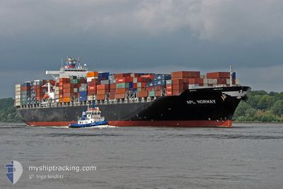
Container Ship

Current Trip
| Trip Time | 4 days |
|---|---|
| Trip Distance | 1414.64 nm |
| AVG Speed | 13.7 Knop |
| MAX Speed | 16.8 Knop |
| Djupgående | 13.5 m |
| AVG Wind | 6.8 knots |
| MAX Wind | 11 knots |
| MIN Temp | 24.7°C / 76.46°F |
| MAX Temp | 28.6°C / 83.48°F |
| Position mottagen | 2 d sen |
Current Position
| Longitud | --- |
|---|---|
| Latitude | --- |
| Status | Under way using engine |
| Fart | 16.3 Knop |
| Kurs | 133° |
| Område | Andaman or Burma Sea |
| Station | T-AIS |
| Position mottagen | 2 d sen |
Information
The current position of BHUDTHI BHUM is in Andaman or Burma Sea with coordinates 7.10392° / 95.92008° as reported on 2025-02-16 19:32 by AIS to our vessel tracker app. The vessel's current speed is 16.3 Knop and is currently inside the port of PORT KLANG.
The vessel BHUDTHI BHUM (IMO: 9403621, MMSI: 563136800) is a Container Ship that was built in 2007 ( 18 År gammal ). It's sailing under the flag of [SG] Singapore.
In this page you can find informations about the vessels current position, last detected port calls, and current voyage information. If the vessels is not in coverage by AIS you will find the latest position.
The current position of BHUDTHI BHUM is detected by our AIS receivers and we are not responsible for the reliability of the data. The last position was recorded while the vessel was in Coverage by the Ais receivers of our vessel tracking app.
The current draught of BHUDTHI BHUM as reported by AIS is 13.5 meters
Weather
| Temperature | 27.6°C / 81.68°F |
|---|---|
| Wind Speed | 5 knots |
| Direction | 196° SSW |
| Pressure | 1008.2 hPa |
| Humidity | 72.5 % |
| Cloud Coverage | 100 % |


Featured Company
Last Port Calls
| Port | Arrival | Departure | Time In Port |
|---|---|---|---|
| 2025-02-18 09:39 | |||
| 2025-02-13 02:59 | 2025-02-14 03:48 | 1 d | |
| 2025-02-09 15:09 | 2025-02-12 06:21 | 2 d | |
| 2025-02-05 03:05 | 2025-02-05 16:41 | 13 h | |
| 2025-02-03 05:52 | 2025-02-04 00:15 | 18 h | |
| 2025-01-21 08:13 | 2025-01-21 22:44 | 14 h | |
| 2025-01-14 11:54 | 2025-01-15 01:28 | 13 h | |
| 2025-01-12 07:37 | 2025-01-13 06:48 | 23 h | |
| 2025-01-04 18:00 | 2025-01-05 05:07 | 11 h | |
| 2024-12-23 10:29 | 2024-12-25 14:16 | 2 d |
Last Trips
| Origin | Departure | Destination | Arrival | Distance | |
|---|---|---|---|---|---|
| 2025-02-14 09:18 | 2025-02-18 17:39 | 1414.64 nm | |||
| 2025-02-12 11:51 | 2025-02-13 08:29 | 337.58 nm | |||
| 2025-02-06 00:41 | 2025-02-09 20:39 | 1412.36 nm | |||
| 2025-02-04 08:15 | 2025-02-05 11:05 | 190.60 nm | |||
| 2025-01-22 06:44 | 2025-02-03 13:52 | 2412.76 nm | |||
| 2025-01-15 10:28 | 2025-01-21 16:13 | 470.97 nm | |||
| 2025-01-13 14:48 | 2025-01-14 20:54 | 502.22 nm | |||
| 2025-01-05 13:07 | 2025-01-12 15:37 | 2612.05 nm | |||
| 2024-12-25 17:16 | 2025-01-05 02:00 | 3759.34 nm | |||
| 2024-12-21 18:33 | 2024-12-23 13:29 | 330.52 nm |
Events
| Tid | Event | Detaljer | Position / Dest | Information |
|---|---|---|---|---|
| 2025-02-18 09:39 | STOPPAR förflyttning |
2.92677 / 101.28960
[MY] PORT KLANG
|
Fart: Kurs: 211° |
|
| 2025-02-18 09:39 | ANLÄNDER HAMN |
|
2.92677 / 101.28960
[MY] PORT KLANG
|
Fart: 1.1 kn Kurs: 207° |
| 2025-02-18 07:37 | STARTAR förflyttning | 13.64 nm, South of PORT KLANG |
2.78317 / 101.27245
MYPKG
|
Fart: 3.2 kn Kurs: 216° |
| 2025-02-18 02:45 | STOPPAR förflyttning | 13.6 nm, South of PORT KLANG |
2.78220 / 101.27720
MYPKG
|
Fart: 0.1 kn Kurs: 310° |
| 2025-02-16 19:38 | Status ändrad | Default Under way using engine |
7.08513 / 95.94015
MYPKG
|
Fart: 16.3 kn Kurs: 133° |
| 2025-02-16 19:32 | Status ändrad | Under way using engine Default |
7.10392 / 95.92008
MYPKG
|
Fart: 16.3 kn Kurs: 134° |
| 2025-02-16 19:32 | UTANFÖR täckningsområde |
7.10392 / 95.92008
Andaman or Burma Sea
|
Fart: 16.3 kn Kurs: 133° |
|
| 2025-02-16 19:25 | Status ändrad | Default Under way using engine |
7.12355 / 95.89825
MYPKG
|
Fart: 16.2 kn Kurs: 133° |
| 2025-02-16 17:20 | Byter havsområde | Indonesian part of the Andaman or Burma Sea Malaysian part of the Malacca Strait |
7.48477 / 95.49255
Andaman or Burma Sea
|
Fart: 15.9 kn Kurs: 132° |
| 2025-02-16 17:20 | Status ändrad | Under way using engine Default |
7.48477 / 95.49255
MYPKG
|
Fart: 16 kn Kurs: 134° |