
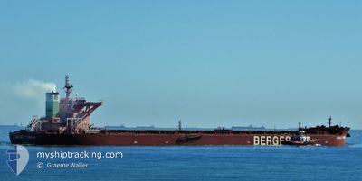
BERGE TOUBKAL
Cargo
Current Trip
| Time Travelled | 25 days |
|---|---|
| Remaining Time | --- |
| Distance Travelled | 6120.47 nm |
| Remaining Distance | --- |
| AVG Speed | 11.4 Knop |
| MAX Speed | 17.5 Knop |
| AVG Wind | 12 knots |
| MAX Wind | 30 knots |
| MIN Temp | 11.1°C / 51.98°F |
| MAX Temp | 34.3°C / 93.74°F |
| Djupgående | 8.7 m |
| Position mottagen | 9 d sen |
Current Position
| Longitud | --- |
|---|---|
| Latitude | --- |
| Status | Moored |
| Fart | |
| Kurs | 62° |
| Område | Indian Ocean |
| Station | T-AIS |
| Position mottagen | 9 d sen |
Info
Information
The current position of BERGE TOUBKAL is in Indian Ocean with coordinates -20.64887° / 116.67393° as reported on 2025-11-26 21:15 by AIS to our vessel tracker app. The vessel's current speed is 0 Knop and is heading at the port of DAMPIER.
The vessel BERGE TOUBKAL (IMO: 9750933, MMSI: 232007360) is a Cargo It's sailing under the flag of [GB] United Kingdom.
In this page you can find informations about the vessels current position, last detected port calls, and current voyage information. If the vessels is not in coverage by AIS you will find the latest position.
The current position of BERGE TOUBKAL is detected by our AIS receivers and we are not responsible for the reliability of the data. The last position was recorded while the vessel was in Coverage by the Ais receivers of our vessel tracking app.
The current draught of BERGE TOUBKAL as reported by AIS is 8.7 meters
Weather
| Temperature | 27°C / 80.6°F |
|---|---|
| Wind Speed | 10 knots |
| Direction | 21° NNE |
| Pressure | 1011.1 hPa |
| Humidity | 69.2 % |
| Cloud Coverage | 82 % |
Featured Company
Last Port Calls
| Port | Arrival | Departure | Time In Port |
|---|---|---|---|
| 2025-11-06 07:04 | 2025-11-10 14:04 | 4 d | |
| 2025-10-15 16:35 | 2025-10-17 20:07 | 2 d |
Most Visited Ports (Last year)
| Port | Arrivals | |
|---|---|---|
| 5 | ||
| 3 | ||
| 2 | ||
| 1 | ||
| 1 | ||
| 1 |
Last Trips
| Origin | Departure | Destination | Arrival | Distance | |
|---|---|---|---|---|---|
| 2025-10-17 20:07 | 2025-11-06 07:04 | 3945.19 nm | |||
| 2025-09-22 05:20 | 2025-10-15 16:35 | 3725.74 nm |
Events
| Tid | Event | Detaljer | Position / Dest | Information |
|---|---|---|---|---|
| 2025-11-27 07:36 | STARTAR förflyttning | 3.68 nm, West of DAMPIER |
-20.64387 / 116.67971
AU DAM
|
Fart: 4.1 kn Kurs: 40° |
| 2025-11-26 21:21 | Status ändrad | Default Moored |
-20.64890 / 116.67389
AU DAM
|
Fart: Kurs: 62° |
| 2025-11-26 21:15 | Status ändrad | Moored Default |
-20.64887 / 116.67393
AU DAM
|
Fart: Kurs: 62° |
| 2025-11-26 21:15 | UTANFÖR täckningsområde |
-20.64887 / 116.67393
Indian Ocean
|
Fart: Kurs: 204.1° |
|
| 2025-11-26 20:54 | Status ändrad | Default Moored |
-20.64888 / 116.67392
AU DAM
|
Fart: Kurs: 62° |
| 2025-11-26 20:48 | Status ändrad | Moored Default |
-20.64891 / 116.67391
AU DAM
|
Fart: 0.1 kn Kurs: 62° |
| 2025-11-26 20:45 | Status ändrad | Default Moored |
-20.64895 / 116.67390
AU DAM
|
Fart: Kurs: 62° |
| 2025-11-26 20:33 | Status ändrad | Moored Default |
-20.64891 / 116.67390
AU DAM
|
Fart: Kurs: 62° |
| 2025-11-26 20:27 | I täckningsområde |
-20.64891 / 116.67390
Indian Ocean
|
Fart: Kurs: 226.2° |
|
| 2025-11-26 13:03 | UTANFÖR täckningsområde |
-20.64889 / 116.67393
Indian Ocean
|
Fart: Kurs: 238.3° |