
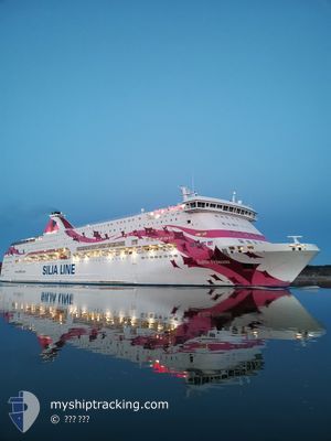
BALTIC PRINCESS
Ro-Ro/Passenger Ship
Current Trip
| Time Travelled | 1 h, 6 mins |
|---|---|
| Remaining Time | 26 mins |
| Distance Travelled | 15.31 nm |
| Remaining Distance | --- |
| AVG Speed | 18.7 Knop |
| MAX Speed | 20 Knop |
| AVG Wind | 15.9 knots |
| MAX Wind | 16.3 knots |
| MIN Temp | 0.3°C / 32.54°F |
| MAX Temp | 0.6°C / 33.08°F |
| Djupgående | 6.3 m |
| Position mottagen | 36 m sen |
Current Position
| Longitud | --- |
|---|---|
| Latitude | --- |
| Status | Under way using engine |
| Fart | 20 Knop |
| Kurs | 99.5° |
| Område | Gulf of Bothnia |
| Station | T-AIS |
| Position mottagen | 36 m sen |
Info
Information
The current position of BALTIC PRINCESS is in Gulf of Bothnia with coordinates 59.96845° / 19.99319° as reported on 2025-01-30 12:23 by AIS to our vessel tracker app. The vessel's current speed is 20 Knop and is heading at the port of LANGNAS. The estimated time of arrival as calculated by MyShipTracking vessel tracking app is 2025-01-30 13:25 LT
The vessel BALTIC PRINCESS (IMO: 9354284, MMSI: 230639000) is a Ro-Ro/Passenger Ship that was built in 2008 ( 17 År gammal ). It's sailing under the flag of [FI] Finland.
In this page you can find informations about the vessels current position, last detected port calls, and current voyage information. If the vessels is not in coverage by AIS you will find the latest position.
The current position of BALTIC PRINCESS is detected by our AIS receivers and we are not responsible for the reliability of the data. The last position was recorded while the vessel was in Coverage by the Ais receivers of our vessel tracking app.
The current draught of BALTIC PRINCESS as reported by AIS is 6.3 meters
Weather
| Temperature | 0.3°C / 32.54°F |
|---|---|
| Wind Speed | 15 knots |
| Direction | 261° W |
| Pressure | 1004.3 hPa |
| Humidity | 83.6 % |
| Cloud Coverage | 88 % |
Featured Company
Last Port Calls
| Port | Arrival | Departure | Time In Port |
|---|---|---|---|
| 2025-01-30 11:25 | 2025-01-30 11:53 | 28 m | |
| 2025-01-30 04:53 | 2025-01-30 06:15 | 1 h | |
| 2025-01-29 07:59 | 2025-01-29 18:27 | 10 h | |
| 2025-01-28 08:15 | 2025-01-28 17:57 | 9 h | |
| 2025-01-27 22:32 | 2025-01-27 22:45 | 13 m | |
| 2025-01-27 16:56 | 2025-01-27 18:30 | 1 h | |
| 2025-01-27 11:29 | 2025-01-27 11:53 | 24 m | |
| 2025-01-27 04:54 | 2025-01-27 06:14 | 1 h | |
| 2025-01-26 22:37 | 2025-01-26 22:44 | 7 m | |
| 2025-01-26 16:56 | 2025-01-26 18:32 | 1 h |
Most Visited Ports (Last year)
| Port | Arrivals | |
|---|---|---|
| 340 | ||
| 288 | ||
| 266 | ||
| 219 | ||
| 120 | ||
| 1 |
Last Trips
| Origin | Departure | Destination | Arrival | Distance | |
|---|---|---|---|---|---|
| 2025-01-30 07:15 | 2025-01-30 13:25 | 77.37 nm | |||
| 2025-01-29 20:27 | 2025-01-30 05:53 | 157.55 nm | |||
| 2025-01-28 18:57 | 2025-01-29 09:59 | 160.82 nm | |||
| 2025-01-28 00:45 | 2025-01-28 09:15 | 100.26 nm | |||
| 2025-01-27 20:30 | 2025-01-28 00:32 | 65.35 nm | |||
| 2025-01-27 13:53 | 2025-01-27 18:56 | 88.20 nm | |||
| 2025-01-27 07:14 | 2025-01-27 13:29 | 78.65 nm | |||
| 2025-01-27 00:44 | 2025-01-27 05:54 | 92.08 nm | |||
| 2025-01-26 20:32 | 2025-01-27 00:37 | 66.44 nm | |||
| 2025-01-26 13:50 | 2025-01-26 18:56 | 89.21 nm |
Events
| Tid | Event | Detaljer | Position / Dest | Information |
|---|---|---|---|---|
| 2025-01-30 12:29 | Status ändrad | Default Under way using engine |
59.96766 / 20.06301
SESTO-FIMHQ-FITKU
|
Fart: 20 kn Kurs: 99.5° |
| 2025-01-30 12:23 | Status ändrad | Under way using engine Default |
59.96845 / 19.99319
SESTO-FIMHQ-FITKU
|
Fart: 19.9 kn Kurs: 104° |
| 2025-01-30 12:13 | Status ändrad | Default Under way using engine |
59.99087 / 19.90843
SESTO-FIMHQ-FITKU
|
Fart: 20 kn Kurs: 161.1° |
| 2025-01-30 12:08 | Status ändrad | Under way using engine Default |
60.01918 / 19.89256
SESTO-FIMHQ-FITKU
|
Fart: 19 kn Kurs: 164° |
| 2025-01-30 12:05 | Status ändrad | Default Under way using engine |
60.03316 / 19.89190
SESTO-FIMHQ-FITKU
|
Fart: 18.8 kn Kurs: 169.7° |
| 2025-01-30 11:58 | Status ändrad | Under way using engine Default |
60.06398 / 19.91376
SESTO-FIMHQ-FITKU
|
Fart: 14.5 kn Kurs: 211° |
| 2025-01-30 11:53 | AVGÅTT HAMN |
|
60.08000 / 19.92636
SESTO-FIMHQ-FITKU
|
Fart: 7 kn Kurs: 180° |
| 2025-01-30 11:49 | STARTAR förflyttning |
60.09032 / 19.92675
[FI] MARIEHAMN
|
Fart: 7 kn Kurs: 180° |
|
| 2025-01-30 11:37 | STOPPAR förflyttning |
60.09215 / 19.92720
[FI] MARIEHAMN
|
Fart: 0.2 kn Kurs: 174° |
|
| 2025-01-30 11:25 | ANLÄNDER HAMN |
|
60.08872 / 19.92619
[FI] MARIEHAMN
|
Fart: 8.7 kn Kurs: 2° |