
BAGUS
Cargo
Current Trip
| Time Travelled | 1 day |
|---|---|
| Remaining Time | 3 days |
| Distance Travelled | 19.99 nm |
| Remaining Distance | 705.19 nm |
| AVG Speed | 6.2 Knop |
| MAX Speed | 8 Knop |
| AVG Wind | 13.9 knots |
| MAX Wind | 14 knots |
| MIN Temp | 26.8°C / 80.24°F |
| MAX Temp | 27.1°C / 80.78°F |
| Djupgående | 5 m |
| Position mottagen | 1 d sen |
Current Position
| Longitud | --- |
|---|---|
| Latitude | --- |
| Status | Under way using engine |
| Fart | 5.8 Knop |
| Kurs | 272.1° |
| Område | Eastern China Sea |
| Station | T-AIS |
| Position mottagen | 1 d sen |
Info
Information
The current position of BAGUS is in Eastern China Sea with coordinates 25.40508° / 121.61490° as reported on 2024-10-05 16:13 by AIS to our vessel tracker app. The vessel's current speed is 5.8 Knop and is heading at the port of BUSAN. The estimated time of arrival as calculated by MyShipTracking vessel tracking app is 2024-10-09 20:36 LT
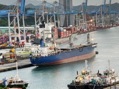
The vessel BAGUS (IMO: 9020091, MMSI: 457329000) is a Cargo It's sailing under the flag of [MN] Mongolia.
In this page you can find informations about the vessels current position, last detected port calls, and current voyage information. If the vessels is not in coverage by AIS you will find the latest position.
The current position of BAGUS is detected by our AIS receivers and we are not responsible for the reliability of the data. The last position was recorded while the vessel was in Coverage by the Ais receivers of our vessel tracking app.
The current draught of BAGUS as reported by AIS is 5 meters
Weather
| Temperature | 26.2°C / 79.16°F |
|---|---|
| Wind Speed | 13 knots |
| Direction | 49° NE |
| Pressure | 1014.9 hPa |
| Humidity | 89.4 % |
| Cloud Coverage | 1 % |
Featured Company
Events
| Tid | Event | Detaljer | Position / Dest | Information |
|---|---|---|---|---|
| 2024-10-05 16:15 | Status ändrad | Default Under way using engine |
25.40596 / 121.61187
BUSAN
|
Fart: 5.8 kn Kurs: 272.1° |
| 2024-10-05 16:13 | UTANFÖR täckningsområde |
25.40508 / 121.61490
Eastern China Sea
BUSAN
|
Fart: 5.8 kn Kurs: 272.1° |
|
| 2024-10-05 15:09 | Status ändrad | Under way using engine Moored |
25.35972 / 121.73537
BUSAN
|
Fart: 7.4 kn Kurs: 315.8° |
| 2024-10-05 13:01 | AVGÅTT HAMN |
|
25.16466 / 121.75245
BUSAN
|
Fart: 8.6 kn Kurs: 342° |
| 2024-10-05 12:51 | STARTAR förflyttning |
25.14561 / 121.75563
[TW] KEELUNG
|
Fart: 3.1 kn Kurs: 353.4° |
|
| 2024-10-05 07:23 | Status ändrad | Moored Under way using engine |
25.14519 / 121.75831
[TW] KEELUNG
|
Fart: Kurs: 511° |
| 2024-10-05 07:23 | Djupgående ändrat | 5 0 |
25.14520 / 121.75833
[TW] KEELUNG
|
Fart: Kurs: 511° |
| 2024-10-05 07:23 | ETA ändrat | 2024/10/10 08:00 2024/10/10 20:00 |
25.14520 / 121.75833
[TW] KEELUNG
|
Fart: Kurs: 511° |
| 2024-10-05 07:19 | Status ändrad | Under way using engine Moored |
25.14520 / 121.75832
[TW] KEELUNG
|
Fart: Kurs: 511° |
| 2024-10-05 04:24 | Status ändrad | Moored Default |
25.14517 / 121.75830
[TW] KEELUNG
|
Fart: Kurs: -1° |