
AVENCA
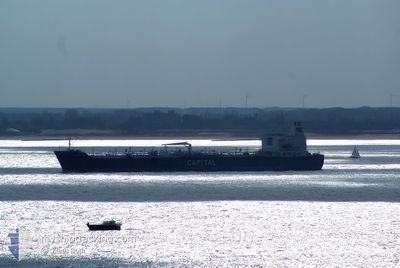
Oil/Chemical Tanker
Current Trip
| Time Travelled | 10 h, 16 mins |
|---|---|
| Remaining Time | 3 h, 2 mins |
| Distance Travelled | 111.60 nm |
| Remaining Distance | 145.49 nm |
| AVG Speed | 13 Knop |
| MAX Speed | 13.9 Knop |
| AVG Wind | 6.1 knots |
| MAX Wind | 13.7 knots |
| MIN Temp | 20.4°C / 68.72°F |
| MAX Temp | 26.8°C / 80.24°F |
| Djupgående | 8.9 m |
| Position mottagen | 4 d sen |
Current Position
| Longitud | --- |
|---|---|
| Latitude | --- |
| Status | Under way using engine |
| Fart | 5.5 Knop |
| Kurs | 325.8° |
| Område | Caribbean Sea |
| Station | T-AIS |
| Position mottagen | 4 d sen |
Info
Information
The current position of AVENCA is in Caribbean Sea with coordinates 17.64165° / -64.72061° as reported on 2024-12-26 23:37 by AIS to our vessel tracker app. The vessel's current speed is 5.5 Knop and is heading at the port of MONTEGO BAY. The estimated time of arrival as calculated by MyShipTracking vessel tracking app is 2024-12-31 14:33 LT
The vessel AVENCA (IMO: 9410002, MMSI: 636021420) is a Oil/Chemical Tanker that was built in 2008 ( 16 År gammal ). It's sailing under the flag of [LR] Liberia.
In this page you can find informations about the vessels current position, last detected port calls, and current voyage information. If the vessels is not in coverage by AIS you will find the latest position.
The current position of AVENCA is detected by our AIS receivers and we are not responsible for the reliability of the data. The last position was recorded while the vessel was in Coverage by the Ais receivers of our vessel tracking app.
The current draught of AVENCA as reported by AIS is 8.9 meters
Weather
| Temperature | 26°C / 78.8°F |
|---|---|
| Wind Speed | 8 knots |
| Direction | 40° NE |
| Pressure | 1011.7 hPa |
| Humidity | 82.7 % |
| Cloud Coverage | 98 % |
Featured Company
Last Port Calls
| Port | Arrival | Departure | Time In Port |
|---|---|---|---|
| 2024-12-31 01:07 | 2024-12-31 01:15 | 8 m | |
| 2024-12-30 14:47 | 2024-12-30 14:55 | 8 m | |
| 2024-12-27 00:02 | 2024-12-27 23:58 | 23 h | |
| 2024-12-24 12:15 | 2024-12-24 12:23 | 8 m | |
| 2024-12-23 01:07 | 2024-12-24 11:47 | 1 d | |
| 2024-12-23 00:15 | 2024-12-23 00:15 | 0 m | |
| 2024-12-22 06:21 | |||
| 2024-10-25 19:18 | 2024-10-25 21:04 | 1 h | |
| 2024-10-21 22:04 | 2024-10-24 07:58 | 2 d | |
| 2024-10-02 19:21 |
Most Visited Ports (Last year)
| Port | Arrivals | |
|---|---|---|
| 5 | ||
| 2 | ||
| 2 | ||
| 1 | ||
| 1 | ||
| 1 |
Last Trips
| Origin | Departure | Destination | Arrival | Distance | |
|---|---|---|---|---|---|
| 2024-12-30 09:55 | 2024-12-30 20:07 | 5.25 nm | |||
| 2024-12-27 19:58 | 2024-12-30 09:47 | 742.15 nm | |||
| 2024-12-24 07:23 | 2024-12-26 20:02 | 747.21 nm | |||
| 2024-12-24 06:47 | 2024-12-24 07:15 | 4.51 nm | |||
| 2024-12-22 19:15 | 2024-12-22 20:07 | 2.34 nm | |||
| 2024-12-22 01:21 | 2024-12-22 19:15 | 178.10 nm | |||
| 2024-10-24 03:58 | 2024-10-25 15:18 | 424.67 nm | |||
| 2024-10-02 22:21 | 2024-10-21 18:04 | 4941.52 nm |
Events
| Tid | Event | Detaljer | Position / Dest | Information |
|---|---|---|---|---|
| 2024-12-31 01:15 | AVGÅTT HAMN |
|
17.96016 / -76.84725
JM MBJ
|
Fart: 10.9 kn Kurs: 246° |
| 2024-12-31 01:07 | ANLÄNDER HAMN |
|
17.96685 / -76.82378
[JM] KINGSTON (JM)
|
Fart: 9.1 kn Kurs: 296° |
| 2024-12-31 00:51 | STARTAR förflyttning | 1.44 nm, East of KINGSTON (JM) |
17.95679 / -76.78413
JM MBJ
|
Fart: 6.9 kn Kurs: 281° |
| 2024-12-30 15:19 | STOPPAR förflyttning | 1.77 nm, East of KINGSTON (JM) |
17.95661 / -76.77818
JM MBJ
|
Fart: 0.1 kn Kurs: 107° |
| 2024-12-30 14:55 | AVGÅTT HAMN |
|
17.96101 / -76.80903
JM MBJ
|
Fart: 10.1 kn Kurs: 120° |
| 2024-12-30 14:47 | ANLÄNDER HAMN |
|
17.96940 / -76.83010
[JM] KINGSTON (JM)
|
Fart: 10.6 kn Kurs: 62° |
| 2024-12-28 00:03 | STARTAR förflyttning | 0.72 nm, East of ST CROIX |
17.68455 / -64.74071
JM MBJ
|
Fart: 7.1 kn Kurs: 153° |
| 2024-12-27 23:58 | AVGÅTT HAMN |
|
17.68455 / -64.74071
JM MBJ
|
Fart: Kurs: 154° |
| 2024-12-27 00:23 | STOPPAR förflyttning |
17.69285 / -64.74731
[VI] ST CROIX
|
Fart: 0.2 kn Kurs: 155° |
|
| 2024-12-26 23:37 | UTANFÖR täckningsområde |
17.64165 / -64.72061
Caribbean Sea
[VI] ST CROIX
|
Fart: 5.5 kn Kurs: 325.8° |