
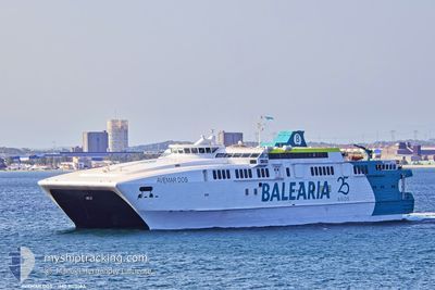
AVEMAR DOS
High speed craft
Current Trip
ALG-CEU-ALG
| Time Travelled | 13 mins |
|---|---|
| Remaining Time | --- |
| Distance Travelled | 5.91 nm |
| Remaining Distance | --- |
| AVG Speed | 23.9 Knop |
| MAX Speed | 24.6 Knop |
| AVG Wind | 17 knots |
| MAX Wind | 17 knots |
| MIN Temp | 16.4°C / 61.52°F |
| MAX Temp | 16.4°C / 61.52°F |
| Djupgående | 2.5 m |
| Position mottagen | 1 m sen |
Current Position
| Longitud | --- |
|---|---|
| Latitude | --- |
| Status | Under way using engine |
| Fart | 22.9 Knop |
| Kurs | 334.8° |
| Område | Strait of Gibraltar |
| Station | T-AIS |
| Position mottagen | 1 m sen |
Information
The current position of AVEMAR DOS is in Strait of Gibraltar with coordinates 35.99791° / -5.33320° as reported on 2025-03-30 09:51 by AIS to our vessel tracker app. The vessel's current speed is 22.9 Knop
The vessel AVEMAR DOS (IMO: 9170183, MMSI: 224704000) is a High speed craft that was built in 1997 ( 28 År gammal ). It's sailing under the flag of [ES] Spain.
In this page you can find informations about the vessels current position, last detected port calls, and current voyage information. If the vessels is not in coverage by AIS you will find the latest position.
The current position of AVEMAR DOS is detected by our AIS receivers and we are not responsible for the reliability of the data. The last position was recorded while the vessel was in Coverage by the Ais receivers of our vessel tracking app.
The current draught of AVEMAR DOS as reported by AIS is 2.5 meters
Weather
| Temperature | 16.4°C / 61.52°F |
|---|---|
| Wind Speed | 17 knots |
| Direction | 75° ENE |
| Pressure | 1018.6 hPa |
| Humidity | 75.8 % |
| Cloud Coverage | --- |
Featured Company
Last Port Calls
| Port | Arrival | Departure | Time In Port |
|---|---|---|---|
| 2025-03-30 08:58 | 2025-03-30 09:39 | 41 m | |
| 2025-03-30 07:14 | 2025-03-30 08:13 | 58 m | |
| 2025-03-30 05:45 | 2025-03-30 06:38 | 53 m | |
| 2025-03-29 22:06 | 2025-03-30 05:08 | 7 h | |
| 2025-03-29 20:13 | 2025-03-29 21:16 | 1 h | |
| 2025-03-29 17:12 | 2025-03-29 19:35 | 2 h | |
| 2025-03-29 15:48 | 2025-03-29 16:35 | 47 m | |
| 2025-03-29 14:12 | 2025-03-29 15:10 | 58 m | |
| 2025-03-29 12:51 | 2025-03-29 13:32 | 40 m | |
| 2025-03-29 11:15 | 2025-03-29 12:18 | 1 h |
Last Trips
| Origin | Departure | Destination | Arrival | Distance | |
|---|---|---|---|---|---|
| 2025-03-30 10:13 | 2025-03-30 10:58 | 19.04 nm | |||
| 2025-03-30 08:38 | 2025-03-30 09:14 | 15.99 nm | |||
| 2025-03-30 07:08 | 2025-03-30 07:45 | 16.63 nm | |||
| 2025-03-29 22:16 | 2025-03-29 23:06 | 17.16 nm | |||
| 2025-03-29 20:35 | 2025-03-29 21:13 | 17.17 nm | |||
| 2025-03-29 17:35 | 2025-03-29 18:12 | 16.80 nm | |||
| 2025-03-29 16:10 | 2025-03-29 16:48 | 17.28 nm | |||
| 2025-03-29 14:32 | 2025-03-29 15:12 | 16.83 nm | |||
| 2025-03-29 13:18 | 2025-03-29 13:51 | 16.88 nm | |||
| 2025-03-29 11:37 | 2025-03-29 12:15 | 16.67 nm |
Events
| Tid | Event | Detaljer | Position / Dest | Information |
|---|---|---|---|---|
| 2025-03-30 09:49 | Byter havsområde | Spanish part of the Strait of Gibraltar Spanish part of the Alboran Sea |
35.98898 / -5.32775
Strait of Gibraltar
ALG-CEU-ALG
|
Fart: 24.6 kn Kurs: 334.5° |
| 2025-03-30 09:41 | Status ändrad | Under way using engine Default |
35.93950 / -5.30143
ALG-CEU-ALG
|
Fart: 26 kn Kurs: 10° |
| 2025-03-30 09:40 | Status ändrad | Default Under way using engine |
35.93317 / -5.30321
ALG-CEU-ALG
|
Fart: 27.2 kn Kurs: 8.9° |
| 2025-03-30 09:39 | Byter havsområde | Spanish part of the Alboran Sea Spanish part of the Strait of Gibraltar |
35.92745 / -5.30480
Alboran Sea
ALG-CEU-ALG
|
Fart: 27.2 kn Kurs: 8.9° |
| 2025-03-30 09:39 | AVGÅTT HAMN |
|
35.92645 / -5.30503
ALG-CEU-ALG
|
Fart: 9.5 kn Kurs: 34° |
| 2025-03-30 09:32 | STARTAR förflyttning |
35.89431 / -5.31780
[ES] CEUTA
|
Fart: 7.5 kn Kurs: 73° |
|
| 2025-03-30 09:06 | STOPPAR förflyttning |
35.89417 / -5.32039
[ES] CEUTA
|
Fart: Kurs: 130° |
|
| 2025-03-30 08:58 | Byter havsområde | Spanish part of the Strait of Gibraltar Spanish part of the Alboran Sea |
35.89491 / -5.31394
Strait of Gibraltar
ALG-CEU-ALG
|
Fart: 8.8 kn Kurs: 281.5° |
| 2025-03-30 08:58 | ANLÄNDER HAMN |
|
35.89478 / -5.31329
[ES] CEUTA
|
Fart: 18.7 kn Kurs: 193.9° |
| 2025-03-30 08:38 | Byter havsområde | Spanish part of the Alboran Sea Gibraltarian part of the Alboran Sea |
36.00851 / -5.31566
Alboran Sea
ALG-CEU-ALG
|
Fart: 28.2 kn Kurs: 140.1° |