
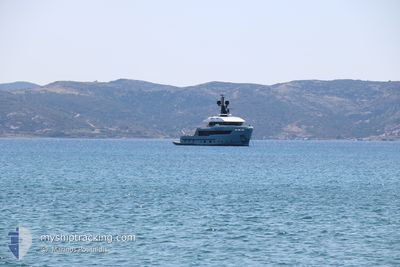
AURELIA
Pleasure Craft
Current Trip
| Trip Time | 3 days |
|---|---|
| Trip Distance | 194.77 nm |
| AVG Speed | 11.2 Knop |
| MAX Speed | 13.3 Knop |
| Djupgående | 2.8 m |
| AVG Wind | 11.1 knots |
| MAX Wind | 20.8 knots |
| MIN Temp | 22.8°C / 73.04°F |
| MAX Temp | 30.6°C / 87.08°F |
| Position mottagen | Nu |
Current Position
| Longitud | 15.29131° |
|---|---|
| Latitude | 37.06003° |
| Status | Under way using engine |
| Fart | |
| Kurs | 256° |
| Område | Ionian Sea |
| Station | T-AIS |
| Position mottagen | Nu |
Info
Information
The current position of AURELIA is in Ionian Sea with coordinates 37.06003° / 15.29131° as reported on 2024-07-05 02:35 by AIS to our vessel tracker app. The vessel's current speed is 0 Knop and is currently inside the port of SIRACUSA.
The vessel AURELIA (IMO: 9920241, MMSI: 319195800) is a Pleasure Craft It's sailing under the flag of [KY] Cayman Is.
In this page you can find informations about the vessels current position, last detected port calls, and current voyage information. If the vessels is not in coverage by AIS you will find the latest position.
The current position of AURELIA is detected by our AIS receivers and we are not responsible for the reliability of the data. The last position was recorded while the vessel was in Coverage by the Ais receivers of our vessel tracking app.
The current draught of AURELIA as reported by AIS is 2.8 meters
Weather
| Temperature | 22.5°C / 72.5°F |
|---|---|
| Wind Speed | 7 knots |
| Direction | 5° N |
| Pressure | 1013.1 hPa |
| Humidity | 79 % |
| Cloud Coverage | --- |
Featured Company
Last Trips
| Origin | Departure | Destination | Arrival | Distance | |
|---|---|---|---|---|---|
| 2024-06-30 07:06 | 2024-07-03 08:41 | 194.77 nm | |||
| 2024-06-15 08:38 | 2024-06-27 12:08 | 240.70 nm | |||
| 2024-05-25 12:42 | 2024-06-13 10:02 | 518.19 nm | |||
| 2024-05-06 09:02 | 2024-05-06 12:29 | 22.71 nm |
Events
| Tid | Event | Detaljer | Position / Dest | Information |
|---|---|---|---|---|
| 2024-07-03 06:45 | STOPPAR förflyttning |
37.05988 / 15.28985
[IT] SIRACUSA
|
Fart: 0.2 kn Kurs: 317° |
|
| 2024-07-03 06:41 | STARTAR förflyttning |
37.05843 / 15.28861
[IT] SIRACUSA
|
Fart: 5.4 kn Kurs: 51.7° |
|
| 2024-07-03 06:41 | ANLÄNDER HAMN |
|
37.05843 / 15.28861
[IT] SIRACUSA
|
Fart: 0.4 kn Kurs: 348° |
| 2024-07-02 18:56 | I täckningsområde |
37.05297 / 15.28449
Ionian Sea
|
Fart: 0.6 kn Kurs: 293.5° |
|
| 2024-07-02 16:46 | UTANFÖR täckningsområde |
37.05308 / 15.28455
Ionian Sea
|
Fart: 0.4 kn Kurs: 256.3° |
|
| 2024-07-02 07:55 | STOPPAR förflyttning | 0.53 nm, South of SIRACUSA |
37.05382 / 15.28547
SIRACUSA
|
Fart: 0.2 kn Kurs: 258° |
| 2024-07-02 05:44 | STARTAR förflyttning | 5.64 nm, North of PORTOPALO |
36.76430 / 15.12241
SIRACUSA
|
Fart: 3.2 kn Kurs: 354° |
| 2024-07-01 00:04 | ETA ändrat | 2025/06/30 21:40 2024/06/30 21:40 |
36.76268 / 15.12233
SIRACUSA
|
Fart: 0.2 kn Kurs: 286° |
| 2024-06-30 18:26 | STOPPAR förflyttning | 5.53 nm, North of PORTOPALO |
36.76254 / 15.12188
SIRACUSA
|
Fart: 0.3 kn Kurs: 239° |
| 2024-06-30 17:35 | Byter havsområde | Italian part of the Ionian Sea Italian part of the Mediterranean Sea - Eastern Basin |
36.65075 / 15.15112
Ionian Sea
SIRACUSA
|
Fart: 13 kn Kurs: 46° |