
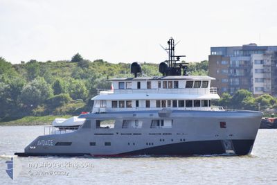
AUDACE
Pleasure Craft
Current Trip
| Time Travelled | 20 h, 12 mins |
|---|---|
| Remaining Time | --- |
| Distance Travelled | 187.30 nm |
| Remaining Distance | --- |
| AVG Speed | 12.9 Knop |
| MAX Speed | 17.9 Knop |
| AVG Wind | 14.7 knots |
| MAX Wind | 22.7 knots |
| MIN Temp | 16.3°C / 61.34°F |
| MAX Temp | 17.6°C / 63.68°F |
| Djupgående | 3 m |
| Position mottagen | 3 m sen |
Current Position
| Longitud | 4.47891° |
|---|---|
| Latitude | 51.90657° |
| Status | Moored |
| Fart | 0.1 Knop |
| Kurs | 160° |
| Område | North Sea |
| Station | T-AIS |
| Position mottagen | 3 m sen |
Info
Information
The current position of AUDACE is in North Sea with coordinates 51.90657° / 4.47891° as reported on 2024-07-06 14:03 by AIS to our vessel tracker app. The vessel's current speed is 0.1 Knop
The vessel AUDACE (MMSI: 215224000) is a Pleasure Craft It's sailing under the flag of [MT] Malta.
In this page you can find informations about the vessels current position, last detected port calls, and current voyage information. If the vessels is not in coverage by AIS you will find the latest position.
The current position of AUDACE is detected by our AIS receivers and we are not responsible for the reliability of the data. The last position was recorded while the vessel was in Coverage by the Ais receivers of our vessel tracking app.
The current draught of AUDACE as reported by AIS is 3 meters
Weather
| Temperature | 16.9°C / 62.42°F |
|---|---|
| Wind Speed | 21 knots |
| Direction | 248° WSW |
| Pressure | 1000.2 hPa |
| Humidity | 68.4 % |
| Cloud Coverage | 6 % |
Featured Company
Last Port Calls
| Port | Arrival | Departure | Time In Port |
|---|---|---|---|
| 2024-07-04 08:47 | 2024-07-05 17:54 | 1 d | |
| 2024-07-02 15:32 | 2024-07-03 04:59 | 13 h | |
| 2024-06-26 18:39 | 2024-06-26 21:52 | 3 h | |
| 2024-06-24 06:09 | 2024-06-24 13:05 | 6 h | |
| 2024-06-24 13:05 | |||
| 2024-06-03 08:49 | 2024-06-23 22:10 | 20 d | |
| 2024-05-29 14:08 | 2024-06-03 07:18 | 4 d | |
| 2024-05-26 06:05 |
Last Trips
| Origin | Departure | Destination | Arrival | Distance | |
|---|---|---|---|---|---|
| 2024-07-03 05:59 | 2024-07-04 09:47 | 315.13 nm | |||
| 2024-06-26 23:52 | 2024-07-02 16:32 | 1104.49 nm | |||
| 2024-06-24 15:05 | 2024-06-26 20:39 | 786.50 nm | |||
| 2024-06-24 00:10 | 2024-06-24 08:09 | 99.18 nm | |||
| 2024-06-03 09:18 | 2024-06-03 10:49 | 20.37 nm | |||
| 2024-05-26 08:05 | 2024-05-29 16:08 | 127.85 nm |
Events
| Tid | Event | Detaljer | Position / Dest | Information |
|---|---|---|---|---|
| 2024-07-06 10:45 | Status ändrad | Moored Under way using engine |
51.90656 / 4.47891
ROTTERDAM
|
Fart: Kurs: 160° |
| 2024-07-06 07:49 | STOPPAR förflyttning | 0.53 nm, East of PARKHAVEN |
51.90514 / 4.47910
ROTTERDAM
|
Fart: 0.3 kn Kurs: 236° |
| 2024-07-06 02:23 | Byter havsområde | Dutch part of the North Sea Belgian part of the North Sea |
51.78281 / 2.70407
North Sea
ROTTERDAM
|
Fart: 13.4 kn Kurs: 68.2° |
| 2024-07-06 00:46 | Byter havsområde | Belgian part of the North Sea French part of the North Sea |
51.52448 / 2.25908
North Sea
ROTTERDAM
|
Fart: 14.4 kn Kurs: 44° |
| 2024-07-06 00:05 | Byter havsområde | French part of the North Sea United Kingdom part of the North Sea |
51.40553 / 2.07518
North Sea
ROTTERDAM
|
Fart: 16 kn Kurs: 49.8° |
| 2024-07-05 17:54 | AVGÅTT HAMN |
|
51.49634 / .02194
ROTTERDAM
|
Fart: 11.2 kn Kurs: 113° |
| 2024-07-05 17:15 | STARTAR förflyttning |
51.50637 / -.07854
[GB] LONDON
|
Fart: 11.2 kn Kurs: 114° |
|
| 2024-07-05 16:55 | STOPPAR förflyttning |
51.50732 / -.08168
[GB] LONDON
|
Fart: 0.3 kn Kurs: 288° |
|
| 2024-07-05 16:46 | STARTAR förflyttning |
51.50424 / -.07046
[GB] LONDON
|
Fart: 3.1 kn Kurs: 294° |
|
| 2024-07-05 16:41 | STOPPAR förflyttning |
51.50314 / -.06723
[GB] LONDON
|
Fart: 0.1 kn Kurs: 296° |