
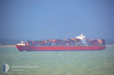
ATACAMA
Cargo
Current Trip
| Time Travelled | 1 day |
|---|---|
| Remaining Time | 16 h, 39 mins |
| Distance Travelled | 479.96 nm |
| Remaining Distance | 302.29 nm |
| AVG Speed | 17 Knop |
| MAX Speed | 19.3 Knop |
| AVG Wind | 9.8 knots |
| MAX Wind | 18 knots |
| MIN Temp | 7°C / 44.6°F |
| MAX Temp | 17.2°C / 62.96°F |
| Djupgående | 9.5 m |
| Position mottagen | 1 d sen |
Current Position
| Longitud | -54.78288° |
|---|---|
| Latitude | -35.08160° |
| Status | Under way using engine |
| Fart | 17.5 Knop |
| Kurs | 86.8° |
| Område | South Atlantic Ocean |
| Station | T-AIS |
| Position mottagen | 1 d sen |
Info
Information
The current position of ATACAMA is in South Atlantic Ocean with coordinates -35.08160° / -54.78288° as reported on 2024-07-12 21:46 by AIS to our vessel tracker app. The vessel's current speed is 17.5 Knop and is heading at the port of PARANAGUA. The estimated time of arrival as calculated by MyShipTracking vessel tracking app is 2024-07-14 15:01 LT
The vessel ATACAMA (IMO: 9718947, MMSI: 636092895) is a Cargo It's sailing under the flag of [LR] Liberia.
In this page you can find informations about the vessels current position, last detected port calls, and current voyage information. If the vessels is not in coverage by AIS you will find the latest position.
The current position of ATACAMA is detected by our AIS receivers and we are not responsible for the reliability of the data. The last position was recorded while the vessel was in Coverage by the Ais receivers of our vessel tracking app.
The current draught of ATACAMA as reported by AIS is 9.5 meters
Weather
| Temperature | 17°C / 62.6°F |
|---|---|
| Wind Speed | 17 knots |
| Direction | 99° E |
| Pressure | 1028 hPa |
| Humidity | 75.3 % |
| Cloud Coverage | 100 % |
Featured Company
Last Port Calls
| Port | Arrival | Departure | Time In Port |
|---|---|---|---|
| 2024-07-11 09:36 | 2024-07-12 16:55 | 1 d | |
| 2024-07-06 23:49 | 2024-07-08 12:39 | 1 d | |
| 2024-07-04 10:33 | 2024-07-05 14:37 | 1 d | |
| 2024-06-08 11:41 | 2024-06-09 10:01 | 22 h | |
| 2024-06-01 06:04 | 2024-06-02 04:26 | 22 h | |
| 2024-05-31 11:30 | 2024-06-01 02:05 | 14 h | |
| 2024-05-18 21:08 | 2024-05-19 10:56 | 13 h | |
| 2024-05-13 18:11 | 2024-05-15 12:13 | 1 d |
Last Trips
| Origin | Departure | Destination | Arrival | Distance | |
|---|---|---|---|---|---|
| 2024-07-08 09:39 | 2024-07-11 06:36 | 757.65 nm | |||
| 2024-07-05 11:37 | 2024-07-06 20:49 | 193.48 nm | |||
| 2024-06-09 18:01 | 2024-07-04 07:33 | 9075.41 nm | |||
| 2024-06-02 12:26 | 2024-06-08 19:41 | 1467.71 nm | |||
| 2024-06-01 10:05 | 2024-06-01 14:04 | 52.53 nm | |||
| 2024-05-19 18:56 | 2024-05-31 19:30 | 1843.76 nm | |||
| 2024-05-15 20:13 | 2024-05-19 05:08 | 1462.01 nm | |||
| 2024-04-17 10:01 | 2024-05-14 02:11 | 9059.53 nm |
Events
| Tid | Event | Detaljer | Position / Dest | Information |
|---|---|---|---|---|
| 2024-07-12 21:49 | Status ändrad | Default Under way using engine |
-35.08076 / -54.76349
BRPNG
|
Fart: 17.5 kn Kurs: 86.8° |
| 2024-07-12 21:46 | Status ändrad | Under way using engine Default |
-35.08160 / -54.78288
BRPNG
|
Fart: 17.8 kn Kurs: 88° |
| 2024-07-12 21:46 | UTANFÖR täckningsområde |
-35.08160 / -54.78288
South Atlantic Ocean
BRPNG
|
Fart: 17.5 kn Kurs: 86.8° |
|
| 2024-07-12 21:42 | Status ändrad | Default Under way using engine |
-35.08243 / -54.80373
BRPNG
|
Fart: 18.1 kn Kurs: 88.2° |
| 2024-07-12 20:55 | Byter havsområde | Uruguayan part of the South Atlantic Ocean Uruguayan part of the Rio de La Plata |
-35.05987 / -55.08018
South Atlantic Ocean
BRPNG
|
Fart: 17.2 kn Kurs: 98.8° |
| 2024-07-12 19:48 | Destination ändrad | BRPNG UYMVTDC |
-35.04093 / -55.47250
BRPNG
|
Fart: 16.8 kn Kurs: 88.5° |
| 2024-07-12 19:48 | ETA ändrat | 2024/07/14 16:00 2024/07/10 08:00 |
-35.04093 / -55.47250
BRPNG
|
Fart: 16.8 kn Kurs: 88.5° |
| 2024-07-12 19:44 | Status ändrad | Under way using engine Default |
-35.04120 / -55.49065
UYMVTDC
|
Fart: 16.6 kn Kurs: 89° |
| 2024-07-12 19:28 | Status ändrad | Default Under way using engine |
-35.04525 / -55.58178
UYMVTDC
|
Fart: 16.6 kn Kurs: 82.9° |
| 2024-07-12 19:08 | Status ändrad | Under way using engine Default |
-35.05622 / -55.69288
UYMVTDC
|
Fart: 15.7 kn Kurs: 89° |