
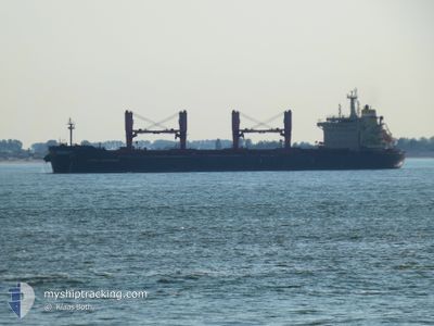
ASTRA CENTAURUS
Cargo
Current Trip
| Time Travelled | 20 days |
|---|---|
| Remaining Time | 1 day |
| Distance Travelled | 4876.00 nm |
| Remaining Distance | 408.01 nm |
| AVG Speed | 11.6 Knop |
| MAX Speed | 14.3 Knop |
| AVG Wind | 10.1 knots |
| MAX Wind | 24 knots |
| MIN Temp | 11.8°C / 53.24°F |
| MAX Temp | 25.3°C / 77.54°F |
| Djupgående | 11.8 m |
| Position mottagen | 3 d sen |
Current Position
| Longitud | --- |
|---|---|
| Latitude | --- |
| Status | Under way using engine |
| Fart | 11.6 Knop |
| Kurs | 268.7° |
| Område | North Atlantic Ocean |
| Station | T-AIS |
| Position mottagen | 3 d sen |
Info
Information
The current position of ASTRA CENTAURUS is in North Atlantic Ocean with coordinates 22.13580° / -72.14066° as reported on 2025-02-23 01:04 by AIS to our vessel tracker app. The vessel's current speed is 11.6 Knop and is heading at the port of COATZACOALCOS. The estimated time of arrival as calculated by MyShipTracking vessel tracking app is 2025-02-27 20:03 LT
The vessel ASTRA CENTAURUS (IMO: 9611802, MMSI: 538004714) is a Cargo It's sailing under the flag of [MH] Marshall Is.
In this page you can find informations about the vessels current position, last detected port calls, and current voyage information. If the vessels is not in coverage by AIS you will find the latest position.
The current position of ASTRA CENTAURUS is detected by our AIS receivers and we are not responsible for the reliability of the data. The last position was recorded while the vessel was in Coverage by the Ais receivers of our vessel tracking app.
The current draught of ASTRA CENTAURUS as reported by AIS is 11.8 meters
Weather
| Temperature | 23.8°C / 74.84°F |
|---|---|
| Wind Speed | 9 knots |
| Direction | 131° SE |
| Pressure | 1014.2 hPa |
| Humidity | 59.8 % |
| Cloud Coverage | --- |
Featured Company
Last Port Calls
| Port | Arrival | Departure | Time In Port |
|---|---|---|---|
| 2025-01-31 22:45 | 2025-02-06 17:33 | 5 d | |
| 2025-01-25 09:41 | 2025-01-26 22:05 | 1 d | |
| 2025-01-20 05:03 | 2025-01-21 13:15 | 1 d | |
| 2024-12-26 16:13 | 2024-12-27 22:41 | 1 d | |
| 2024-12-15 23:23 | 2024-12-25 13:35 | 9 d | |
| 2024-12-10 01:29 | 2024-12-15 12:46 | 5 d |
Most Visited Ports (Last year)
| Port | Arrivals | |
|---|---|---|
| 3 | ||
| 3 | ||
| 2 | ||
| 2 | ||
| 1 | ||
| 1 |
Last Trips
| Origin | Departure | Destination | Arrival | Distance | |
|---|---|---|---|---|---|
| 2025-01-26 23:05 | 2025-01-31 23:45 | 138.69 nm | |||
| 2025-01-21 14:15 | 2025-01-25 10:41 | 20.57 nm | |||
| 2024-12-27 17:41 | 2025-01-20 06:03 | 3853.76 nm | |||
| 2024-12-25 08:35 | 2024-12-26 11:13 | 187.60 nm | |||
| 2024-12-15 07:46 | 2024-12-15 18:23 | 79.39 nm | |||
| 2024-11-28 14:30 | 2024-12-09 20:29 | 1607.69 nm |
Events
| Tid | Event | Detaljer | Position / Dest | Information |
|---|---|---|---|---|
| 2025-02-23 02:33 | Status ändrad | Default Under way using engine |
22.10448 / -72.43820
MXCOA
|
Fart: 10.9 kn Kurs: 270.3° |
| 2025-02-23 02:23 | Status ändrad | Under way using engine Default |
22.10868 / -72.40486
MXCOA
|
Fart: 10.9 kn Kurs: 262° |
| 2025-02-23 02:15 | Status ändrad | Default Under way using engine |
22.11267 / -72.38107
MXCOA
|
Fart: 10.9 kn Kurs: 262.9° |
| 2025-02-23 01:56 | Status ändrad | Under way using engine Default |
22.11654 / -72.31798
MXCOA
|
Fart: 11.3 kn Kurs: 263° |
| 2025-02-23 01:46 | Status ändrad | Default Under way using engine |
22.11906 / -72.28348
MXCOA
|
Fart: 11.3 kn Kurs: 257.2° |
| 2025-02-23 01:36 | Status ändrad | Under way using engine Default |
22.12484 / -72.25141
MXCOA
|
Fart: 11.5 kn Kurs: 254° |
| 2025-02-23 01:33 | Status ändrad | Default Under way using engine |
22.12720 / -72.24157
MXCOA
|
Fart: 11.6 kn Kurs: 269.4° |
| 2025-02-23 01:15 | Status ändrad | Under way using engine Default |
22.13560 / -72.17729
MXCOA
|
Fart: 11.8 kn Kurs: 270° |
| 2025-02-23 01:07 | Status ändrad | Default Under way using engine |
22.13569 / -72.15117
MXCOA
|
Fart: 11.6 kn Kurs: 268.7° |
| 2025-02-23 01:04 | UTANFÖR täckningsområde |
22.13580 / -72.14066
North Atlantic Ocean
MXCOA
|
Fart: 11.6 kn Kurs: 268.7° |