

ASTERIY
Tug

Current Trip
VYSOTSK
| Time Travelled | 1 day |
|---|---|
| Remaining Time | --- |
| Distance Travelled | 15.72 nm |
| Remaining Distance | --- |
| AVG Speed | 7.8 Knop |
| MAX Speed | 10.8 Knop |
| AVG Wind | 6.6 knots |
| MAX Wind | 7.8 knots |
| MIN Temp | -1.6°C / 29.12°F |
| MAX Temp | -0.5°C / 31.1°F |
| Djupgående | 4.3 m |
| Position mottagen | 15 h, 58 m sen |
Current Position
| Longitud | --- |
|---|---|
| Latitude | --- |
| Status | Under way using engine |
| Fart | 10.5 Knop |
| Kurs | 56.5° |
| Område | Gulf of Finland |
| Station | T-AIS |
| Position mottagen | 15 h, 58 m sen |
Information
The current position of ASTERIY is in Gulf of Finland with coordinates 60.46746° / 28.32968° as reported on 2025-03-02 00:02 by AIS to our vessel tracker app. The vessel's current speed is 10.5 Knop
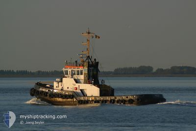
The vessel ASTERIY (IMO: 8409290, MMSI: 273397140) is a Tug that was built in 1985 ( 40 År gammal ). It's sailing under the flag of [RU] Russia.
In this page you can find informations about the vessels current position, last detected port calls, and current voyage information. If the vessels is not in coverage by AIS you will find the latest position.
The current position of ASTERIY is detected by our AIS receivers and we are not responsible for the reliability of the data. The last position was recorded while the vessel was in Coverage by the Ais receivers of our vessel tracking app.
The current draught of ASTERIY as reported by AIS is 4.3 meters
Weather
| Temperature | -0.5°C / 31.1°F |
|---|---|
| Wind Speed | 8 knots |
| Direction | 220° SW |
| Pressure | 1018.5 hPa |
| Humidity | 97.2 % |
| Cloud Coverage | 100 % |


Featured Company
Last Port Calls
| Port | Arrival | Departure | Time In Port |
|---|---|---|---|
| 2025-03-01 09:33 | |||
| 2025-02-28 09:50 | |||
| 2025-02-27 17:29 | |||
| 2025-02-27 15:37 | |||
| 2025-02-25 16:14 | 2025-02-25 16:34 | 20 m | |
| 2025-02-24 23:31 | 2025-02-25 15:31 | 15 h | |
| 2025-02-24 08:55 | 2025-02-24 18:54 | 9 h | |
| 2025-02-20 10:13 | 2025-02-23 20:56 | 3 d | |
| 2025-02-20 08:32 | 2025-02-20 09:45 | 1 h | |
| 2025-02-19 09:36 | 2025-02-20 07:49 | 22 h |
Last Trips
| Origin | Departure | Destination | Arrival | Distance | |
|---|---|---|---|---|---|
| 2025-02-27 20:29 | 2025-02-27 18:37 | --- | |||
| 2025-02-25 18:31 | 2025-02-25 19:14 | 1.23 nm | |||
| 2025-02-24 21:54 | 2025-02-25 02:31 | 31.20 nm | |||
| 2025-02-23 23:56 | 2025-02-24 11:55 | 5.47 nm | |||
| 2025-02-20 12:45 | 2025-02-20 13:13 | 1.83 nm | |||
| 2025-02-20 10:49 | 2025-02-20 11:32 | 1.09 nm | |||
| 2025-02-19 12:14 | 2025-02-19 12:36 | 1.63 nm | |||
| 2025-02-19 07:19 | 2025-02-19 11:36 | 4.15 nm | |||
| 2025-02-17 10:04 | 2025-02-17 11:24 | 6.75 nm | |||
| 2025-02-17 09:32 | 2025-02-17 09:58 | 1.02 nm |
Events
| Tid | Event | Detaljer | Position / Dest | Information |
|---|---|---|---|---|
| 2025-03-02 00:02 | UTANFÖR täckningsområde |
60.46746 / 28.32968
Gulf of Finland
|
Fart: 10.5 kn Kurs: 56.5° |
|
| 2025-03-01 22:37 | I täckningsområde |
60.46895 / 28.33270
Gulf of Finland
|
Fart: 7.4 kn Kurs: 231.4° |
|
| 2025-03-01 11:35 | UTANFÖR täckningsområde |
60.41586 / 28.13705
Gulf of Finland
|
Fart: 5 kn Kurs: 42.9° |
|
| 2025-03-01 11:27 | I täckningsområde |
60.41325 / 28.11945
Gulf of Finland
|
Fart: 6 kn Kurs: 65.8° |
|
| 2025-03-01 09:33 | AVGÅTT HAMN |
|
60.41209 / 28.11477
VYSOTSK
|
Fart: Kurs: 147° |
| 2025-02-28 10:06 | STOPPAR förflyttning |
60.61876 / 28.56031
[RU] VYSOTSK
|
Fart: Kurs: 146° |
|
| 2025-02-28 09:50 | AVGÅTT HAMN |
|
60.61871 / 28.56018
VYSOTSK
|
Fart: Kurs: 42° |
| 2025-02-27 18:05 | UTANFÖR täckningsområde |
60.36489 / 28.67839
Gulf of Finland
[RU] PRIMORSK
|
Fart: Kurs: 42° |
|
| 2025-02-27 17:29 | I täckningsområde |
60.36483 / 28.67839
Gulf of Finland
[RU] PRIMORSK
|
Fart: Kurs: 52° |
|
| 2025-02-27 17:29 | AVGÅTT HAMN |
|
60.36484 / 28.67842
VYSOTSK
|
Fart: 5.9 kn Kurs: 266° |