
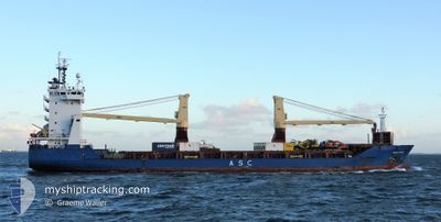
ASC LOTTI
General Cargo
Current Trip
COCOS ISLAND
| Time Travelled | 3 days |
|---|---|
| Remaining Time | --- |
| Distance Travelled | 1145.01 nm |
| Remaining Distance | --- |
| AVG Speed | 12.3 Knop |
| MAX Speed | 14 Knop |
| AVG Wind | 13.6 knots |
| MAX Wind | 22.6 knots |
| MIN Temp | 18.6°C / 65.48°F |
| MAX Temp | 24.8°C / 76.64°F |
| Djupgående | 6.1 m |
| Position mottagen | 3 d sen |
Current Position
| Longitud | 114.21612° |
|---|---|
| Latitude | -28.64305° |
| Status | Under way using engine |
| Fart | 12.6 Knop |
| Kurs | 325.8° |
| Område | Indian Ocean |
| Station | T-AIS |
| Position mottagen | 3 d sen |
Info
Information
The current position of ASC LOTTI is in Indian Ocean with coordinates -28.64305° / 114.21612° as reported on 2024-05-26 18:20 by AIS to our vessel tracker app. The vessel's current speed is 12.6 Knop
The vessel ASC LOTTI (IMO: 9436953, MMSI: 305240000) is a General Cargo that was built in 2008 ( 16 År gammal ). It's sailing under the flag of [AG] Antigua Barbuda.
In this page you can find informations about the vessels current position, last detected port calls, and current voyage information. If the vessels is not in coverage by AIS you will find the latest position.
The current position of ASC LOTTI is detected by our AIS receivers and we are not responsible for the reliability of the data. The last position was recorded while the vessel was in Coverage by the Ais receivers of our vessel tracking app.
The current draught of ASC LOTTI as reported by AIS is 6.1 meters
Weather
| Temperature | 24.3°C / 75.74°F |
|---|---|
| Wind Speed | 21 knots |
| Direction | 122° ESE |
| Pressure | 1015 hPa |
| Humidity | 72.8 % |
| Cloud Coverage | 61 % |
Featured Company
Last Port Calls
| Port | Arrival | Departure | Time In Port |
|---|---|---|---|
| 2024-05-21 13:39 | 2024-05-26 07:25 | 4 d | |
| 2024-05-01 13:27 | 2024-05-02 11:31 | 22 h | |
| 2024-04-26 22:32 | 2024-04-27 22:08 | 23 h | |
| 2024-04-23 17:28 | 2024-04-24 14:45 | 21 h | |
| 2024-04-20 08:04 | 2024-04-21 00:29 | 16 h | |
| 2024-04-09 08:26 | 2024-04-11 12:44 | 2 d | |
| 2024-03-30 22:09 | 2024-04-02 15:17 | 2 d | |
| 2024-03-03 18:23 |
Most Visited Ports (Last year)
| Port | Arrivals | |
|---|---|---|
| 11 | ||
| 8 | ||
| 3 | ||
| 2 | ||
| 1 | ||
| 1 |
Last Trips
| Origin | Departure | Destination | Arrival | Distance | |
|---|---|---|---|---|---|
| 2024-05-02 11:31 | 2024-05-21 13:39 | 1746.29 nm | |||
| 2024-04-27 22:08 | 2024-05-01 13:27 | 964.39 nm | |||
| 2024-04-24 14:45 | 2024-04-26 22:32 | 201.99 nm | |||
| 2024-04-21 00:29 | 2024-04-23 17:28 | 805.63 nm | |||
| 2024-04-11 12:44 | 2024-04-20 08:04 | 2622.83 nm | |||
| 2024-04-02 15:17 | 2024-04-09 08:26 | 2076.86 nm | |||
| 2024-03-03 18:23 | 2024-03-30 22:09 | 3511.88 nm |
Events
| Tid | Event | Detaljer | Position / Dest | Information |
|---|---|---|---|---|
| 2024-05-26 18:27 | Status ändrad | Default Under way using engine |
-28.62246 / 114.20060
COCOS ISLAND
|
Fart: 12.6 kn Kurs: 325.8° |
| 2024-05-26 18:20 | Status ändrad | Under way using engine Default |
-28.64305 / 114.21612
COCOS ISLAND
|
Fart: 13 kn Kurs: 326° |
| 2024-05-26 18:20 | UTANFÖR täckningsområde |
-28.64305 / 114.21612
Indian Ocean
COCOS ISLAND
|
Fart: 12.6 kn Kurs: 325.8° |
|
| 2024-05-26 18:15 | Status ändrad | Default Under way using engine |
-28.65667 / 114.22667
COCOS ISLAND
|
Fart: 12.6 kn Kurs: 326.5° |
| 2024-05-26 15:37 | Status ändrad | Under way using engine Default |
-29.18702 / 114.41924
COCOS ISLAND
|
Fart: 12.2 kn Kurs: 345° |
| 2024-05-26 15:34 | Status ändrad | Default Under way using engine |
-29.19610 / 114.42147
COCOS ISLAND
|
Fart: 12.4 kn Kurs: 349.4° |
| 2024-05-26 15:31 | Status ändrad | Under way using engine Default |
-29.20751 / 114.42420
COCOS ISLAND
|
Fart: 12 kn Kurs: 347° |
| 2024-05-26 15:22 | I täckningsområde |
-29.20636 / 114.42392
Indian Ocean
COCOS ISLAND
|
Fart: 12.4 kn Kurs: 349.4° |
|
| 2024-05-26 01:20 | Status ändrad | Default Under way using engine |
-31.83780 / 115.51514
COCOS ISLAND
|
Fart: 10.4 kn Kurs: 329.1° |
| 2024-05-26 01:13 | UTANFÖR täckningsområde |
-31.85314 / 115.52677
Indian Ocean
COCOS ISLAND
|
Fart: 10.4 kn Kurs: 329.1° |