
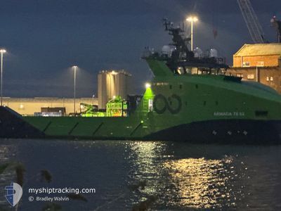
ARMADA 78 02
Other Type
Current Trip
OFFSHORE UK SECTOR
| Time Travelled | --- |
|---|---|
| Remaining Time | --- |
| Distance Travelled | 164.74 nm |
| Remaining Distance | --- |
| AVG Speed | 7 Knop |
| MAX Speed | 11.5 Knop |
| AVG Wind | 11.9 knots |
| MAX Wind | 23.6 knots |
| MIN Temp | 10.9°C / 51.62°F |
| MAX Temp | 17.1°C / 62.78°F |
| Djupgående | 6.3 m |
| Position mottagen | 1 m sen |
Current Position
| Longitud | -1.50716° |
|---|---|
| Latitude | 57.65466° |
| Status | Restricted manoeuverability |
| Fart | |
| Kurs | 158° |
| Område | North Sea |
| Station | T-AIS |
| Position mottagen | 1 m sen |
Info
Information
The current position of ARMADA 78 02 is in North Sea with coordinates 57.65466° / -1.50716° as reported on 2024-09-01 01:52 by AIS to our vessel tracker app. The vessel's current speed is 0 Knop
The vessel ARMADA 78 02 (IMO: 9924259, MMSI: 563175800) is a Other Type It's sailing under the flag of [SG] Singapore.
In this page you can find informations about the vessels current position, last detected port calls, and current voyage information. If the vessels is not in coverage by AIS you will find the latest position.
The current position of ARMADA 78 02 is detected by our AIS receivers and we are not responsible for the reliability of the data. The last position was recorded while the vessel was in Coverage by the Ais receivers of our vessel tracking app.
The current draught of ARMADA 78 02 as reported by AIS is 6.3 meters
Weather
| Temperature | 12.9°C / 55.22°F |
|---|---|
| Wind Speed | 15 knots |
| Direction | 154° SSE |
| Pressure | 1025.1 hPa |
| Humidity | 88.4 % |
| Cloud Coverage | 12 % |
Featured Company
Last Port Calls
Most Visited Ports (Last year)
| Port | Arrivals | |
|---|---|---|
| 34 | ||
| 2 | ||
| 2 | ||
| 2 |
Last Trips
| Origin | Departure | Destination | Arrival | Distance |
|---|
Events
| Tid | Event | Detaljer | Position / Dest | Information |
|---|---|---|---|---|
| 2024-09-01 00:06 | ETA ändrat | 2025/08/31 18:00 2024/08/31 18:00 |
57.65466 / -1.50717
OFFSHORE UK SECTOR
|
Fart: Kurs: 158° |
| 2024-08-31 15:16 | Status ändrad | Restricted manoeuverability Under way using engine |
57.65529 / -1.50539
OFFSHORE UK SECTOR
|
Fart: Kurs: 169° |
| 2024-08-31 14:54 | STOPPAR förflyttning | 12.94 nm, North East of PETERHEAD |
57.65446 / -1.50598
OFFSHORE UK SECTOR
|
Fart: 0.1 kn Kurs: 161° |
| 2024-08-31 11:00 | STARTAR förflyttning | 1.01 nm, South East of ABERDEEN |
57.13128 / -2.05235
OFFSHORE UK SECTOR
|
Fart: 3.1 kn Kurs: 95° |
| 2024-08-31 10:17 | ETA ändrat | 2024/08/31 18:00 2024/08/26 07:00 |
57.13218 / -2.05196
OFFSHORE UK SECTOR
|
Fart: Kurs: 262° |
| 2024-08-31 10:17 | Status ändrad | Under way using engine Moored |
57.13218 / -2.05196
OFFSHORE UK SECTOR
|
Fart: Kurs: 262° |
| 2024-08-26 07:46 | Status ändrad | Moored Under way using engine |
57.13518 / -2.05750
OFFSHORE UK SECTOR
|
Fart: Kurs: 82° |
| 2024-08-26 07:05 | STOPPAR förflyttning | 0.79 nm, South East of ABERDEEN |
57.13436 / -2.05652
OFFSHORE UK SECTOR
|
Fart: 0.3 kn Kurs: 84° |
| 2024-08-26 06:31 | STARTAR förflyttning | 2.43 nm, South East of ABERDEEN ANCH |
57.15729 / -1.98859
OFFSHORE UK SECTOR
|
Fart: 3.5 kn Kurs: 224° |
| 2024-08-26 05:36 | STOPPAR förflyttning | 2.45 nm, South East of ABERDEEN ANCH |
57.15937 / -1.98217
OFFSHORE UK SECTOR
|
Fart: 0.3 kn Kurs: 204° |