
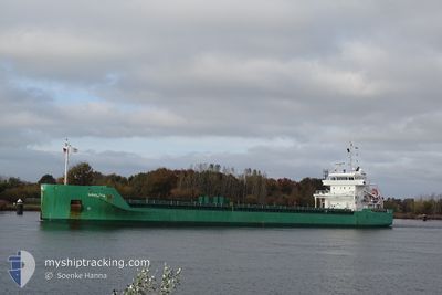
ARKLOW BAY
General Cargo
Current Trip
| Time Travelled | 1 day |
|---|---|
| Remaining Time | 15 h, 4 mins |
| Distance Travelled | 444.81 nm |
| Remaining Distance | 175.90 nm |
| AVG Speed | 11.3 Knop |
| MAX Speed | 14.4 Knop |
| AVG Wind | 12.2 knots |
| MAX Wind | 23 knots |
| MIN Temp | 7.8°C / 46.04°F |
| MAX Temp | 11.6°C / 52.88°F |
| Djupgående | 7.2 m |
| Position mottagen | 5 m sen |
Current Position
| Longitud | --- |
|---|---|
| Latitude | --- |
| Status | Under way using engine |
| Fart | 11.2 Knop |
| Kurs | 282° |
| Område | English Channel |
| Station | T-AIS |
| Position mottagen | 5 m sen |
Information
The current position of ARKLOW BAY is in English Channel with coordinates 49.97514° / -5.59610° as reported on 2025-03-08 12:15 by AIS to our vessel tracker app. The vessel's current speed is 11.2 Knop and is heading at the port of PORTBURY. The estimated time of arrival as calculated by MyShipTracking vessel tracking app is 2025-03-09 03:24 LT
The vessel ARKLOW BAY (IMO: 9638771, MMSI: 244700336) is a General Cargo that was built in 2014 ( 11 År gammal ). It's sailing under the flag of [NL] Netherlands.
In this page you can find informations about the vessels current position, last detected port calls, and current voyage information. If the vessels is not in coverage by AIS you will find the latest position.
The current position of ARKLOW BAY is detected by our AIS receivers and we are not responsible for the reliability of the data. The last position was recorded while the vessel was in Coverage by the Ais receivers of our vessel tracking app.
The current draught of ARKLOW BAY as reported by AIS is 7.2 meters
Weather
| Temperature | 10.7°C / 51.26°F |
|---|---|
| Wind Speed | 20 knots |
| Direction | 120° ESE |
| Pressure | 1000.7 hPa |
| Humidity | 91 % |
| Cloud Coverage | 100 % |
Featured Company
Last Port Calls
| Port | Arrival | Departure | Time In Port |
|---|---|---|---|
| 2025-03-05 07:48 | 2025-03-06 22:11 | 1 d | |
| 2025-03-05 05:54 | 2025-03-05 07:09 | 1 h | |
| 2025-03-03 04:20 | 2025-03-03 04:35 | 14 m | |
| 2025-02-24 12:29 | 2025-02-25 17:17 | 1 d | |
| 2025-02-16 18:42 | 2025-02-17 19:44 | 1 d | |
| 2025-02-11 16:02 | 2025-02-12 21:17 | 1 d | |
| 2025-02-03 16:46 | 2025-02-05 16:02 | 1 d | |
| 2025-02-02 22:47 | 2025-02-03 01:11 | 2 h | |
| 2025-01-27 20:43 | 2025-01-29 00:42 | 1 d | |
| 2025-01-23 20:16 | 2025-01-24 21:05 | 1 d |
Last Trips
| Origin | Departure | Destination | Arrival | Distance | |
|---|---|---|---|---|---|
| 2025-03-05 08:09 | 2025-03-05 08:48 | 5.52 nm | |||
| 2025-03-03 05:35 | 2025-03-05 06:54 | 128.44 nm | |||
| 2025-02-25 18:17 | 2025-03-03 05:20 | 762.30 nm | |||
| 2025-02-17 20:44 | 2025-02-24 13:29 | 1098.06 nm | |||
| 2025-02-12 22:17 | 2025-02-16 19:42 | 783.13 nm | |||
| 2025-02-05 17:02 | 2025-02-11 17:02 | 1517.50 nm | |||
| 2025-02-03 02:11 | 2025-02-03 17:46 | 103.71 nm | |||
| 2025-01-29 00:42 | 2025-02-02 23:47 | 1296.86 nm | |||
| 2025-01-24 22:05 | 2025-01-27 20:43 | 621.31 nm | |||
| 2025-01-21 15:16 | 2025-01-23 21:16 | 590.80 nm |
Events
| Tid | Event | Detaljer | Position / Dest | Information |
|---|---|---|---|---|
| 2025-03-08 12:16 | Status ändrad | Default Under way using engine |
49.97554 / -5.60013
PORTBURY
|
Fart: 11.2 kn Kurs: 282° |
| 2025-03-08 12:15 | Status ändrad | Under way using engine Default |
49.97514 / -5.59610
PORTBURY
|
Fart: 11.1 kn Kurs: 281° |
| 2025-03-08 12:00 | Status ändrad | Default Under way using engine |
49.96870 / -5.52315
PORTBURY
|
Fart: 11.3 kn Kurs: 280° |
| 2025-03-08 11:54 | Status ändrad | Under way using engine Default |
49.96605 / -5.49519
PORTBURY
|
Fart: 11.2 kn Kurs: 276° |
| 2025-03-08 11:54 | I täckningsområde |
49.96654 / -5.49992
English Channel
PORTBURY
|
Fart: 11.3 kn Kurs: 280° |
|
| 2025-03-08 11:00 | Status ändrad | Default Under way using engine |
49.93936 / -5.23639
PORTBURY
|
Fart: 11.5 kn Kurs: 266.9° |
| 2025-03-08 10:53 | UTANFÖR täckningsområde |
49.93874 / -5.20289
English Channel
PORTBURY
|
Fart: 11.5 kn Kurs: 266.9° |
|
| 2025-03-08 07:02 | ETA ändrat | 2025/03/09 01:30 2025/03/09 03:00 |
50.06163 / -4.02956
PORTBURY
|
Fart: 12.3 kn Kurs: 260.7° |
| 2025-03-08 01:22 | Status ändrad | Under way using engine Default |
50.26271 / -2.31978
PORTBURY
|
Fart: 10.8 kn Kurs: 258° |
| 2025-03-08 01:20 | Status ändrad | Default Under way using engine |
50.26419 / -2.30920
PORTBURY
|
Fart: 10.8 kn Kurs: 257.5° |