
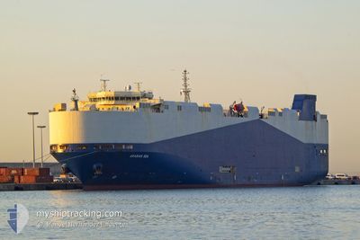
ARABIAN SEA
Vehicles Carrier
Current Trip
| Time Travelled | 35 days |
|---|---|
| Remaining Time | --- |
| Distance Travelled | 6219.02 nm |
| Remaining Distance | 17.83 nm |
| AVG Speed | 16.3 Knop |
| MAX Speed | 23.3 Knop |
| AVG Wind | 10.1 knots |
| MAX Wind | 28.8 knots |
| MIN Temp | 7.3°C / 45.14°F |
| MAX Temp | 29°C / 84.2°F |
| Djupgående | 7.6 m |
| Position mottagen | 26 d sen |
Current Position
| Longitud | --- |
|---|---|
| Latitude | --- |
| Status | Under way using engine |
| Fart | 14.4 Knop |
| Kurs | 85.4° |
| Område | Singapore Strait |
| Station | T-AIS |
| Position mottagen | 26 d sen |
Information
The current position of ARABIAN SEA is in Singapore Strait with coordinates 1.25211° / 104.14400° as reported on 2025-03-03 15:27 by AIS to our vessel tracker app. The vessel's current speed is 14.4 Knop and is heading at the port of ZHOUSHAN. The estimated time of arrival as calculated by MyShipTracking vessel tracking app is 2025-03-09 01:00 LT
The vessel ARABIAN SEA (IMO: 9483786, MMSI: 538007767) is a Vehicles Carrier that was built in 2010 ( 15 År gammal ). It's sailing under the flag of [MH] Marshall Is.
In this page you can find informations about the vessels current position, last detected port calls, and current voyage information. If the vessels is not in coverage by AIS you will find the latest position.
The current position of ARABIAN SEA is detected by our AIS receivers and we are not responsible for the reliability of the data. The last position was recorded while the vessel was in Coverage by the Ais receivers of our vessel tracking app.
The current draught of ARABIAN SEA as reported by AIS is 7.6 meters
Weather
| Temperature | 13.5°C / 56.3°F |
|---|---|
| Wind Speed | 10 knots |
| Direction | 193° SSW |
| Pressure | 1020.4 hPa |
| Humidity | 74.9 % |
| Cloud Coverage | --- |
Featured Company
Last Port Calls
| Port | Arrival | Departure | Time In Port |
|---|---|---|---|
| 2025-02-20 17:52 | 2025-02-21 21:22 | 1 d | |
| 2025-02-19 01:28 | 2025-02-20 03:12 | 1 d | |
| 2025-01-25 07:53 | 2025-01-26 02:57 | 19 h | |
| 2025-01-20 22:28 | 2025-01-21 09:12 | 10 h | |
| 2025-01-19 22:45 | 2025-01-20 05:25 | 6 h | |
| 2025-01-18 21:34 | 2025-01-19 08:33 | 10 h |
Last Trips
| Origin | Departure | Destination | Arrival | Distance | |
|---|---|---|---|---|---|
| 2025-02-20 06:12 | 2025-02-20 20:52 | 189.76 nm | |||
| 2025-01-26 10:57 | 2025-02-19 04:28 | 6742.21 nm | |||
| 2025-01-21 18:12 | 2025-01-25 15:53 | 907.71 nm | |||
| 2025-01-20 14:25 | 2025-01-21 07:28 | 238.70 nm | |||
| 2025-01-19 17:33 | 2025-01-20 07:45 | 199.30 nm | |||
| 2024-12-27 10:17 | 2025-01-19 06:34 | 6991.25 nm |
Events
| Tid | Event | Detaljer | Position / Dest | Information |
|---|---|---|---|---|
| 2025-03-21 01:21 | STOPPAR förflyttning | 11.33 nm, South of ZHOUSHAN |
29.78780 / 122.12949
CN ZOS
|
Fart: Kurs: 163° |
| 2025-03-21 01:18 | STARTAR förflyttning | 11.71 nm, South of ZHOUSHAN |
29.77889 / 122.13770
CN ZOS
|
Fart: 11.1 kn Kurs: 70° |