
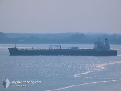
AQUILA L
Tanker
Current Trip
| Time Travelled | 5 days |
|---|---|
| Remaining Time | --- |
| Distance Travelled | 1460.55 nm |
| Remaining Distance | --- |
| AVG Speed | 11.7 Knop |
| MAX Speed | 13.9 Knop |
| AVG Wind | 13 knots |
| MAX Wind | 20 knots |
| MIN Temp | 16.5°C / 61.7°F |
| MAX Temp | 28.1°C / 82.58°F |
| Djupgående | 10.8 m |
| Position mottagen | 5 d sen |
Current Position
| Longitud | -94.79707° |
|---|---|
| Latitude | 29.35480° |
| Status | Under way using engine |
| Fart | 8.9 Knop |
| Kurs | 117.2° |
| Område | Gulf of Mexico |
| Station | T-AIS |
| Position mottagen | 5 d sen |
Info
Information
The current position of AQUILA L is in Gulf of Mexico with coordinates 29.35480° / -94.79707° as reported on 2024-04-23 09:21 by AIS to our vessel tracker app. The vessel's current speed is 8.9 Knop
The vessel AQUILA L (IMO: 9829411, MMSI: 636018640) is a Tanker It's sailing under the flag of [LR] Liberia.
In this page you can find informations about the vessels current position, last detected port calls, and current voyage information. If the vessels is not in coverage by AIS you will find the latest position.
The current position of AQUILA L is detected by our AIS receivers and we are not responsible for the reliability of the data. The last position was recorded while the vessel was in Coverage by the Ais receivers of our vessel tracking app.
The current draught of AQUILA L as reported by AIS is 10.8 meters
Weather
| Temperature | 27.4°C / 81.32°F |
|---|---|
| Wind Speed | 16 knots |
| Direction | 73° ENE |
| Pressure | 1011.8 hPa |
| Humidity | 85.2 % |
| Cloud Coverage | 51 % |
Featured Company
Last Port Calls
| Port | Arrival | Departure | Time In Port |
|---|---|---|---|
| 2024-04-20 07:12 | 2024-04-23 08:44 | 3 d | |
| 2024-04-11 14:43 | 2024-04-14 17:20 | 3 d | |
| 2024-04-05 19:39 | 2024-04-08 11:09 | 2 d | |
| 2024-03-28 10:00 | 2024-03-29 17:13 | 1 d | |
| 2024-02-28 16:47 | 2024-02-29 19:43 | 1 d | |
| 2024-02-09 15:08 | 2024-02-13 07:46 | 3 d |
Most Visited Ports (Last year)
| Port | Arrivals | |
|---|---|---|
| 4 | ||
| 3 | ||
| 2 | ||
| 2 | ||
| 2 | ||
| 1 |
Last Trips
| Origin | Departure | Destination | Arrival | Distance | |
|---|---|---|---|---|---|
| 2024-04-14 12:20 | 2024-04-20 02:12 | 568.66 nm | |||
| 2024-04-08 06:09 | 2024-04-11 09:43 | 577.72 nm | |||
| 2024-03-29 12:13 | 2024-04-05 14:39 | 1681.94 nm | |||
| 2024-02-29 14:43 | 2024-03-28 05:00 | 877.86 nm | |||
| 2024-02-13 01:46 | 2024-02-28 11:47 | 1951.33 nm | |||
| 2024-01-30 11:18 | 2024-02-09 09:08 | 2258.23 nm |
Events
| Tid | Event | Detaljer | Position / Dest | Information |
|---|---|---|---|---|
| 2024-04-23 09:26 | Status ändrad | Default Under way using engine |
29.34949 / -94.78513
US TXT
|
Fart: 8.9 kn Kurs: 117.2° |
| 2024-04-23 09:21 | Status ändrad | Under way using engine Default |
29.35480 / -94.79707
US TXT
|
Fart: 9 kn Kurs: 117° |
| 2024-04-23 09:21 | UTANFÖR täckningsområde |
29.35480 / -94.79707
Gulf of Mexico
US TXT
|
Fart: 8.9 kn Kurs: 117.2° |
|
| 2024-04-23 09:14 | Status ändrad | Default Under way using engine |
29.36239 / -94.81473
US TXT
|
Fart: 8.4 kn Kurs: 105.6° |
| 2024-04-23 08:53 | Status ändrad | Under way using engine Default |
29.37760 / -94.86558
US TXT
|
Fart: 6 kn Kurs: 104° |
| 2024-04-23 08:50 | Status ändrad | Default Under way using engine |
29.37872 / -94.87051
US TXT
|
Fart: 5.8 kn Kurs: 91.9° |
| 2024-04-23 08:44 | AVGÅTT HAMN |
|
29.38063 / -94.88139
US TXT
|
Fart: 5.6 kn Kurs: 83° |
| 2024-04-23 08:39 | Djupgående ändrat | 10.8 8.6 |
29.37583 / -94.88759
[US] TEXAS CITY
|
Fart: 4.3 kn Kurs: 28° |
| 2024-04-23 08:39 | Destination ändrad | US TXT US HOU |
29.37583 / -94.88759
[US] TEXAS CITY
|
Fart: 4.3 kn Kurs: 28° |
| 2024-04-23 08:39 | ETA ändrat | 2024/04/28 08:38 2024/04/16 14:00 |
29.37583 / -94.88759
[US] TEXAS CITY
|
Fart: 4.3 kn Kurs: 28° |