
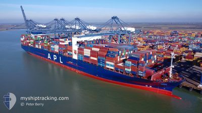
APL VANDA
Container Ship
Current Trip
| Time Travelled | 6 days |
|---|---|
| Remaining Time | --- |
| Distance Travelled | 2126.92 nm |
| Remaining Distance | --- |
| AVG Speed | 14.4 Knop |
| MAX Speed | 21.1 Knop |
| AVG Wind | 14.6 knots |
| MAX Wind | 26 knots |
| MIN Temp | 11.6°C / 52.88°F |
| MAX Temp | 27.5°C / 81.5°F |
| Djupgående | 12.9 m |
| Position mottagen | 4 d sen |
Current Position
| Longitud | --- |
|---|---|
| Latitude | --- |
| Status | Under way using engine |
| Fart | 15 Knop |
| Kurs | 210.4° |
| Område | North Atlantic Ocean |
| Station | T-AIS |
| Position mottagen | 4 d sen |
Info
Information
The current position of APL VANDA is in North Atlantic Ocean with coordinates 28.09645° / -13.44641° as reported on 2025-03-13 21:59 by AIS to our vessel tracker app. The vessel's current speed is 15 Knop and is heading at the port of PORT KLANG. The estimated time of arrival as calculated by MyShipTracking vessel tracking app is 2025-04-12 00:00 LT
The vessel APL VANDA (IMO: 9631993, MMSI: 566954000) is a Container Ship that was built in 2013 ( 12 År gammal ). It's sailing under the flag of [SG] Singapore.
In this page you can find informations about the vessels current position, last detected port calls, and current voyage information. If the vessels is not in coverage by AIS you will find the latest position.
The current position of APL VANDA is detected by our AIS receivers and we are not responsible for the reliability of the data. The last position was recorded while the vessel was in Coverage by the Ais receivers of our vessel tracking app.
The current draught of APL VANDA as reported by AIS is 12.9 meters
Weather
| Temperature | 27.5°C / 81.5°F |
|---|---|
| Wind Speed | 4 knots |
| Direction | 239° WSW |
| Pressure | 1012.2 hPa |
| Humidity | 78.3 % |
| Cloud Coverage | 99 % |
Featured Company
Last Port Calls
| Port | Arrival | Departure | Time In Port |
|---|---|---|---|
| 2025-03-11 02:37 | 2025-03-12 01:05 | 22 h | |
| 2025-03-04 06:22 | 2025-03-05 14:44 | 1 d | |
| 2025-03-02 18:54 | 2025-03-03 20:16 | 1 d | |
| 2025-02-25 03:59 | 2025-02-27 13:03 | 2 d | |
| 2025-02-19 19:59 | 2025-02-22 11:15 | 2 d | |
| 2025-02-14 20:54 | 2025-02-18 12:11 | 3 d | |
| 2025-02-09 21:55 | 2025-02-10 21:31 | 23 h | |
| 2025-01-14 10:07 | 2025-01-14 23:40 | 13 h | |
| 2025-01-09 22:21 | 2025-01-11 00:53 | 1 d | |
| 2025-01-04 09:57 | 2025-01-05 23:13 | 1 d |
Last Trips
| Origin | Departure | Destination | Arrival | Distance | |
|---|---|---|---|---|---|
| 2025-03-05 14:44 | 2025-03-11 02:37 | 1582.57 nm | |||
| 2025-03-03 20:16 | 2025-03-04 06:22 | 114.42 nm | |||
| 2025-02-27 13:03 | 2025-03-02 18:54 | 1035.49 nm | |||
| 2025-02-22 11:15 | 2025-02-25 03:59 | 952.15 nm | |||
| 2025-02-18 12:11 | 2025-02-19 19:59 | 521.12 nm | |||
| 2025-02-10 21:31 | 2025-02-14 20:54 | 1214.98 nm | |||
| 2025-01-14 23:40 | 2025-02-09 21:55 | 10807.36 nm | |||
| 2025-01-11 00:53 | 2025-01-14 10:07 | 1483.07 nm | |||
| 2025-01-05 23:13 | 2025-01-09 22:21 | 836.44 nm | |||
| 2024-12-26 18:05 | 2025-01-04 09:57 | 2549.50 nm |
Events
| Tid | Event | Detaljer | Position / Dest | Information |
|---|---|---|---|---|
| 2025-03-13 22:05 | Status ändrad | Default Under way using engine |
28.07532 / -13.46001
MYPKG
|
Fart: 15 kn Kurs: 210.4° |
| 2025-03-13 21:59 | UTANFÖR täckningsområde |
28.09645 / -13.44641
North Atlantic Ocean
MYPKG
|
Fart: 15 kn Kurs: 210.4° |
|
| 2025-03-13 21:46 | Byter havsområde | Spanish (Canary Islands) part of the North Atlantic Ocean Moroccan part of the North Atlantic Ocean |
28.14208 / -13.41493
North Atlantic Ocean
MYPKG
|
Fart: 14.9 kn Kurs: 213.4° |
| 2025-03-13 21:46 | Status ändrad | Under way using engine Default |
28.14377 / -13.41365
MYPKG
|
Fart: 14.9 kn Kurs: 218° |
| 2025-03-13 21:27 | I täckningsområde |
28.14208 / -13.41493
North Atlantic Ocean
MYPKG
|
Fart: 14.9 kn Kurs: 213.4° |
|
| 2025-03-13 20:34 | Status ändrad | Default Under way using engine |
28.36298 / -13.18888
MYPKG
|
Fart: 14.3 kn Kurs: 226.9° |
| 2025-03-13 20:26 | Byter havsområde | Moroccan part of the North Atlantic Ocean Spanish (Canary Islands) part of the North Atlantic Ocean |
28.38330 / -13.16361
North Atlantic Ocean
MYPKG
|
Fart: 14.3 kn Kurs: 226.9° |
| 2025-03-13 20:26 | Status ändrad | Under way using engine Default |
28.38330 / -13.16361
MYPKG
|
Fart: 14.3 kn Kurs: 224° |
| 2025-03-13 20:26 | UTANFÖR täckningsområde |
28.38330 / -13.16361
North Atlantic Ocean
MYPKG
|
Fart: 14.3 kn Kurs: 226.9° |
|
| 2025-03-13 19:32 | Status ändrad | Default Under way using engine |
28.57131 / -13.03494
MYPKG
|
Fart: 14.7 kn Kurs: 204.4° |