

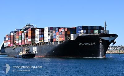
APL OREGON
Container Ship

Current Trip
| Time Travelled | 3 days |
|---|---|
| Remaining Time | 3 days |
| Distance Travelled | 1347.75 nm |
| Remaining Distance | 1256.39 nm |
| AVG Speed | 15.3 Knop |
| MAX Speed | 19.7 Knop |
| AVG Wind | 14.6 knots |
| MAX Wind | 23 knots |
| MIN Temp | 25.2°C / 77.36°F |
| MAX Temp | 30.6°C / 87.08°F |
| Djupgående | 13.4 m |
| Position mottagen | 2 h, 59 m sen |
Current Position
| Longitud | --- |
|---|---|
| Latitude | --- |
| Status | Under way using engine |
| Fart | 14.1 Knop |
| Kurs | 303.9° |
| Område | Laccadive Sea |
| Station | T-AIS |
| Position mottagen | 2 h, 59 m sen |
Information
The current position of APL OREGON is in Laccadive Sea with coordinates 5.91253° / 80.09675° as reported on 2025-02-28 06:15 by AIS to our vessel tracker app. The vessel's current speed is 14.1 Knop and is heading at the port of MUNDRA. The estimated time of arrival as calculated by MyShipTracking vessel tracking app is 2025-03-04 07:06 LT
The vessel APL OREGON (IMO: 9532783, MMSI: 248711000) is a Container Ship that was built in 2010 ( 15 År gammal ). It's sailing under the flag of [MT] Malta.
In this page you can find informations about the vessels current position, last detected port calls, and current voyage information. If the vessels is not in coverage by AIS you will find the latest position.
The current position of APL OREGON is detected by our AIS receivers and we are not responsible for the reliability of the data. The last position was recorded while the vessel was in Coverage by the Ais receivers of our vessel tracking app.
The current draught of APL OREGON as reported by AIS is 13.4 meters
Weather
| Temperature | 27.4°C / 81.32°F |
|---|---|
| Wind Speed | 8 knots |
| Direction | 273° W |
| Pressure | 1007.3 hPa |
| Humidity | 81.2 % |
| Cloud Coverage | 55 % |


Featured Company
Last Port Calls
| Port | Arrival | Departure | Time In Port |
|---|---|---|---|
| 2025-02-24 07:13 | 2025-02-24 23:09 | 15 h | |
| 2025-02-20 04:44 | 2025-02-21 02:12 | 21 h | |
| 2025-02-11 05:45 | 2025-02-12 00:05 | 18 h | |
| 2025-02-01 06:05 | 2025-02-02 00:04 | 17 h | |
| 2025-01-29 01:13 | 2025-01-30 09:26 | 1 d | |
| 2025-01-24 03:14 | 2025-01-25 16:47 | 1 d | |
| 2025-01-17 04:11 | 2025-01-17 22:43 | 18 h | |
| 2025-01-08 12:41 | 2025-01-09 16:57 | 1 d | |
| 2025-01-07 01:56 | 2025-01-07 21:38 | 19 h | |
| 2025-01-02 09:13 | 2025-01-04 05:25 | 1 d |
Most Visited Ports (Last year)
| Port | Arrivals | |
|---|---|---|
| 9 | ||
| 8 | ||
| 4 | ||
| 3 | ||
| 2 | ||
| 2 |
Last Trips
| Origin | Departure | Destination | Arrival | Distance | |
|---|---|---|---|---|---|
| 2025-02-21 02:12 | 2025-02-24 07:13 | 785.26 nm | |||
| 2025-02-12 00:05 | 2025-02-20 04:44 | 1906.61 nm | |||
| 2025-02-02 00:04 | 2025-02-11 05:45 | 3135.25 nm | |||
| 2025-01-30 09:26 | 2025-02-01 06:05 | 557.54 nm | |||
| 2025-01-25 16:47 | 2025-01-29 01:13 | 354.12 nm | |||
| 2025-01-17 22:43 | 2025-01-24 03:14 | 1235.86 nm | |||
| 2025-01-09 16:57 | 2025-01-17 04:11 | 2307.06 nm | |||
| 2025-01-07 21:38 | 2025-01-08 12:41 | 195.27 nm | |||
| 2025-01-04 05:25 | 2025-01-07 01:56 | 818.53 nm | |||
| 2024-12-30 03:25 | 2025-01-02 09:13 | 1039.61 nm |
Events
| Tid | Event | Detaljer | Position / Dest | Information |
|---|---|---|---|---|
| 2025-02-28 06:22 | Status ändrad | Default Under way using engine |
5.92648 / 80.07644
INMUN
|
Fart: 14.1 kn Kurs: 303.9° |
| 2025-02-28 06:15 | UTANFÖR täckningsområde |
5.91253 / 80.09675
Laccadive Sea
INMUN
|
Fart: 14.1 kn Kurs: 303.9° |
|
| 2025-02-28 04:57 | Djupgående ändrat | 13.4 12.1 |
5.84340 / 80.38970
INMUN
|
Fart: 14 kn Kurs: 273.9° |
| 2025-02-28 04:57 | Destination ändrad | INMUN MYPKG |
5.84340 / 80.38970
INMUN
|
Fart: 14 kn Kurs: 273.9° |
| 2025-02-28 04:57 | ETA ändrat | 2025/03/03 15:00 2025/02/23 16:00 |
5.84340 / 80.38970
INMUN
|
Fart: 14 kn Kurs: 273.9° |
| 2025-02-28 04:34 | Byter havsområde | Sri Lankan part of the Laccadive Sea Sri Lankan part of the Indian Ocean |
5.82883 / 80.48259
Laccadive Sea
|
Fart: 14.4 kn Kurs: 279° |
| 2025-02-28 04:21 | Upptäckt i hav | Sri Lankan part of the Indian Ocean |
5.82258 / 80.53252
Indian Ocean
|
Fart: 14.4 kn Kurs: 275.2° |
| 2025-02-28 04:21 | Status ändrad | Under way using engine Default |
5.82258 / 80.53252
MYPKG
|
Fart: 14.2 kn Kurs: 271° |
| 2025-02-28 04:15 | I täckningsområde |
5.82258 / 80.53252
Indian Ocean
|
Fart: 14.4 kn Kurs: 275.2° |
|
| 2025-02-24 15:09 | AVGÅTT HAMN |
|
2.90459 / 101.26636
MYPKG
|
Fart: 7.2 kn Kurs: 218° |