
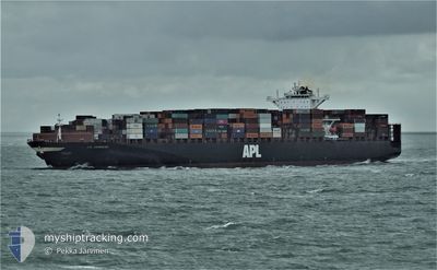
APL CHONGQING
Container Ship
Current Trip
| Time Travelled | 8 days |
|---|---|
| Remaining Time | 1 day |
| Distance Travelled | 4028.42 nm |
| Remaining Distance | 657.62 nm |
| AVG Speed | 18.9 Knop |
| MAX Speed | 22.1 Knop |
| AVG Wind | 17.7 knots |
| MAX Wind | 34 knots |
| MIN Temp | 2°C / 35.6°F |
| MAX Temp | 15.3°C / 59.54°F |
| Djupgående | 14.2 m |
| Position mottagen | 7 d sen |
Current Position
| Longitud | 141.53693° |
|---|---|
| Latitude | 41.64230° |
| Status | Under way using engine |
| Fart | 20.2 Knop |
| Kurs | 93.5° |
| Område | North Pacific Ocean |
| Station | T-AIS |
| Position mottagen | 7 d sen |
Info
Information
The current position of APL CHONGQING is in North Pacific Ocean with coordinates 41.64230° / 141.53693° as reported on 2024-05-10 13:39 by AIS to our vessel tracker app. The vessel's current speed is 20.2 Knop and is heading at the port of SEATTLE. The estimated time of arrival as calculated by MyShipTracking vessel tracking app is 2024-05-19 04:54 LT
The vessel APL CHONGQING (IMO: 9461867, MMSI: 566318000) is a Container Ship that was built in 2011 ( 13 År gammal ). It's sailing under the flag of [SG] Singapore.
In this page you can find informations about the vessels current position, last detected port calls, and current voyage information. If the vessels is not in coverage by AIS you will find the latest position.
The current position of APL CHONGQING is detected by our AIS receivers and we are not responsible for the reliability of the data. The last position was recorded while the vessel was in Coverage by the Ais receivers of our vessel tracking app.
The current draught of APL CHONGQING as reported by AIS is 14.2 meters
Weather
| Temperature | 7.1°C / 44.78°F |
|---|---|
| Wind Speed | 16 knots |
| Direction | 234° SW |
| Pressure | 1025.5 hPa |
| Humidity | 83.3 % |
| Cloud Coverage | 100 % |
Featured Company
Last Port Calls
| Port | Arrival | Departure | Time In Port |
|---|---|---|---|
| 2024-05-07 11:24 | 2024-05-08 21:42 | 1 d | |
| 2024-05-05 15:04 | 2024-05-06 07:43 | 16 h | |
| 2024-04-29 16:40 | 2024-04-30 05:36 | 12 h | |
| 2024-04-26 09:15 | 2024-04-26 23:12 | 13 h | |
| 2024-04-12 12:06 | 2024-04-15 16:35 | 3 d | |
| 2024-04-09 10:36 | 2024-04-12 03:38 | 2 d | |
| 2024-03-27 20:04 | 2024-03-29 08:40 | 1 d | |
| 2024-03-25 16:53 | 2024-03-26 11:44 | 18 h | |
| 2024-03-18 21:01 | 2024-03-19 11:13 | 14 h | |
| 2024-03-02 20:58 |
Last Trips
| Origin | Departure | Destination | Arrival | Distance | |
|---|---|---|---|---|---|
| 2024-05-06 15:43 | 2024-05-07 20:24 | 483.99 nm | |||
| 2024-04-30 13:36 | 2024-05-05 23:04 | 1042.76 nm | |||
| 2024-04-27 08:12 | 2024-04-30 00:40 | 1133.78 nm | |||
| 2024-04-15 09:35 | 2024-04-26 18:15 | 4778.12 nm | |||
| 2024-04-11 20:38 | 2024-04-12 05:06 | 133.46 nm | |||
| 2024-03-29 17:40 | 2024-04-09 03:36 | 4703.03 nm | |||
| 2024-03-26 19:44 | 2024-03-28 05:04 | 475.36 nm | |||
| 2024-03-19 19:13 | 2024-03-26 00:53 | 1029.52 nm | |||
| 2024-03-02 12:58 | 2024-03-19 05:01 | 5884.20 nm |
Events
| Tid | Event | Detaljer | Position / Dest | Information |
|---|---|---|---|---|
| 2024-05-10 13:43 | Status ändrad | Default Under way using engine |
41.64002 / 141.57136
USSEA
|
Fart: 20.2 kn Kurs: 93.5° |
| 2024-05-10 13:39 | Status ändrad | Under way using engine Default |
41.64230 / 141.53693
USSEA
|
Fart: 20.2 kn Kurs: 93° |
| 2024-05-10 13:39 | UTANFÖR täckningsområde |
41.64230 / 141.53693
North Pacific Ocean
USSEA
|
Fart: 20.2 kn Kurs: 93.5° |
|
| 2024-05-10 13:29 | Status ändrad | Default Under way using engine |
41.64400 / 141.46230
USSEA
|
Fart: 19.2 kn Kurs: 89.2° |
| 2024-05-10 13:05 | Byter havsområde | Japanese part of the North Pacific Ocean Japanese part of the Japan Sea |
41.62122 / 141.30379
North Pacific Ocean
USSEA
|
Fart: 18.9 kn Kurs: 64.2° |
| 2024-05-10 12:42 | Status ändrad | Under way using engine Default |
41.59252 / 141.15053
USSEA
|
Fart: 20.3 kn Kurs: 92° |
| 2024-05-10 12:22 | Status ändrad | Default Under way using engine |
41.59799 / 141.00037
USSEA
|
Fart: 20.3 kn Kurs: 92.7° |
| 2024-05-10 12:16 | Status ändrad | Under way using engine Default |
41.59924 / 140.95101
USSEA
|
Fart: 19.6 kn Kurs: 88° |
| 2024-05-10 11:44 | Status ändrad | Default Under way using engine |
41.56273 / 140.73659
USSEA
|
Fart: 19.4 kn Kurs: 49.3° |
| 2024-05-10 11:36 | Status ändrad | Under way using engine Default |
41.53899 / 140.68888
USSEA
|
Fart: 19.2 kn Kurs: 49° |