

APIRADEE NAREE
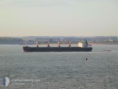
Bulk Carrier

Current Trip
| Trip Time | 17 days |
|---|---|
| Trip Distance | 2329.13 nm |
| AVG Speed | 10.9 Knop |
| MAX Speed | 14.3 Knop |
| Djupgående | 13 m |
| AVG Wind | 9.1 knots |
| MAX Wind | 18.3 knots |
| MIN Temp | 22.1°C / 71.78°F |
| MAX Temp | 29.9°C / 85.82°F |
| Position mottagen | 14 d sen |
Current Position
| Longitud | --- |
|---|---|
| Latitude | --- |
| Status | Under way using engine |
| Fart | 11 Knop |
| Kurs | 310.8° |
| Område | Laccadive Sea |
| Station | T-AIS |
| Position mottagen | 14 d sen |
Information
The current position of APIRADEE NAREE is in Laccadive Sea with coordinates 8.08596° / 76.67651° as reported on 2025-02-14 23:19 by AIS to our vessel tracker app. The vessel's current speed is 11 Knop and is currently inside the port of KANDLA.
The vessel APIRADEE NAREE (IMO: 9613410, MMSI: 566631000) is a Bulk Carrier that was built in 2012 ( 13 År gammal ). It's sailing under the flag of [SG] Singapore.
In this page you can find informations about the vessels current position, last detected port calls, and current voyage information. If the vessels is not in coverage by AIS you will find the latest position.
The current position of APIRADEE NAREE is detected by our AIS receivers and we are not responsible for the reliability of the data. The last position was recorded while the vessel was in Coverage by the Ais receivers of our vessel tracking app.
The current draught of APIRADEE NAREE as reported by AIS is 13 meters
Weather
| Temperature | 22.7°C / 72.86°F |
|---|---|
| Wind Speed | 7 knots |
| Direction | 292° WNW |
| Pressure | 1011.9 hPa |
| Humidity | 61 % |
| Cloud Coverage | 88 % |


Featured Company
Last Port Calls
| Port | Arrival | Departure | Time In Port |
|---|---|---|---|
| 2025-02-28 08:29 | |||
| 2025-02-09 06:56 | 2025-02-10 21:54 | 1 d | |
| 2025-01-26 09:20 | 2025-02-02 08:21 | 6 d |
Most Visited Ports (Last year)
| Port | Arrivals | |
|---|---|---|
| 2 | ||
| 2 | ||
| 2 | ||
| 2 | ||
| 1 | ||
| 1 |
Last Trips
| Origin | Departure | Destination | Arrival | Distance | |
|---|---|---|---|---|---|
| 2025-02-11 03:24 | 2025-02-28 13:59 | 2329.13 nm | |||
| 2025-02-02 13:51 | 2025-02-09 12:26 | 37.46 nm | |||
| 2024-12-02 11:04 | 2025-01-26 14:50 | 5223.23 nm |
Events
| Tid | Event | Detaljer | Position / Dest | Information |
|---|---|---|---|---|
| 2025-02-28 08:29 | STOPPAR förflyttning |
22.98258 / 70.23034
[IN] KANDLA
|
Fart: 0.2 kn Kurs: 171° |
|
| 2025-02-28 08:29 | ANLÄNDER HAMN |
|
22.98258 / 70.23034
[IN] KANDLA
|
Fart: 0.7 kn Kurs: 152° |
| 2025-02-28 06:32 | STARTAR förflyttning | 14.37 nm, South West of KANDLA |
22.80672 / 70.09322
INTUN
|
Fart: 7.7 kn Kurs: 356° |
| 2025-02-27 02:44 | STOPPAR förflyttning | 15.7 nm, South West of KANDLA |
22.78299 / 70.09174
INTUN
|
Fart: 0.2 kn Kurs: 25° |
| 2025-02-26 18:36 | STARTAR förflyttning | 19.86 nm, West of OKHA |
22.36264 / 68.74020
INTUN
|
Fart: 3.7 kn Kurs: 18° |
| 2025-02-24 09:22 | STOPPAR förflyttning | 20.05 nm, West of OKHA |
22.35796 / 68.73825
INTUN
|
Fart: 0.3 kn Kurs: 15° |
| 2025-02-24 01:07 | STARTAR förflyttning | 9.67 nm, South West of KANDLA |
22.88734 / 70.10998
INTUN
|
Fart: 3.8 kn Kurs: 190° |
| 2025-02-20 14:53 | STOPPAR förflyttning | 9.6 nm, South West of KANDLA |
22.89004 / 70.10780
INTUN
|
Fart: 0.3 kn Kurs: 238° |
| 2025-02-20 12:29 | STARTAR förflyttning | 14.5 nm, East of MUNDRA |
22.75918 / 69.94898
INTUN
|
Fart: 3.4 kn Kurs: 10° |