
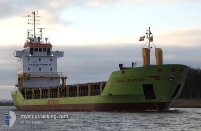
ANNA LEHMANN
General Cargo
Current Trip
| Time Travelled | 1 day |
|---|---|
| Remaining Time | 3 days |
| Distance Travelled | 424.55 nm |
| Remaining Distance | 824.73 nm |
| AVG Speed | 10.3 Knop |
| MAX Speed | 11.9 Knop |
| AVG Wind | 12.3 knots |
| MAX Wind | 21.8 knots |
| MIN Temp | 13.8°C / 56.84°F |
| MAX Temp | 21.4°C / 70.52°F |
| Djupgående | 5.9 m |
| Position mottagen | 1 m sen |
Current Position
| Longitud | 12.02444° |
|---|---|
| Latitude | 57.04868° |
| Status | Under way using engine |
| Fart | 11 Knop |
| Kurs | 340.7° |
| Område | Kattegat |
| Station | T-AIS |
| Position mottagen | 1 m sen |
Info
Information
The current position of ANNA LEHMANN is in Kattegat with coordinates 57.04868° / 12.02444° as reported on 2024-06-29 10:26 by AIS to our vessel tracker app. The vessel's current speed is 11 Knop and is heading at the port of MOIRANA. The estimated time of arrival as calculated by MyShipTracking vessel tracking app is 2024-07-02 16:28 LT
The vessel ANNA LEHMANN (IMO: 9225562, MMSI: 304145000) is a General Cargo that was built in 2000 ( 24 År gammal ). It's sailing under the flag of [AG] Antigua Barbuda.
In this page you can find informations about the vessels current position, last detected port calls, and current voyage information. If the vessels is not in coverage by AIS you will find the latest position.
The current position of ANNA LEHMANN is detected by our AIS receivers and we are not responsible for the reliability of the data. The last position was recorded while the vessel was in Coverage by the Ais receivers of our vessel tracking app.
The current draught of ANNA LEHMANN as reported by AIS is 5.9 meters
Weather
| Temperature | 16°C / 60.8°F |
|---|---|
| Wind Speed | 13 knots |
| Direction | 229° SW |
| Pressure | 1016.1 hPa |
| Humidity | 69.9 % |
| Cloud Coverage | 37 % |
Featured Company
Last Port Calls
| Port | Arrival | Departure | Time In Port |
|---|---|---|---|
| 2024-06-26 14:00 | 2024-06-27 19:47 | 1 d | |
| 2024-06-22 15:12 | |||
| 2024-06-20 14:37 | 2024-06-21 07:49 | 17 h | |
| 2024-06-12 01:35 | 2024-06-14 18:07 | 2 d | |
| 2024-06-06 07:26 | 2024-06-06 08:04 | 37 m | |
| 2024-06-05 01:07 | 2024-06-06 02:28 | 1 d | |
| 2024-06-04 20:06 | 2024-06-04 20:31 | 25 m | |
| 2024-06-02 12:22 | 2024-06-03 21:07 | 1 d | |
| 2024-06-01 10:55 | 2024-06-01 11:50 | 55 m | |
| 2024-05-30 19:42 | 2024-06-01 06:05 | 1 d |
Most Visited Ports (Last year)
| Port | Arrivals | |
|---|---|---|
| 12 | ||
| 11 | ||
| 9 | ||
| 8 | ||
| 4 | ||
| 4 |
Last Trips
| Origin | Departure | Destination | Arrival | Distance | |
|---|---|---|---|---|---|
| 2024-06-21 07:49 | 2024-06-26 14:00 | 490.18 nm | |||
| 2024-06-21 07:49 | 2024-06-22 15:12 | 256.66 nm | |||
| 2024-06-14 18:07 | 2024-06-20 14:37 | 1402.71 nm | |||
| 2024-06-06 08:04 | 2024-06-12 01:35 | 1294.23 nm | |||
| 2024-06-06 02:28 | 2024-06-06 07:26 | 47.93 nm | |||
| 2024-06-04 20:31 | 2024-06-05 01:07 | 49.47 nm | |||
| 2024-06-03 21:07 | 2024-06-04 20:06 | 238.71 nm | |||
| 2024-06-01 11:50 | 2024-06-02 12:22 | 233.48 nm | |||
| 2024-06-01 06:05 | 2024-06-01 10:55 | 48.66 nm | |||
| 2024-05-30 17:18 | 2024-05-30 19:42 | 23.80 nm |
Events
| Tid | Event | Detaljer | Position / Dest | Information |
|---|---|---|---|---|
| 2024-06-29 03:05 | Byter havsområde | Swedish part of the Kattegat Danish part of the Kattegat |
55.81714 / 12.72081
Kattegat
MO I RANA
|
Fart: 11.3 kn Kurs: 9.7° |
| 2024-06-29 01:11 | Byter havsområde | Danish part of the Kattegat Swedish part of the Kattegat |
55.49498 / 12.71006
Kattegat
MO I RANA
|
Fart: 10.2 kn Kurs: 8.7° |
| 2024-06-29 00:19 | Byter havsområde | Swedish part of the Kattegat Swedish part of the Baltic Sea |
55.34431 / 12.68351
Kattegat
MO I RANA
|
Fart: 10.5 kn Kurs: 5° |
| 2024-06-28 16:11 | Byter havsområde | Swedish part of the Baltic Sea Danish part of the Kattegat |
55.51526 / 14.76670
Baltic Sea
MO I RANA
|
Fart: 9.5 kn Kurs: 240.1° |
| 2024-06-28 14:23 | Byter havsområde | Danish part of the Kattegat Swedish part of the Baltic Sea |
55.65282 / 15.21040
Kattegat
MO I RANA
|
Fart: 9.6 kn Kurs: 241° |
| 2024-06-28 09:09 | Status ändrad | Under way using engine Default |
56.10746 / 16.59814
MO I RANA
|
Fart: 10.5 kn Kurs: 236° |
| 2024-06-28 09:05 | Status ändrad | Default Under way using engine |
56.11275 / 16.61203
MO I RANA
|
Fart: 10.5 kn Kurs: 231.9° |
| 2024-06-28 07:20 | Status ändrad | Under way using engine Default |
56.40469 / 16.83114
MO I RANA
|
Fart: 11.7 kn Kurs: 195° |
| 2024-06-28 07:18 | Status ändrad | Default Under way using engine |
56.41260 / 16.83521
MO I RANA
|
Fart: 11.7 kn Kurs: 196.2° |
| 2024-06-28 07:14 | Status ändrad | Under way using engine Default |
56.42471 / 16.84127
MO I RANA
|
Fart: 11.6 kn Kurs: 195° |