

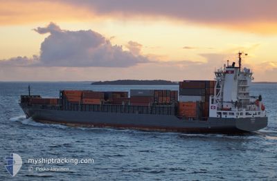
ANINA
Container Ship

Current Trip
| Time Travelled | 14 h, 12 mins |
|---|---|
| Remaining Time | 21 h, 27 mins |
| Distance Travelled | 136.40 nm |
| Remaining Distance | 230.99 nm |
| AVG Speed | 10.2 Knop |
| MAX Speed | 14.4 Knop |
| AVG Wind | 3.5 knots |
| MAX Wind | 6 knots |
| MIN Temp | 2.3°C / 36.14°F |
| MAX Temp | 4.3°C / 39.74°F |
| Djupgående | 8.3 m |
| Position mottagen | Nu |
Current Position
| Longitud | --- |
|---|---|
| Latitude | --- |
| Status | Under way using engine |
| Fart | 10.8 Knop |
| Kurs | 210.7° |
| Område | North Sea |
| Station | T-AIS |
| Position mottagen | Nu |
Information
The current position of ANINA is in North Sea with coordinates 57.01527° / 8.19500° as reported on 2025-02-28 13:27 by AIS to our vessel tracker app. The vessel's current speed is 10.8 Knop and is heading at the port of BREMERHAVEN. The estimated time of arrival as calculated by MyShipTracking vessel tracking app is 2025-03-01 10:55 LT
The vessel ANINA (IMO: 9354351, MMSI: 255805899) is a Container Ship that was built in 2006 ( 19 År gammal ). It's sailing under the flag of [PT] Portugal.
In this page you can find informations about the vessels current position, last detected port calls, and current voyage information. If the vessels is not in coverage by AIS you will find the latest position.
The current position of ANINA is detected by our AIS receivers and we are not responsible for the reliability of the data. The last position was recorded while the vessel was in Coverage by the Ais receivers of our vessel tracking app.
The current draught of ANINA as reported by AIS is 8.3 meters
Weather
| Temperature | 4.1°C / 39.38°F |
|---|---|
| Wind Speed | 5 knots |
| Direction | 339° NNW |
| Pressure | 1024.9 hPa |
| Humidity | 75 % |
| Cloud Coverage | --- |


Featured Company
Last Port Calls
| Port | Arrival | Departure | Time In Port |
|---|---|---|---|
| 2025-02-27 02:16 | 2025-02-27 23:16 | 20 h | |
| 2025-02-23 05:24 | 2025-02-24 15:11 | 1 d | |
| 2025-02-22 12:01 | 2025-02-22 19:37 | 7 h | |
| 2025-02-20 04:45 | 2025-02-21 02:39 | 21 h | |
| 2025-02-16 13:55 | 2025-02-18 16:00 | 2 d | |
| 2025-02-15 16:02 | 2025-02-16 04:55 | 12 h | |
| 2025-02-13 05:18 | 2025-02-13 23:26 | 18 h | |
| 2025-02-10 05:36 | 2025-02-11 16:23 | 1 d | |
| 2025-02-08 21:13 | 2025-02-09 07:16 | 10 h | |
| 2025-02-06 05:18 | 2025-02-06 23:14 | 17 h |
Most Visited Ports (Last year)
| Port | Arrivals | |
|---|---|---|
| 50 | ||
| 46 | ||
| 26 | ||
| 25 | ||
| 4 | ||
| 4 |
Last Trips
| Origin | Departure | Destination | Arrival | Distance | |
|---|---|---|---|---|---|
| 2025-02-24 16:11 | 2025-02-27 03:16 | 420.05 nm | |||
| 2025-02-22 20:37 | 2025-02-23 06:24 | 112.96 nm | |||
| 2025-02-21 03:39 | 2025-02-22 13:01 | 376.48 nm | |||
| 2025-02-18 17:00 | 2025-02-20 05:45 | 411.20 nm | |||
| 2025-02-16 05:55 | 2025-02-16 14:55 | 113.69 nm | |||
| 2025-02-14 00:26 | 2025-02-15 17:02 | 373.64 nm | |||
| 2025-02-11 17:23 | 2025-02-13 06:18 | 410.93 nm | |||
| 2025-02-09 08:16 | 2025-02-10 06:36 | 118.68 nm | |||
| 2025-02-07 00:14 | 2025-02-08 22:13 | 376.45 nm | |||
| 2025-02-04 22:10 | 2025-02-06 06:18 | 412.84 nm |
Events
| Tid | Event | Detaljer | Position / Dest | Information |
|---|---|---|---|---|
| 2025-02-28 12:07 | Upptäckt i hav | Danish part of the North Sea |
57.20043 / 8.45504
North Sea
DEBRV
|
Fart: 10.4 kn Kurs: 238.1° |
| 2025-02-28 02:41 | Byter havsområde | Danish part of the Skaggerak Danish part of the Kattegat |
57.80271 / 10.93911
Skaggerak
DEBRV
|
Fart: 9.1 kn Kurs: 302.7° |
| 2025-02-28 01:59 | Upptäckt i hav | Danish part of the Kattegat |
57.74826 / 11.11348
Kattegat
DEBRV
|
Fart: 9.1 kn Kurs: 299.9° |
| 2025-02-27 23:16 | AVGÅTT HAMN |
|
57.67989 / 11.81208
DEBRV
|
Fart: 12.1 kn Kurs: 239° |
| 2025-02-27 23:05 | STARTAR förflyttning |
57.68761 / 11.86051
[SE] GOTEBORG
|
Fart: 4.3 kn Kurs: 251° |
|
| 2025-02-27 22:56 | Djupgående ändrat | 8.3 8.4 |
57.68841 / 11.86396
[SE] GOTEBORG
|
Fart: Kurs: 269° |
| 2025-02-27 22:56 | ETA ändrat | 2025/03/01 09:00 2025/03/01 17:00 |
57.68841 / 11.86396
[SE] GOTEBORG
|
Fart: Kurs: 269° |
| 2025-02-27 22:56 | Status ändrad | Under way using engine Moored |
57.68840 / 11.86396
[SE] GOTEBORG
|
Fart: Kurs: 271° |
| 2025-02-27 17:15 | Djupgående ändrat | 8.4 8.1 |
57.68838 / 11.86397
[SE] GOTEBORG
|
Fart: Kurs: 271° |
| 2025-02-27 17:15 | Destination ändrad | DEBRV SEGOT |
57.68838 / 11.86397
[SE] GOTEBORG
|
Fart: Kurs: 271° |