

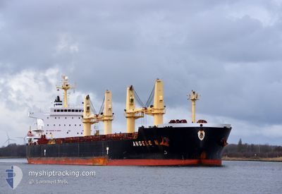
ANGELE N
Bulk Carrier

Current Trip
SGSIN>CNFAN
| Time Travelled | 6 days |
|---|---|
| Remaining Time | --- |
| Distance Travelled | 977.90 nm |
| Remaining Distance | --- |
| AVG Speed | 12.2 Knop |
| MAX Speed | 15.1 Knop |
| AVG Wind | 11.4 knots |
| MAX Wind | 21 knots |
| MIN Temp | -2.5°C / 27.5°F |
| MAX Temp | 7.7°C / 45.86°F |
| Djupgående | 11.4 m |
| Position mottagen | 2025-01-05 07:14 |
Current Position
| Longitud | --- |
|---|---|
| Latitude | --- |
| Status | Under way using engine |
| Fart | 9.9 Knop |
| Kurs | 85.1° |
| Område | Singapore Strait |
| Station | T-AIS |
| Position mottagen | 2025-01-05 07:14 |
Information
The current position of ANGELE N is in Singapore Strait with coordinates 1.25441° / 104.07385° as reported on 2025-01-05 07:14 by AIS to our vessel tracker app. The vessel's current speed is 9.9 Knop
The vessel ANGELE N (IMO: 9509528, MMSI: 477634100) is a Bulk Carrier that was built in 2010 ( 15 År gammal ). It's sailing under the flag of [HK] Hong Kong.
In this page you can find informations about the vessels current position, last detected port calls, and current voyage information. If the vessels is not in coverage by AIS you will find the latest position.
The current position of ANGELE N is detected by our AIS receivers and we are not responsible for the reliability of the data. The last position was recorded while the vessel was in Coverage by the Ais receivers of our vessel tracking app.
The current draught of ANGELE N as reported by AIS is 11.4 meters
Weather
| Temperature | 3.8°C / 38.84°F |
|---|---|
| Wind Speed | 17 knots |
| Direction | 167° SSE |
| Pressure | 1016.1 hPa |
| Humidity | 88.5 % |
| Cloud Coverage | 33 % |


Featured Company
Last Port Calls
| Port | Arrival | Departure | Time In Port |
|---|---|---|---|
| 2025-02-03 05:57 | 2025-02-22 07:21 | 19 d | |
| 2025-01-31 08:25 | 2025-02-02 12:37 | 2 d | |
| 2025-01-19 10:47 | 2025-01-24 06:12 | 4 d | |
| 2025-01-14 08:25 | 2025-01-16 07:48 | 1 d |
Last Trips
| Origin | Departure | Destination | Arrival | Distance | |
|---|---|---|---|---|---|
| 2025-02-02 20:37 | 2025-02-03 13:57 | 176.22 nm | |||
| 2025-01-24 14:12 | 2025-01-31 16:25 | 976.93 nm | |||
| 2025-01-16 15:48 | 2025-01-19 18:47 | 820.57 nm | |||
| 2024-12-03 14:01 | 2025-01-14 16:25 | 10315.17 nm |
Events
| Tid | Event | Detaljer | Position / Dest | Information |
|---|---|---|---|---|
| 2025-02-28 17:37 | STOPPAR förflyttning | 11.16 nm, North West of BAYUQUAN |
40.36237 / 121.84415
SGSIN>CNFAN
|
Fart: 0.3 kn Kurs: 205° |
| 2025-02-27 02:13 | STARTAR förflyttning | 3.77 nm, North of LANSHAN |
35.15666 / 119.40389
SGSIN>CNFAN
|
Fart: 4.8 kn Kurs: 154° |
| 2025-02-25 14:42 | STOPPAR förflyttning | 4.01 nm, North of LANSHAN |
35.16089 / 119.40139
SGSIN>CNFAN
|
Fart: Kurs: 90° |
| 2025-02-25 12:01 | STARTAR förflyttning | 13.16 nm, East of LANSHAN |
35.08947 / 119.66145
SGSIN>CNFAN
|
Fart: 3.5 kn Kurs: 273° |
| 2025-02-23 20:02 | STOPPAR förflyttning | 13.45 nm, East of LANSHAN |
35.08642 / 119.66723
SGSIN>CNFAN
|
Fart: 0.3 kn Kurs: 293° |
| 2025-02-22 07:21 | AVGÅTT HAMN |
|
39.94921 / 119.83050
SGSIN>CNFAN
|
Fart: 3.6 kn Kurs: 182° |
| 2025-02-22 07:01 | STARTAR förflyttning |
39.97039 / 119.82797
[CN] SHANHAIGUAN
|
Fart: 3.9 kn Kurs: 185° |