
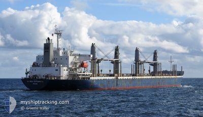
ANDREA ENTERPRISE
Cargo
Current Trip
| Time Travelled | 20 days |
|---|---|
| Remaining Time | 9 h, 40 mins |
| Distance Travelled | 2797.19 nm |
| Remaining Distance | 202.29 nm |
| AVG Speed | 10.7 Knop |
| MAX Speed | 15.6 Knop |
| AVG Wind | 8 knots |
| MAX Wind | 19.5 knots |
| MIN Temp | 4.7°C / 40.46°F |
| MAX Temp | 29°C / 84.2°F |
| Djupgående | 6.5 m |
| Position mottagen | 15 h, 19 m sen |
Current Position
| Longitud | --- |
|---|---|
| Latitude | --- |
| Status | Under way using engine |
| Fart | 2.3 Knop |
| Kurs | 289° |
| Område | Malacca Strait |
| Station | T-AIS |
| Position mottagen | 15 h, 19 m sen |
Info
Information
The current position of ANDREA ENTERPRISE is in Malacca Strait with coordinates 1.23447° / 103.44809° as reported on 2025-03-17 14:29 by AIS to our vessel tracker app. The vessel's current speed is 2.3 Knop and is heading at the port of BELAWAN. The estimated time of arrival as calculated by MyShipTracking vessel tracking app is 2025-03-18 22:28 LT
The vessel ANDREA ENTERPRISE (IMO: 9749946, MMSI: 353929000) is a Cargo It's sailing under the flag of [PA] Panama.
In this page you can find informations about the vessels current position, last detected port calls, and current voyage information. If the vessels is not in coverage by AIS you will find the latest position.
The current position of ANDREA ENTERPRISE is detected by our AIS receivers and we are not responsible for the reliability of the data. The last position was recorded while the vessel was in Coverage by the Ais receivers of our vessel tracking app.
The current draught of ANDREA ENTERPRISE as reported by AIS is 6.5 meters
Weather
| Temperature | 29°C / 84.2°F |
|---|---|
| Wind Speed | 4 knots |
| Direction | 284° WNW |
| Pressure | 1011.5 hPa |
| Humidity | 66.8 % |
| Cloud Coverage | 72 % |
Featured Company
Last Port Calls
| Port | Arrival | Departure | Time In Port |
|---|---|---|---|
| 2025-02-16 22:17 | 2025-02-26 01:29 | 9 d | |
| 2025-02-11 03:04 | 2025-02-14 19:59 | 3 d | |
| 2025-01-25 10:51 | 2025-01-27 11:18 | 2 d | |
| 2025-01-21 22:24 | 2025-01-23 12:31 | 1 d | |
| 2025-01-11 05:35 | 2025-01-12 22:24 | 1 d |
Most Visited Ports (Last year)
| Port | Arrivals | |
|---|---|---|
| 2 | ||
| 2 | ||
| 2 | ||
| 2 | ||
| 1 | ||
| 1 |
Last Trips
| Origin | Departure | Destination | Arrival | Distance | |
|---|---|---|---|---|---|
| 2025-02-14 19:59 | 2025-02-16 22:17 | 379.67 nm | |||
| 2025-01-27 11:18 | 2025-02-11 03:04 | 3962.76 nm | |||
| 2025-01-23 12:31 | 2025-01-25 10:51 | 506.82 nm | |||
| 2025-01-12 22:24 | 2025-01-21 22:24 | 1060.55 nm | |||
| 2024-12-28 16:25 | 2025-01-11 05:35 | 3663.85 nm |
Events
| Tid | Event | Detaljer | Position / Dest | Information |
|---|---|---|---|---|
| 2025-03-17 14:34 | Status ändrad | Default Under way using engine |
1.23517 / 103.44541
IDBLW
|
Fart: 2.3 kn Kurs: 289° |
| 2025-03-17 14:29 | UTANFÖR täckningsområde |
1.23448 / 103.44809
Malacca Strait
IDBLW
|
Fart: 2.3 kn Kurs: 284.6° |
|
| 2025-03-17 14:20 | Status ändrad | Under way using engine Default |
1.23276 / 103.45391
IDBLW
|
Fart: 4.2 kn Kurs: 289° |
| 2025-03-17 14:14 | Status ändrad | Default Under way using engine |
1.23082 / 103.46031
IDBLW
|
Fart: 4.3 kn Kurs: 288° |
| 2025-03-17 14:13 | Status ändrad | Under way using engine Default |
1.23065 / 103.46087
IDBLW
|
Fart: 5.5 kn Kurs: 285° |
| 2025-03-17 14:13 | Byter havsområde | Malaysian part of the Malacca Strait Malaysian part of the Singapore Strait |
1.23065 / 103.46087
Malacca Strait
IDBLW
|
Fart: 4.3 kn Kurs: 286.7° |
| 2025-03-17 14:05 | Status ändrad | Default Under way using engine |
1.22765 / 103.47183
IDBLW
|
Fart: 5.9 kn Kurs: 284.5° |
| 2025-03-17 13:26 | Status ändrad | Under way using engine Default |
1.20971 / 103.53040
IDBLW
|
Fart: 4.9 kn Kurs: 267° |
| 2025-03-17 13:26 | Status ändrad | Default Under way using engine |
1.20991 / 103.53129
IDBLW
|
Fart: 4.9 kn Kurs: 264° |
| 2025-03-17 12:32 | Byter havsområde | Malaysian part of the Singapore Strait Indonesian part of the Singapore Strait |
1.19857 / 103.59077
Singapore Strait
IDBLW
|
Fart: 5.1 kn Kurs: 285.2° |