
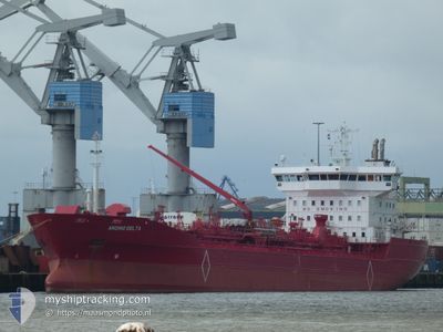
ANDINO DELTA
Oil/Chemical Tanker
Current Trip
| Trip Time | 8 days |
|---|---|
| Trip Distance | 1824.17 nm |
| AVG Speed | 10.7 Knop |
| MAX Speed | 15 Knop |
| Djupgående | 5.7 m |
| AVG Wind | 6.2 knots |
| MAX Wind | 13 knots |
| MIN Temp | 22.7°C / 72.86°F |
| MAX Temp | 32.3°C / 90.14°F |
| Position mottagen | 7 m sen |
Current Position
| Longitud | -90.00015° |
|---|---|
| Latitude | 29.82747° |
| Status | At anchor |
| Fart | |
| Kurs | 355° |
| Område | Caribbean Sea |
| Station | T-AIS |
| Position mottagen | 7 m sen |
Info
Information
The current position of ANDINO DELTA is in Caribbean Sea with coordinates 29.82747° / -90.00015° as reported on 2024-09-14 22:04 by AIS to our vessel tracker app. The vessel's current speed is 0 Knop and is currently inside the port of NEW ORLEANS.
The vessel ANDINO DELTA (IMO: 9172210, MMSI: 210603000) is a Oil/Chemical Tanker that was built in 1998 ( 26 År gammal ). It's sailing under the flag of [CY] Cyprus.
In this page you can find informations about the vessels current position, last detected port calls, and current voyage information. If the vessels is not in coverage by AIS you will find the latest position.
The current position of ANDINO DELTA is detected by our AIS receivers and we are not responsible for the reliability of the data. The last position was recorded while the vessel was in Coverage by the Ais receivers of our vessel tracking app.
The current draught of ANDINO DELTA as reported by AIS is 6.1 meters
Weather
| Temperature | 32°C / 89.6°F |
|---|---|
| Wind Speed | 5 knots |
| Direction | 262° W |
| Pressure | 1009.9 hPa |
| Humidity | 51.8 % |
| Cloud Coverage | 97 % |
Featured Company
Last Port Calls
| Port | Arrival | Departure | Time In Port |
|---|---|---|---|
| 2024-09-09 08:30 | |||
| 2024-08-30 12:20 | 2024-08-31 16:45 | 1 d | |
| 2024-08-26 06:56 | 2024-08-27 13:28 | 1 d | |
| 2024-08-05 21:53 | 2024-08-06 07:06 | 9 h | |
| 2024-07-24 13:59 | 2024-07-25 07:52 | 17 h | |
| 2024-07-15 09:42 |
Most Visited Ports (Last year)
| Port | Arrivals | |
|---|---|---|
| 3 | ||
| 2 | ||
| 1 | ||
| 1 | ||
| 1 |
Last Trips
| Origin | Departure | Destination | Arrival | Distance | |
|---|---|---|---|---|---|
| 2024-08-31 16:45 | 2024-09-09 08:30 | 1824.17 nm | |||
| 2024-08-27 13:28 | 2024-08-30 12:20 | 17.78 nm | |||
| 2024-08-06 07:06 | 2024-08-26 06:56 | 1605.94 nm | |||
| 2024-07-25 07:52 | 2024-08-05 21:53 | 1923.84 nm | |||
| 2024-07-15 09:42 | 2024-07-24 13:59 | 1855.34 nm |
Events
| Tid | Event | Detaljer | Position / Dest | Information |
|---|---|---|---|---|
| 2024-09-14 16:33 | I täckningsområde |
29.82791 / -89.99893
Caribbean Sea
[US] NEW ORLEANS
|
Fart: Kurs: 102.6° |
|
| 2024-09-14 15:14 | UTANFÖR täckningsområde |
29.82754 / -89.99953
Caribbean Sea
[US] NEW ORLEANS
|
Fart: Kurs: 102.6° |
|
| 2024-09-14 13:02 | I täckningsområde |
29.82748 / -89.99995
Caribbean Sea
[US] NEW ORLEANS
|
Fart: Kurs: 102.6° |
|
| 2024-09-14 11:54 | UTANFÖR täckningsområde |
29.82745 / -90.00013
Caribbean Sea
[US] NEW ORLEANS
|
Fart: Kurs: 102.6° |
|
| 2024-09-09 17:25 | Djupgående ändrat | 6.1 5.7 |
29.82753 / -90.00073
[US] NEW ORLEANS
|
Fart: Kurs: 25° |
| 2024-09-09 17:23 | Status ändrad | At anchor Under way using engine |
29.82753 / -90.00073
[US] NEW ORLEANS
|
Fart: Kurs: 27° |
| 2024-09-09 13:50 | STOPPAR förflyttning |
29.82739 / -89.99999
[US] NEW ORLEANS
|
Fart: 0.3 kn Kurs: 19° |
|
| 2024-09-09 13:30 | ANLÄNDER HAMN |
|
29.81112 / -90.00471
[US] NEW ORLEANS
|
Fart: 4.7 kn Kurs: 13° |
| 2024-09-09 13:22 | Djupgående ändrat | 5.7 6.9 |
29.79797 / -90.00893
USMSY
|
Fart: 8.7 kn Kurs: 19.9° |
| 2024-09-09 13:22 | Destination ändrad | USMSY DOHAI |
29.79797 / -90.00893
USMSY
|
Fart: 8.7 kn Kurs: 19.9° |