
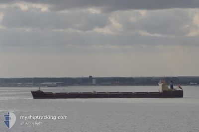
ANABELA
Bulk Carrier
Current Trip
| Time Travelled | 17 days |
|---|---|
| Remaining Time | --- |
| Distance Travelled | 4292.14 nm |
| Remaining Distance | --- |
| AVG Speed | 9.5 Knop |
| MAX Speed | 13.7 Knop |
| AVG Wind | 15.5 knots |
| MAX Wind | 33.1 knots |
| MIN Temp | 4.7°C / 40.46°F |
| MAX Temp | 21.3°C / 70.34°F |
| Djupgående | 8.8 m |
| Position mottagen | 8 d sen |
Current Position
| Longitud | -8.97226° |
|---|---|
| Latitude | 36.03276° |
| Status | Under way using engine |
| Fart | 10.2 Knop |
| Kurs | 286° |
| Område | North Atlantic Ocean |
| Station | T-AIS |
| Position mottagen | 8 d sen |
Info
Information
The current position of ANABELA is in North Atlantic Ocean with coordinates 36.03276° / -8.97226° as reported on 2024-04-28 13:57 by AIS to our vessel tracker app. The vessel's current speed is 10.2 Knop and is heading at the port of SEPT-ILES. The estimated time of arrival as calculated by MyShipTracking vessel tracking app is 2024-05-08 00:00 LT
The vessel ANABELA (IMO: 9587350, MMSI: 636019937) is a Bulk Carrier that was built in 2010 ( 14 År gammal ). It's sailing under the flag of [LR] Liberia.
In this page you can find informations about the vessels current position, last detected port calls, and current voyage information. If the vessels is not in coverage by AIS you will find the latest position.
The current position of ANABELA is detected by our AIS receivers and we are not responsible for the reliability of the data. The last position was recorded while the vessel was in Coverage by the Ais receivers of our vessel tracking app.
The current draught of ANABELA as reported by AIS is 8.8 meters
Weather
| Temperature | 7.4°C / 45.32°F |
|---|---|
| Wind Speed | 9 knots |
| Direction | 250° WSW |
| Pressure | 1019.2 hPa |
| Humidity | 71.2 % |
| Cloud Coverage | 100 % |
Featured Company
Events
| Tid | Event | Detaljer | Position / Dest | Information |
|---|---|---|---|---|
| 2024-04-28 14:18 | Status ändrad | Default Under way using engine |
36.04833 / -9.05166
ES ALG > CA SEI
|
Fart: 10.2 kn Kurs: 286° |
| 2024-04-28 13:57 | Status ändrad | Under way using engine Default |
36.03276 / -8.97226
ES ALG > CA SEI
|
Fart: 10.5 kn Kurs: 286° |
| 2024-04-28 13:57 | I täckningsområde |
36.03276 / -8.97226
North Atlantic Ocean
ES ALG > CA SEI
|
Fart: 10.2 kn Kurs: 286° |
|
| 2024-04-28 13:57 | UTANFÖR täckningsområde |
36.03276 / -8.97226
North Atlantic Ocean
ES ALG > CA SEI
|
Fart: 10.2 kn Kurs: 286° |
|
| 2024-04-28 08:42 | Status ändrad | Default Under way using engine |
35.94500 / -7.80500
ES ALG > CA SEI
|
Fart: 11.6 kn Kurs: 268.7° |
| 2024-04-28 08:33 | Status ändrad | Under way using engine Default |
35.94746 / -7.75688
ES ALG > CA SEI
|
Fart: 11 kn Kurs: 269° |
| 2024-04-28 08:33 | UTANFÖR täckningsområde |
35.94746 / -7.75688
North Atlantic Ocean
ES ALG > CA SEI
|
Fart: 11.6 kn Kurs: 268.7° |
|
| 2024-04-28 08:21 | I täckningsområde |
35.94746 / -7.75688
North Atlantic Ocean
ES ALG > CA SEI
|
Fart: 11.6 kn Kurs: 268.7° |
|
| 2024-04-28 07:44 | Status ändrad | Default Under way using engine |
35.95053 / -7.57540
ES ALG > CA SEI
|
Fart: 11.7 kn Kurs: 270.6° |
| 2024-04-28 07:32 | UTANFÖR täckningsområde |
35.95090 / -7.51610
North Atlantic Ocean
ES ALG > CA SEI
|
Fart: 11.7 kn Kurs: 270.6° |