
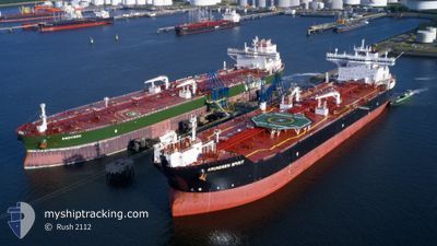
AMUNDSEN SPIRIT
Oil Products Tanker
Current Trip
CATCHER OF
| Time Travelled | 3 days |
|---|---|
| Remaining Time | --- |
| Distance Travelled | 20.05 nm |
| Remaining Distance | --- |
| AVG Speed | 7.8 Knop |
| MAX Speed | 12.7 Knop |
| AVG Wind | 17.6 knots |
| MAX Wind | 34 knots |
| MIN Temp | 5.8°C / 42.44°F |
| MAX Temp | 11.4°C / 52.52°F |
| Djupgående | 9.2 m |
| Position mottagen | 1 m sen |
Current Position
| Longitud | --- |
|---|---|
| Latitude | --- |
| Status | At anchor |
| Fart | |
| Kurs | 312° |
| Område | English Channel |
| Station | T-AIS |
| Position mottagen | 1 m sen |
Info
Information
The current position of AMUNDSEN SPIRIT is in English Channel with coordinates 49.57009° / -0.14888° as reported on 2025-01-25 18:28 by AIS to our vessel tracker app. The vessel's current speed is 0 Knop
The vessel AMUNDSEN SPIRIT (IMO: 9438858, MMSI: 311027700) is a Oil Products Tanker that was built in 2010 ( 15 År gammal ). It's sailing under the flag of [BS] Bahamas.
In this page you can find informations about the vessels current position, last detected port calls, and current voyage information. If the vessels is not in coverage by AIS you will find the latest position.
The current position of AMUNDSEN SPIRIT is detected by our AIS receivers and we are not responsible for the reliability of the data. The last position was recorded while the vessel was in Coverage by the Ais receivers of our vessel tracking app.
The current draught of AMUNDSEN SPIRIT as reported by AIS is 9.2 meters
Weather
| Temperature | 6.8°C / 44.24°F |
|---|---|
| Wind Speed | 12 knots |
| Direction | 52° NE |
| Pressure | 1006.5 hPa |
| Humidity | 64.3 % |
| Cloud Coverage | 100 % |
Featured Company
Last Port Calls
| Port | Arrival | Departure | Time In Port |
|---|---|---|---|
| 2025-01-20 12:28 | 2025-01-22 03:47 | 1 d | |
| 2025-01-07 16:50 | 2025-01-10 07:12 | 2 d | |
| 2024-12-23 23:03 | 2024-12-25 17:24 | 1 d | |
| 2024-12-17 17:47 | 2024-12-19 01:58 | 1 d | |
| 2024-12-08 00:03 | 2024-12-09 04:52 | 1 d | |
| 2024-11-21 13:23 | 2024-11-22 17:45 | 1 d | |
| 2024-11-13 10:44 | 2024-11-14 18:20 | 1 d |
Most Visited Ports (Last year)
| Port | Arrivals | |
|---|---|---|
| 6 | ||
| 4 | ||
| 2 | ||
| 2 | ||
| 1 | ||
| 1 |
Last Trips
| Origin | Departure | Destination | Arrival | Distance | |
|---|---|---|---|---|---|
| 2025-01-10 08:12 | 2025-01-20 13:28 | 1881.53 nm | |||
| 2024-12-25 18:24 | 2025-01-07 17:50 | 1216.25 nm | |||
| 2024-12-19 02:58 | 2024-12-24 00:03 | 715.30 nm | |||
| 2024-12-09 05:52 | 2024-12-17 18:47 | 1348.97 nm | |||
| 2024-11-22 18:45 | 2024-12-08 01:03 | 1305.30 nm | |||
| 2024-11-14 19:20 | 2024-11-21 14:23 | 1249.61 nm | |||
| 2024-10-05 20:08 | 2024-11-13 11:44 | 3924.43 nm |
Events
| Tid | Event | Detaljer | Position / Dest | Information |
|---|---|---|---|---|
| 2025-01-25 17:22 | Status ändrad | At anchor Default |
49.57015 / -.14858
CATCHER OF
|
Fart: Kurs: 313° |
| 2025-01-25 17:13 | Status ändrad | Default At anchor |
49.57009 / -.14874
CATCHER OF
|
Fart: Kurs: 315° |
| 2025-01-25 16:28 | Status ändrad | At anchor Default |
49.56979 / -.14946
CATCHER OF
|
Fart: Kurs: 337° |
| 2025-01-25 16:25 | Status ändrad | Default At anchor |
49.56978 / -.14950
CATCHER OF
|
Fart: Kurs: 336° |
| 2025-01-25 10:22 | Status ändrad | At anchor Default |
49.56954 / -.15008
CATCHER OF
|
Fart: Kurs: 351° |
| 2025-01-25 10:16 | Status ändrad | Default At anchor |
49.56955 / -.14999
CATCHER OF
|
Fart: Kurs: 349° |
| 2025-01-25 09:04 | Status ändrad | At anchor Default |
49.56970 / -.14923
CATCHER OF
|
Fart: Kurs: 332° |
| 2025-01-25 09:01 | Status ändrad | Default At anchor |
49.56967 / -.14917
CATCHER OF
|
Fart: 0.1 kn Kurs: 329° |
| 2025-01-25 08:28 | Status ändrad | At anchor Default |
49.56996 / -.14866
CATCHER OF
|
Fart: 0.1 kn Kurs: 309° |
| 2025-01-25 08:25 | Status ändrad | Default At anchor |
49.57004 / -.14850
CATCHER OF
|
Fart: Kurs: 307° |