
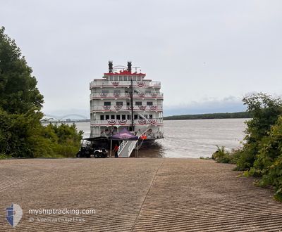
AMERICAN SPLENDOR
Passenger
Current Trip
| Time Travelled | 32 mins |
|---|---|
| Remaining Time | --- |
| Distance Travelled | 4.53 nm |
| Remaining Distance | --- |
| AVG Speed | 8.6 Knop |
| MAX Speed | 8.7 Knop |
| AVG Wind | 7.5 knots |
| MAX Wind | 8 knots |
| MIN Temp | 18.1°C / 64.58°F |
| MAX Temp | 18.4°C / 65.12°F |
| Djupgående | 2.5 m |
| Position mottagen | 2 d sen |
Current Position
| Longitud | -87.41572° |
|---|---|
| Latitude | 36.52045° |
| Status | Under way using engine |
| Fart | 8.1 Knop |
| Kurs | 208.1° |
| Område | Gulf of Mexico |
| Station | T-AIS |
| Position mottagen | 2 d sen |
Info
Information
The current position of AMERICAN SPLENDOR is in Gulf of Mexico with coordinates 36.52045° / -87.41572° as reported on 2024-06-28 11:13 by AIS to our vessel tracker app. The vessel's current speed is 8.1 Knop and is heading at the port of DOVER. The estimated time of arrival as calculated by MyShipTracking vessel tracking app is 2024-06-28 10:00 LT
The vessel AMERICAN SPLENDOR (IMO: 118, MMSI: 367710540) is a Passenger It's sailing under the flag of [US] USA.
In this page you can find informations about the vessels current position, last detected port calls, and current voyage information. If the vessels is not in coverage by AIS you will find the latest position.
The current position of AMERICAN SPLENDOR is detected by our AIS receivers and we are not responsible for the reliability of the data. The last position was recorded while the vessel was in Coverage by the Ais receivers of our vessel tracking app.
The current draught of AMERICAN SPLENDOR as reported by AIS is 2.5 meters
Weather
| Temperature | 18.3°C / 64.94°F |
|---|---|
| Wind Speed | 7 knots |
| Direction | 38° NE |
| Pressure | 1021.2 hPa |
| Humidity | 81.2 % |
| Cloud Coverage | 32 % |
Featured Company
Last Port Calls
| Port | Arrival | Departure | Time In Port |
|---|---|---|---|
| 2024-06-30 00:07 | 2024-07-01 05:56 | 1 d | |
| 2024-06-27 02:24 | 2024-06-28 11:01 | 1 d | |
| 2024-06-25 01:59 | 2024-06-26 20:22 | 1 d | |
| 2024-06-23 15:44 | 2024-06-24 17:52 | 1 d | |
| 2024-06-21 01:15 | 2024-06-22 07:19 | 1 d | |
| 2024-06-20 22:03 | 2024-06-20 22:23 | 20 m | |
| 2024-06-18 12:03 | 2024-06-19 19:55 | 1 d | |
| 2024-06-14 10:43 | 2024-06-14 22:55 | 12 h | |
| 2024-06-12 00:26 | 2024-06-12 22:11 | 21 h | |
| 2024-06-10 00:35 | 2024-06-11 06:03 | 1 d |
Most Visited Ports (Last year)
| Port | Arrivals | |
|---|---|---|
| 30 | ||
| 17 | ||
| 13 | ||
| 10 | ||
| 4 | ||
| 4 |
Last Trips
| Origin | Departure | Destination | Arrival | Distance | |
|---|---|---|---|---|---|
| 2024-06-28 06:01 | 2024-06-29 19:07 | 92.11 nm | |||
| 2024-06-26 15:22 | 2024-06-26 21:24 | 34.81 nm | |||
| 2024-06-24 12:52 | 2024-06-24 20:59 | 38.06 nm | |||
| 2024-06-22 02:19 | 2024-06-23 10:44 | 89.68 nm | |||
| 2024-06-20 17:23 | 2024-06-20 20:15 | 25.23 nm | |||
| 2024-06-19 14:55 | 2024-06-20 17:03 | 200.48 nm | |||
| 2024-06-14 17:55 | 2024-06-18 07:03 | 442.28 nm | |||
| 2024-06-12 17:11 | 2024-06-14 05:43 | 93.99 nm | |||
| 2024-06-11 01:03 | 2024-06-11 19:26 | 104.88 nm | |||
| 2024-06-08 22:20 | 2024-06-09 19:35 | 114.57 nm |
Events
| Tid | Event | Detaljer | Position / Dest | Information |
|---|---|---|---|---|
| 2024-07-01 05:56 | STARTAR förflyttning | 0.37 nm, North of PADUCAH |
37.09222 / -88.59257
DOVER,TN
|
Fart: 8.2 kn Kurs: 330° |
| 2024-07-01 05:56 | AVGÅTT HAMN |
|
37.09222 / -88.59257
DOVER,TN
|
Fart: 2.7 kn Kurs: 260° |
| 2024-06-30 00:08 | STOPPAR förflyttning |
37.08891 / -88.59333
[US] PADUCAH
|
Fart: Kurs: 193° |
|
| 2024-06-30 00:07 | ANLÄNDER HAMN |
|
37.08891 / -88.59333
[US] PADUCAH
|
Fart: 0.4 kn Kurs: 196° |
| 2024-06-29 21:48 | STARTAR förflyttning | 15.95 nm, East of PADUCAH |
37.01717 / -88.26941
DOVER,TN
|
Fart: 4.1 kn Kurs: 305° |
| 2024-06-29 21:11 | STOPPAR förflyttning | 16.16 nm, East of PADUCAH |
37.01511 / -88.26550
DOVER,TN
|
Fart: 0.1 kn Kurs: 302° |
| 2024-06-28 11:13 | UTANFÖR täckningsområde |
36.52045 / -87.41572
Gulf of Mexico
DOVER,TN
|
Fart: 8.1 kn Kurs: 208.1° |
|
| 2024-06-28 11:01 | AVGÅTT HAMN |
|
36.53859 / -87.39201
DOVER,TN
|
Fart: 7.4 kn Kurs: 256° |
| 2024-06-28 10:52 | Status ändrad | Under way using engine Moored |
36.53744 / -87.37136
[US] CLARKSVILLE
|
Fart: 5.5 kn Kurs: 313° |
| 2024-06-28 10:50 | Status ändrad | Moored Default |
36.53632 / -87.37001
[US] CLARKSVILLE
|
Fart: Kurs: -1° |