
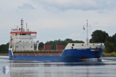
AMBER STAR
General Cargo
Current Trip
| Trip Time | 1 h, 6 mins |
|---|---|
| Trip Distance | 7.76 nm |
| AVG Speed | 5.2 Knop |
| MAX Speed | 8.2 Knop |
| Djupgående | 4.4 m |
| AVG Wind | 3.1 knots |
| MAX Wind | 3.4 knots |
| MIN Temp | -9.9°C / 14.18°F |
| MAX Temp | -7.3°C / 18.86°F |
| Position mottagen | 1 d sen |
Current Position
| Longitud | --- |
|---|---|
| Latitude | --- |
| Status | Under way using engine |
| Fart | 10.7 Knop |
| Kurs | 40.9° |
| Område | Gulf of Finland |
| Station | T-AIS |
| Position mottagen | 1 d sen |
Info
Information
The current position of AMBER STAR is in Gulf of Finland with coordinates 60.46972° / 28.36017° as reported on 2025-02-17 02:52 by AIS to our vessel tracker app. The vessel's current speed is 10.7 Knop and is currently inside the port of VYBORG.
The vessel AMBER STAR (IMO: 9534286, MMSI: 305641000) is a General Cargo that was built in 2011 ( 14 År gammal ). It's sailing under the flag of [AG] Antigua Barbuda.
In this page you can find informations about the vessels current position, last detected port calls, and current voyage information. If the vessels is not in coverage by AIS you will find the latest position.
The current position of AMBER STAR is detected by our AIS receivers and we are not responsible for the reliability of the data. The last position was recorded while the vessel was in Coverage by the Ais receivers of our vessel tracking app.
The current draught of AMBER STAR as reported by AIS is 4.4 meters
Weather
| Temperature | -12.2°C / 10.04°F |
|---|---|
| Wind Speed | 4 knots |
| Direction | 253° WSW |
| Pressure | 1014.9 hPa |
| Humidity | 97.4 % |
| Cloud Coverage | 86 % |
Featured Company
Last Port Calls
| Port | Arrival | Departure | Time In Port |
|---|---|---|---|
| 2025-02-17 10:32 | |||
| 2025-02-17 09:28 | |||
| 2025-02-17 09:26 | |||
| 2025-02-13 18:12 | 2025-02-15 01:36 | 1 d | |
| 2025-02-11 08:23 | 2025-02-11 08:53 | 30 m | |
| 2025-02-09 18:17 | 2025-02-11 07:32 | 1 d | |
| 2025-02-06 17:36 | 2025-02-07 14:00 | 20 h | |
| 2025-02-01 16:53 | 2025-02-04 07:29 | 2 d | |
| 2025-01-28 04:14 | 2025-01-29 12:01 | 1 d | |
| 2025-01-23 15:44 | 2025-01-25 07:17 | 1 d |
Last Trips
| Origin | Departure | Destination | Arrival | Distance | |
|---|---|---|---|---|---|
| 2025-02-17 12:26 | 2025-02-17 13:32 | 7.76 nm | |||
| 2025-02-15 02:36 | 2025-02-17 12:28 | 540.52 nm | |||
| 2025-02-11 11:53 | 2025-02-13 19:12 | 528.67 nm | |||
| 2025-02-11 10:32 | 2025-02-11 11:23 | 6.30 nm | |||
| 2025-02-07 15:00 | 2025-02-09 21:17 | 548.42 nm | |||
| 2025-02-04 10:29 | 2025-02-06 18:36 | 581.83 nm | |||
| 2025-01-29 13:01 | 2025-02-01 19:53 | 579.68 nm | |||
| 2025-01-25 10:17 | 2025-01-28 05:14 | 549.78 nm | |||
| 2025-01-21 16:07 | 2025-01-23 18:44 | 546.23 nm | |||
| 2025-01-18 10:28 | 2025-01-20 14:24 | 549.76 nm |
Events
| Tid | Event | Detaljer | Position / Dest | Information |
|---|---|---|---|---|
| 2025-02-17 10:45 | STOPPAR förflyttning |
60.70620 / 28.73118
[RU] VYBORG
|
Fart: 0.2 kn Kurs: 98° |
|
| 2025-02-17 10:32 | ANLÄNDER HAMN |
|
60.70397 / 28.72571
[RU] VYBORG
|
Fart: 3.1 kn Kurs: 26° |
| 2025-02-17 09:28 | ANLÄNDER HAMN |
|
60.61035 / 28.54618
[RU] VYSOTSK
|
Fart: 10.9 kn Kurs: 43° |
| 2025-02-17 09:26 | AVGÅTT HAMN |
|
60.68118 / 28.67960
VYBORG
|
Fart: 6.1 kn Kurs: 61° |
| 2025-02-17 08:58 | STARTAR förflyttning | 3.71 nm, West of VYSOTSK |
60.58245 / 28.41943
VYBORG
|
Fart: 4.2 kn Kurs: 51° |
| 2025-02-17 03:19 | Status ändrad | Default Under way using engine |
60.54326 / 28.36592
VYBORG
|
Fart: 10.7 kn Kurs: 40.9° |
| 2025-02-17 02:52 | UTANFÖR täckningsområde |
60.46972 / 28.36017
Gulf of Finland
VYBORG
|
Fart: 10.7 kn Kurs: 40.9° |
|
| 2025-02-16 20:37 | Byter havsområde | Russian part of the Gulf of Finland Estonian part of the Gulf of Finland |
59.95815 / 26.41070
Gulf of Finland
VYBORG
|
Fart: 11.7 kn Kurs: 75.6° |
| 2025-02-16 20:03 | Status ändrad | Under way using engine Default |
59.92730 / 26.20112
VYBORG
|
Fart: 12 kn Kurs: 73° |
| 2025-02-16 20:03 | I täckningsområde |
59.92759 / 26.20314
Gulf of Finland
VYBORG
|
Fart: 11.9 kn Kurs: 73.9° |