
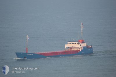
AM DELTA
General Cargo
Current Trip
| Trip Time | 7 days |
|---|---|
| Trip Distance | 739.60 nm |
| AVG Speed | 4.7 Knop |
| MAX Speed | 5.8 Knop |
| Djupgående | 2.9 m |
| AVG Wind | 8.3 knots |
| MAX Wind | 18.2 knots |
| MIN Temp | 25.3°C / 77.54°F |
| MAX Temp | 32.3°C / 90.14°F |
| Position mottagen | 2021-12-14 08:59 |
Current Position
| Longitud | -17.09897° |
|---|---|
| Latitude | 11.34515° |
| Status | Under way using engine |
| Fart | 4.2 Knop |
| Kurs | 169.4° |
| Område | North Atlantic Ocean |
| Station | T-AIS |
| Position mottagen | 2021-12-14 08:59 |
Info
Information
The current position of AM DELTA is in North Atlantic Ocean with coordinates 11.34515° / -17.09897° as reported on 2021-12-14 08:59 by AIS to our vessel tracker app. The vessel's current speed is 4.2 Knop and is currently inside the port of TAKORADI.
The vessel AM DELTA (IMO: 9015929, MMSI: 627254000) is a General Cargo that was built in 1992 ( 32 År gammal ). It's sailing under the flag of [GH] Ghana.
In this page you can find informations about the vessels current position, last detected port calls, and current voyage information. If the vessels is not in coverage by AIS you will find the latest position.
The current position of AM DELTA is detected by our AIS receivers and we are not responsible for the reliability of the data. The last position was recorded while the vessel was in Coverage by the Ais receivers of our vessel tracking app.
The current draught of AM DELTA as reported by AIS is 2.9 meters
Weather
| Temperature | 31.2°C / 88.16°F |
|---|---|
| Wind Speed | 6 knots |
| Direction | 199° SSW |
| Pressure | 1010.5 hPa |
| Humidity | 65.4 % |
| Cloud Coverage | 100 % |
Featured Company
Last Port Calls
| Port | Arrival | Departure | Time In Port |
|---|---|---|---|
| 2024-05-07 12:26 | |||
| 2024-04-27 19:16 | 2024-04-29 17:08 | 1 d | |
| 2024-04-23 20:12 | 2024-04-27 18:39 | 3 d | |
| 2024-04-09 13:02 | 2024-04-17 08:55 | 7 d | |
| 2024-03-28 18:31 | 2024-04-03 14:05 | 5 d | |
| 2024-03-19 17:02 | |||
| 2024-03-07 16:26 | 2024-03-12 17:48 | 5 d |
Last Trips
| Origin | Departure | Destination | Arrival | Distance | |
|---|---|---|---|---|---|
| 2024-04-29 18:08 | 2024-05-07 12:26 | 739.60 nm | |||
| 2024-04-27 19:39 | 2024-04-27 20:16 | 2.00 nm | |||
| 2024-04-17 09:55 | 2024-04-23 21:12 | 456.17 nm | |||
| 2024-04-03 15:05 | 2024-04-09 14:02 | 498.77 nm | |||
| 2024-03-19 17:02 | 2024-03-28 19:31 | 744.97 nm | |||
| 2024-02-25 12:18 | 2024-03-07 16:26 | 368.74 nm |
Events
| Tid | Event | Detaljer | Position / Dest | Information |
|---|---|---|---|---|
| 2024-05-07 12:52 | STOPPAR förflyttning |
4.88666 / -1.74164
[GH] TAKORADI
|
Fart: 0.2 kn Kurs: -1° |
|
| 2024-05-07 12:26 | ANLÄNDER HAMN |
|
4.89743 / -1.73275
[GH] TAKORADI
|
Fart: 4.6 kn Kurs: -1° |
| 2024-05-07 10:38 | STARTAR förflyttning | 0.91 nm, North East of SEKONDI-TAKORADI |
4.94744 / -1.68800
TAKORADI
|
Fart: 4.2 kn Kurs: -1° |
| 2024-05-06 02:46 | STOPPAR förflyttning | 0.9 nm, North East of SEKONDI-TAKORADI |
4.94982 / -1.69089
TAKORADI
|
Fart: 0.2 kn Kurs: -1° |