
AMNA STAR
General Cargo
Current Trip
| Time Travelled | --- |
|---|---|
| Remaining Time | --- |
| Distance Travelled | 763.70 nm |
| Remaining Distance | 4.47 nm |
| AVG Speed | 7.5 Knop |
| MAX Speed | 9.9 Knop |
| AVG Wind | 11.1 knots |
| MAX Wind | 21.5 knots |
| MIN Temp | 12.4°C / 54.32°F |
| MAX Temp | 23.1°C / 73.58°F |
| Djupgående | 2.6 m |
| Position mottagen | 1 m sen |
Current Position
| Longitud | 28.88379° |
|---|---|
| Latitude | 40.95815° |
| Status | At anchor |
| Fart | 0.1 Knop |
| Kurs | --- |
| Område | Sea of Marmara |
| Station | T-AIS |
| Position mottagen | 1 m sen |
Info
Information
The current position of AMNA STAR is in Sea of Marmara with coordinates 40.95815° / 28.88379° as reported on 2024-05-04 05:54 by AIS to our vessel tracker app. The vessel's current speed is 0.1 Knop and is heading at the port of ISTANBUL. The estimated time of arrival as calculated by MyShipTracking vessel tracking app is 2024-05-03 10:00 LT
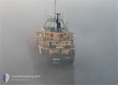
The vessel AMNA STAR (IMO: 7359149, MMSI: 671662000) is a General Cargo that was built in 1975 ( 49 År gammal ). It's sailing under the flag of [TG] Togo.
In this page you can find informations about the vessels current position, last detected port calls, and current voyage information. If the vessels is not in coverage by AIS you will find the latest position.
The current position of AMNA STAR is detected by our AIS receivers and we are not responsible for the reliability of the data. The last position was recorded while the vessel was in Coverage by the Ais receivers of our vessel tracking app.
The current draught of AMNA STAR as reported by AIS is 2.6 meters
Weather
| Temperature | 12.8°C / 55.04°F |
|---|---|
| Wind Speed | 5 knots |
| Direction | 225° SW |
| Pressure | 1004.9 hPa |
| Humidity | 85.4 % |
| Cloud Coverage | 100 % |
Featured Company
Last Port Calls
Last Trips
| Origin | Departure | Destination | Arrival | Distance |
|---|
Events
| Tid | Event | Detaljer | Position / Dest | Information |
|---|---|---|---|---|
| 2024-05-04 01:19 | Status ändrad | At anchor Under way using engine |
40.95768 / 28.88521
ISTANBUL
|
Fart: 0.3 kn Kurs: 511° |
| 2024-05-04 01:17 | STOPPAR förflyttning | 0.98 nm, South of BAKIRKOY |
40.95775 / 28.88542
ISTANBUL
|
Fart: 0.3 kn Kurs: 511° |
| 2024-05-03 15:02 | Status ändrad | Under way using engine Default |
40.60019 / 27.27620
ISTANBUL
|
Fart: 8.8 kn Kurs: 67° |
| 2024-05-03 14:55 | Status ändrad | Default Under way using engine |
40.59382 / 27.25608
ISTANBUL
|
Fart: 8.8 kn Kurs: 67° |
| 2024-05-03 13:56 | Status ändrad | Under way using engine Default |
40.53501 / 27.08095
ISTANBUL
|
Fart: 8.7 kn Kurs: 67° |
| 2024-05-03 13:49 | I täckningsområde |
40.53742 / 27.08781
Sea of Marmara
ISTANBUL
|
Fart: 8.9 kn Kurs: 66° |
|
| 2024-05-03 11:26 | Status ändrad | Default Under way using engine |
40.36286 / 26.66754
ISTANBUL
|
Fart: 8.6 kn Kurs: 33.9° |
| 2024-05-03 11:21 | Status ändrad | Under way using engine Default |
40.35170 / 26.65762
ISTANBUL
|
Fart: 8.6 kn Kurs: 48° |
| 2024-05-03 11:21 | UTANFÖR täckningsområde |
40.35170 / 26.65762
Sea of Marmara
ISTANBUL
|
Fart: 8.6 kn Kurs: 33.9° |
|
| 2024-05-03 10:34 | Status ändrad | Default Under way using engine |
40.27355 / 26.55395
ISTANBUL
|
Fart: 8.6 kn Kurs: 43.8° |